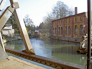
Garte

Last updated
Garte

Garte Leine.JPG

Mouth of the Garte into the Leine south of Göttingen
Location Göttingen district, Lower Saxony, Flag of Germany.svg  Germany
Physical characteristics
Main source east of Weißenborn at the confluence of two streams
303 m above  sea level (NN)
River mouth south of Göttingen into the Leine
152 m above  sea level (NN)
51°30′16″N9°55′09″E / 51.50444°N 9.91917°E / 51.50444; 9.91917 Coordinates: 51°30′16″N9°55′09″E / 51.50444°N 9.91917°E / 51.50444; 9.91917
Length 23.9 km (14.9 mi) [1]
Basin features
Progression LeineAllerWeserNorth Sea
Basin size 89 km2 (34 sq mi) [1]
Tributaries
  • Left:
    Moosgrund, Bischhauser Bach
  • Right:
    Glasehausener Bach, Bernsroder Bach, Bramke, Lengder Bach, Eichbach

The Garte is a small tributary to the Leine River in Lower Saxony, Germany.

Leine river in Germany, tributary of the River Aller

The Leine is a river in Thuringia and Lower Saxony, Germany. It is a left tributary of the Aller and the Weser and it is 281 km (175 mi) long.

Lower Saxony State in Germany

Lower Saxony is a German state (Land) situated in northwestern Germany. It is the second-largest state by land area, with 47,624 km2 (18,388 sq mi), and fourth-largest in population among the 16 Länder federated as the Federal Republic of Germany. In rural areas, Northern Low Saxon and Saterland Frisian are still spoken, but the number of speakers is declining.

Germany Federal parliamentary republic in central-western Europe

Germany, officially the Federal Republic of Germany, is a country in Central and Western Europe, lying between the Baltic and North Seas to the north, and the Alps to the south. It borders Denmark to the north, Poland and the Czech Republic to the east, Austria and Switzerland to the south, France to the southwest, and Luxembourg, Belgium and the Netherlands to the west.

The Garte is a 23 km long stream that rises to the east of Weißenborn at an elevation of 303 m amsl. Towns that it runs through or by include Beienrode, Kerstlingerode, Rittmarshausen (where it is joined by the Bernsroder Bach), Wöllmarshausen, Benniehausen (where the Bischhäuser Bach joins it), Klein Lengden (where the Bramke and Eichbach join it), and Diemarden. The stream joins the Leine River south of Göttingen. With a drop of 151 m, the stream averages a bed slope of 6.6‰. The watershed is 87 km². It is classified as a third-order (i.e., lowest [2] ) stream according to the German system of body-of-water ranking.

Beienrode-im-Gartetal is a village in the municipality (Gemeinde) Gleichen in the district Göttingen, Germany. The nucleated village of 250 residents is primarily agricultural. The village mayor is Marlene Hille. The village's escutcheon is of a green linden tree on a silver background.

Kerstlingerode is a village in the municipality (Gemeinde) Gleichen in the district Göttingen, Germany. It lies on L569 between Beienrode and Rittmarshausen, about ten kilometers south-east of Göttingen. The village of 245 residents is primarily agricultural. There is one church and the largest school in the municipality. There is a volunteer fire department and a wind-instrument band. The village mayor is Claudia Schuppe-Blödow.

Rittmarshausen is a nucleated village in the municipality (Gemeinde) Gleichen in the district Göttingen, Germany. The village of 776 residents is primarily agricultural and home of people working in Göttingen. "Ökozentrum Rittmarshausen" is an association dedicated to the development and marketing of regionally produced natural foods, which are marketed under the Leinehöfe label. The community also sports an athletic association, a volunteer fire department, a chorus, a gun club, and an equestrian association.

The river valley is considered locally as something of a micro-cultural unit, especially solidified by the now-defunct Garte Valley Railway, [3] a 750 mm narrow-gauge railway running from Goettingen to Duderstadt.

The Garte Valley Railway or Göttingen Narrow Gauge Railway, was a narrow-gauge rail line that served to connect the area east of the city to Göttingen, Lower Saxony, Germany, from 1897 through 1959.

Narrow-gauge railway railway with a gauge (distance between rails) less than that of a standard gauge railway

A narrow-gauge railway is a railway with a track gauge narrower than standard 1,435 mm. Most narrow-gauge railways are between 600 mm and 1,067 mm.

Tributaries

from source to mouth

Related Research Articles

Aller (Germany) Sidestream of the river Weser

The Aller is a 215-kilometre (134 mi) long river in the states of Saxony-Anhalt and Lower Saxony in Germany. It is a right-hand, and hence eastern, tributary of the Weser and is also its largest tributary. Its last 117 kilometres (73 mi) form the Lower Aller federal waterway (Bundeswasserstraße). The Aller was extensively straightened, widened and, in places, dyked, during the 1960s to provide flood control of the river. In a 20-kilometre (12 mi) long section near Gifhorn, the river meanders in its natural river bed.

Hamme (river) river in Germany

The Hamme is a 48 km (30 mi) long river in Germany, Lower Saxony, north-east of Bremen. Its source is north of Osterholz-Scharmbeck. It flows through the moors north-east of Bremen called Teufelsmoor, and meets the river Wümme in Ritterhude. From this junction, the river is called Lesum. The Lesum flows into the river Weser in Bremen-Vegesack.

Gleichen, Lower Saxony Place in Lower Saxony, Germany

Gleichen is a municipality in the district of Göttingen, in Lower Saxony, Germany. Named after the two castles, Neuen-Gleichen and Alten-Gleichen on the twin peaks in the Gemeinde, it is situated about 10 km southeast of Göttingen, from which the peaks are visible. Its seat is Reinhausen.

Innerste Sidestream of the river Leine

The Innerste is a river in Lower Saxony, Germany. It is a right tributary of the Leine river and 101 km (63 mi) in length.

Diemarden is a village in Gleichen in the Göttingen district of Lower Saxony, Germany. It had 1463 inhabitants as of 2005 and is the second largest village in Gleichen. In 2010, there were 1398 residents. The village's elevation is 172 meters above mean sea level. The village lies along the Garte stream, a tributary to the Leine river.

Klein Lengden is a village in the Gleichen in the Göttingen district of Lower Saxony, Germany, about eight to ten kilometers south-east of Göttingen. According to the 2010 census, it has about 1363 inhabitants. The village lies in the Garte valley, south of the forested hills of Lengderburg with its Lengdener Burg (castle) and Westerberg and is otherwise surrounded by farm fields. The nearest neighboring villages are Gross Lengden to the east and Diemarden to the west-south-west, each of which is about two kilometers distant.

Rhume river in Germany

The Rhume is a 48 km (30 mi) long river in Lower Saxony, Germany. It is a right tributary of the Leine. Its source is the karstic spring of Rhume Spring in Rhumspringe, south of the Harz mountain range. The water drains with high pressure from the ground of the funnel-shaped well, known for its turquoise colour.

Lutter (Leine) river in Germany

Lutter is a river in Göttingen, Lower Saxony, Germany. It is a tributary from the right (east) to the Leine.

Weser-Harz-Heide Cycle Route

The Weser-Harz-Heide Cycle Route, which is Lower Saxony route no. 5, is a 397 km long-distance cycle path that runs from Hann. Münden, the source of the Weser, over the Harz mountains into the Lüneburg Heath in North Germany.

Hildesheim Forest mountains in Germany

The Hildesheim Forest is a range of hills up to 359 m above sea level (NN) in the district of Hildesheim in the German state of Lower Saxony.

Die Gleichen mountain

Die Gleichen are a pair of hills, up to 430 metres high, in the district of Göttingen in South Lower Saxony in Germany.

Sebnitz (river) river

The Sebnitz is the left, larger headstream of the Lachsbach and runs through both the Czech Republic as well as the German Free State of Saxony. The upper section in the Czech Republic is known as Vilémovský potok in Czech and Wölmsdorfer Bach in German.

Solling Railway railway line in Germany

The Solling Railway (German: Sollingbahn is a non-electrified, single track standard gauge railway connecting Ottbergen in the east of the German state of North Rhine-Westphalia and Northeim in southern Lower Saxony. It takes its name from the fact that it runs through the southern Solling in Lower Saxony, an area of large forests and low mountains.

Göttingen Forest mountain range in Lower Saxony, Germany

The Göttingen Forest is a ridge in Germany's Central Uplands that is up to 427.5 metres high. It forms part of the Lower Saxon Hills in South Lower Saxony.

Sackwald

The Sackwald is a ridge, up to 374 m above sea level (NN) high, in the Lower Saxon Hills in the district of Hildesheim in the North German state of Lower Saxony. It is named after the village of Sack in the borough of Alfeld, the name meaning "Sack Forest".

Heber (hills) mountain range

The Heber is a hogback ridge, relatively small in area and up to 313.5 metres high, in the Lower Saxon Hills within the districts of Goslar, Northeim and Hildesheim in the German state of Lower Saxony.

The Göttingen–Bodenfelde railway, also called the Oberweserbahn and in Göttingen the Bodenfelder Bahn, is a standard gauge railway in South Lower Saxony. The single-track, non-electrified branch line runs from Göttingen to Bodenfelde through the Weser Uplands. It is used mainly by local traffic, but it is also used by through traffic. The route was once used, for example, by Düsseldorf–Göttingen traffic.

References