
The Arctic Archipelago, also known as the Canadian Arctic Archipelago, is a group of islands north of the Canadian mainland.

The CB Series is an extensive line of Honda motorcycles. Most CB models are road-going motorcycles for commuting and cruising. The smaller CB models are also popular for vintage motorcycle racing. All CB series motorcycles have inline engines. Note: The Honda CBR series are sport bikes.

The Antarctic Plateau, or Polar Plateau or Haakon VII Plateau, is a large area of East Antarctica which extends over a diameter of about 1,000 kilometres (620 mi), and includes the region of the geographic South Pole and the Amundsen–Scott South Pole Station. This huge continental plateau is at an average elevation of about 3,000 metres (9,800 ft) high.
Greater Oslo Region is a statistical metropolitan region surrounding the Norwegian capital of Oslo. The region includes the city of Oslo, the entire county of Akershus and several municipalities in the counties of Buskerud (150,709), Oppland (8,552), Vestfold (27,695) and Østfold (102,808).

Akerselva or Akerselven is a river which flows through Oslo. It starts at Maridalsvannet in Oslomarka, and follows the urban areas Nordre Aker, Sagene, Grünerløkka, Oslo centre and Grønland, whereby it finally ends at Paulsenkaien and Oset in Bjørvika. The river is considered to be a part of the Nordmarkvassdraget, and has the watercourse number 006.Z. The entire river is about 8.2 kilometres (5.1 mi) long, and has a difference in elevation between source and mouth of approximately 149 metres (489 ft).
Saunders Coast is that portion of the coast of Marie Byrd Land between Cape Colbeck and Brennan Point, or between Shirase Coast in the west and Ruppert Coast in the east. It stretches from 158°01'W to 146°31'W. The portion west of 150°W is part of Ross Dependency, while the remaining area is unclaimed by any nation. This coast was explored from the air on December 5, 1929, by the Byrd Antarctic Expedition (1928–30) and was first mapped from aerial photographs obtained on that flight by Capt. Harold E. Saunders, USN, for whom the coast is named. The United States Geological Survey (USGS) completely mapped the coast from ground surveys and U.S. Navy air photos, 1959-65.

Nižná Rybnica is a small village and municipality in the Sobrance District in the Košice Region of east Slovakia.
German submarine U-317 was a Type VIIC/41 U-boat of Nazi Germany's Kriegsmarine during World War II.

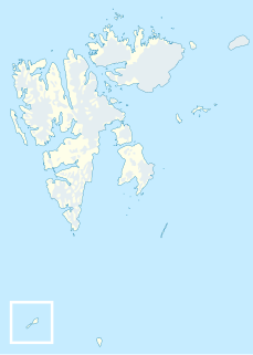
Krossfjorden is a 30 km long fjord on the west coast of Spitsbergen, which is the largest and only permanently populated island of the Svalbard archipelago in Norway. To the north, the fjord branches into Lillehöökfjorden, Möllerfjorden and Kollerfjorden. To the south it is separated from Kongsfjorden by a line from Collinsodden on Mitrahalvøya east to Kapp Guissez.
Bölscheøya is an island southwest of Negerpynten, the southeastern point of Edgeøya. It is part of Thousand Islands. The island was named in 1868 by the German geographer August Petermann (1822–78) after the German journalist Carl Bölsche, father of the German writer and zoologist Wilhelm Bölsche (1843–93). The remains of a whaling station from the 17th century can be found on the island.
Teisten is an islet in Menkeøyane, part of Thousand Islands, a Norwegian island group south of Edgeøya.
İkinci Alıbəyli is a village in the municipality of Alıbəyli in the Agdam Rayon of Azerbaijan.
German submarine U-486 was a Type VIIC U-boat built for Nazi Germany's Kriegsmarine for service during World War II. She was laid down at the Deutsche Werke in Kiel as yard number 321, launched on 12 February 1944 and commissioned on 22 March with Oberleutnant zur See Gerhard Meyer in command.
Obořiště is a village and municipality in Příbram District in the Central Bohemian Region of the Czech Republic.
Nõmmemaa is a village in Lääne-Nigula Parish, Lääne County, in western Estonia.

Hansenbreen is a glacier 15 nautical miles (28 km) long, flowing north along the west side of Mount Nils Larsen in the Sør Rondane Mountains of Antarctica. It was roughly mapped by Norwegian cartographers from air photos taken by the Lars Christensen Expedition, 1936–37, and remapped by them in greater detail in 1957 from air photos taken by U.S. Navy Operation Highjump, 1946–47. It was named for Hans Edvard Hansen, a Norwegian cartographer who compiled these and other maps for Norwegian Antarctic expeditions.
Shivanapur is a village in Dharwad district of Karnataka, India.
Langlifjellet is a mountain in Nathorst Land at Spitsbergen, Svalbard. It has peaks with heights of 1,011, 973 and 885 m.a.s.l. respectively. The mountain is surrounded by the mountains of Sven Nilssonfjellet, Bassøefjellet, and Steindolptoppen, and the glaciers of Løyndbreen, Lundbreen and Langlibreen. The valley of Langlidalen separates Langlifjellet and Sven Nilssonfjellet from the mountain of Rånekampen.

German submarine U-974 was a Type VIIC U-boat of Nazi Germany's Kriegsmarine during World War II.


