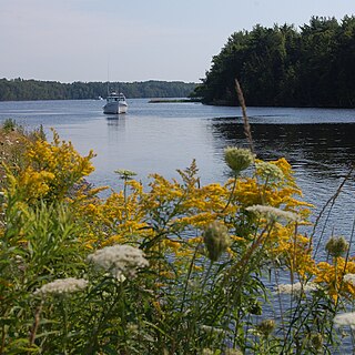
Hyde County is a county located in the U.S. state of North Carolina. As of the 2010 Census, the population was 5,810, making it the second-least populous county in North Carolina. Its county seat is Swan Quarter. The county was created in 1705 as Wickham Precinct. It was renamed Hyde Precinct in 1712 and gained county status in 1739.

Beaufort County is a county located in the U.S. state of North Carolina. As of the 2010 Census, the population was 47,759. Its county seat is Washington. The county was founded in 1705 as Pamptecough Precinct. Originally included in Bath County, it was renamed Beaufort Precinct in 1712 and became Beaufort County in 1739.

The Norfolk Southern Railway was the final name of a railroad that ran from Norfolk, Virginia, southwest and west to Charlotte, North Carolina. It was acquired by the Southern Railway in 1974, which merged with the Norfolk and Western Railway in 1982 to form the current Norfolk Southern Railway.

The Pasquotank River is a coastal water-body in Northeastern North Carolina in the United States. Located between Camden and Pasquotank counties, the Pasquotank connects directly to the Albemarle Sound and is part of the Intracoastal Waterway via Elizabeth City.

Albemarle-Pamlico Peninsula is a large peninsula on the North Carolina coast, lying between the Albemarle Sound to the north and the Pamlico Sound to the south. The 5 counties of Dare, Hyde, Beaufort, Tyrrell, and Washington all lie wholly or partly on the peninsula.

Sherrill is an unincorporated community in northern Texas County, Missouri, United States. It is about six miles north of Licking and is located just west of U.S. Route 63. Sherrill Creek flows past the north side of the community. The community of Beulah lies about 2.5 miles northwest on Sherrill Creek in Phelps County.

Ocracoke Inlet is an estuary located in the Outer Banks, North Carolina, United States that separates Ocracoke Island and Portsmouth Island. It connects the Atlantic Ocean to the Pamlico Sound. It is the southern terminus of the Cape Hatteras National Seashore, and the northern terminus of the Cape Lookout National Seashore. The inlet is approximately one mile across, but changes daily.
Rorketon is a small community located between Lake Dauphin and Lake Manitoba. The main industry in this area is cattle ranching. It is located in the Rural Municipality of Lakeshore. According to 2006 census the population of the Lawrence Municipality, or which it had been part, was 501.
The Douglas State Trail is a 12.5-mile (20.1 km) multiple-use rail trail in Minnesota, USA.
Alligator River is a small river in eastern North Carolina, separating Dare County and Tyrrell County. It empties into Albemarle Sound. A 21-mile canal connects the Alligator River with Pungo River to its west. The Lindsey C. Warren Bridge of U.S. Route 64 crosses the river. Many believe the Alligator River is named for its shape and mere connection to the swamp.

Stonewood-Pentwood-Winston is a small community just west of Hillen Road and Morgan State University in Baltimore, Maryland, United States. The community association is aptly named the Stonewood-Pentwood-Winston Community Association and it has applied and received permission to have residential parking permits issued to its members as the result of the proliferation of students from Morgan parking in the neighborhood.
USS Albemarle (1863) was a screw steamer captured by the Union Navy during the American Civil War. She was used by the Union Navy as a ship's tender in support of the Union Navy blockade of Confederate waterways.

The Three Rivers are the three tidal estuaries in eastern Prince Edward Island, Canada. The water bodies are the Brudenell, Cardigan and Montague rivers, which in 2004 were included on the list of outstanding Canadian Heritage Rivers. The rivers are navigable by canoe for 52 kilometres (32 mi).
Pantego Academy Historic Museum or Ye Olde Academy is a museum in an old academy in Pantego, North Carolina that has ceased operations. It was registered as a National Historic Place on October 25, 1984.
Heads Creek is a stream in Jefferson County in the U.S. state of Missouri. Heads Creek is a tributary of Big River.
Indian Creek is a stream in St. Francois County in the U.S. state of Missouri. It is a tributary of the St. Francis River.
Pungo District Hospital, known for a period as Vidant Pungo Hospital, was a hospital in Belhaven, North Carolina. It opened in 1949, was acquired by Vidant Health in 2011, and closed in 2014.


