
The Houtman Abrolhos is a chain of 122 islands and associated coral reefs, in the Indian Ocean off the west coast of Australia, about 80 kilometres (50 mi) west of Geraldton, Western Australia. It is the southernmost true coral reef in the Indian Ocean, and one of the highest latitude reef systems in the world.
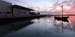
Geraldton is a coastal city in the Mid West region of Western Australia, 424 kilometres (263 mi) north of the state capital, Perth.

The Zeewijk was an 18th-century East Indiaman of the Dutch East India Company that was shipwrecked at the Houtman Abrolhos, off the coast of Western Australia, on 9 June 1727. The survivors built a second ship, the Sloepie, enabling 82 out of the initial crew of 208 to reach their initial destination of Batavia on 30 April 1728. Since the 19th century many objects were found near the wreck site, which are now in the Western Australian Museum. The shipwreck itself was found in 1968 by divers.

The Wallabi Group is the northernmost group of islands in the Houtman Abrolhos off the western coast of Western Australia. it is 58 kilometres from the Australian mainland, and about 9 kilometres from the Easter Group.

The Pelsaert Group is the southernmost of the three groups of islands that make up the Houtman Abrolhos island chain. it consists of a number of islands, the largest of which are Gun Island, Middle Island, and Pelsaert Island. The group is named after a Dutch "opperkoopman" who stranded nearby with the VOC-ship "Batavia" in 1629. The group contains the most southerly true coral reefs in the Indian Ocean. The group is part of the Houtman Abrolhos Important Bird Area, identified as such by BirdLife International because of its importance for supporting large numbers of breeding seabirds.

North Island is the northernmost island in the Houtman Abrolhos, a coral reef archipelago in the Indian Ocean off the coast of Mid West Western Australia. Located about 14 km (9 mi) from the nearest island group, it is one of the largest islands in the Houtman Abrolhos, and one of the few to support dune systems. It has relatively diverse flora dominated by chenopod shrubs and fauna that includes the introduced tammar wallaby, around seven species of reptile, and about 15 resident bird species.
The Big Breaker is the most northerly geographic feature in the Houtman Abrolhos islands in the Indian Ocean off the west coast of Australia. It is located at the extreme tip of a reef that extends about three kilometres north of North Island. Its gazetted location is 28°15′56″S113°35′13″E, but in fact it is located about 270 metres south-east of there, at 28°16′00″S113°35′21″E. It is so named because it is a breaker, a portion of submerged reef over which waves break.

Batavia Road was a passenger boat used from 1946 for commercial tourist operation in the Houtman Abrolhos, a group of islands off the coast of Western Australia.
Suda Bay Passage is a channel through reef just north of North Island in the Houtman Abrolhos. Located at 28°17′29″S113°36′35″E, it is named after the Suda Bay, which was used for lobster fishing around North Island in the late 1940s.
South Passage is a 14 kilometre (9 mi) wide strait that separates the outlying North Island from other islands in the Wallabi Group of the Houtman Abrolhos island chain, in the Indian Ocean off the coast of Western Australia. It is nominally located at 28°21′14″S113°35′46″E.
Assail Bank is a bank in South Passage of the Houtman Abrolhos, in the Indian Ocean off the coast of Western Australia.
Acute Bank is a bank in the Geelvink Channel east of South Passage in the Houtman Abrolhos, in the Indian Ocean off the coast of Western Australia. It is nominally located at 28°22′59″S113°48′10″E.

North East Reef is a reef in the Wallabi Group of the Houtman Abrolhos, in the Indian Ocean off the coast of Western Australia. Located at 28°25′13″S113°48′41″E, it takes its name from the fact that it is situated to the north-east of the main body of islands that makes up the Wallabi Group. The island is part of the Houtman Abrolhos Important Bird Area, identified as such by BirdLife International because of its importance for supporting large numbers of breeding seabirds.

Fish Point is a point in the north-eastern corner of East Wallabi Island in the Houtman Abrolhos island chain off the coast of Western Australia. It is located at 28°25′40″S113°44′34″E. It sits at the foot of Flag Hill, the highest peak on East Wallabi Island, and its western edge looks out onto Turtle Bay.
Gun Island is one of the larger islands in the Pelsaert Group of the Houtman Abrolhos, in the Indian Ocean off the west coast of Australia. It is nominally at 28°53′10″S113°51′35″E, about 4 km (2.5 mi) north and east of Half Moon Reef and is a flat limestone outcrop of about 800 by 420 metres in size. The island is part of the Houtman Abrolhos Important Bird Area, identified as such by BirdLife International because of its importance for supporting large numbers of breeding seabirds.
Batavia Road is an anchorage, or roadstead, in the Pelsaert Group of the Houtman Abrolhos, off the coast of Western Australia. It is located at 28°58′S113°58′E, on the eastern side of Pelsaert Island, near its southern end. It was discovered and named in April 1840 by John Clements Wickham, captain of HMS Beagle. Wickham's assistant John Lort Stokes later wrote:
"On the south west point of the island the beams of a large vessel were discovered, and as the crew of the Zeewyk, lost in 1728 [sic], reported having seen the wreck of a ship on this part, there is little doubt that the remains were those of the Batavia, Commodore Pelsart, lost in 1627. We in consequence named our temporary anchorage Batavia Road, and the whole group Pelsart Group."

Pigeon Island is a small island located need the middle of the Wallabi Group of the Houtman Abrolhos, an archipelago off the coast of Western Australia. It is almost entirely given over to western rock lobster fishers' camps, and as a result is far more disturbed than most other islands in the archipelago. A nearby island also seasonally populated by fishers is named Little Pigeon Island, hence Pigeon Island is sometimes referred to as "Big Pigeon Island".
Shag Rock is a small rocky island in the Wallabi Group of the Houtman Abrolhos.
East Wallabi Island is an island in the Wallabi Group of the Houtman Abrolhos, located in the Indian Ocean off the west coast of mainland Australia.
West Wallabi Island is an island in the Wallabi Group of the Houtman Abrolhos, in the Indian Ocean off the west coast of mainland Australia.
