Ault Park is the fourth-largest park in Cincinnati at 223.949 acres (0.9 km2), owned and operated by the Cincinnati Park Board. It lies in the Mount Lookout neighborhood on the city's east side. The hilltop park has an overlook which commands extensive panoramic views of the Little Miami River valley.

The World Peace Bell is an international, commemorative bell that ceremonially opened the twenty-first century at 1 January 2000 with its first swing. It is a secular bell not associated with any single group, but all mankind collectively. As such, its founding was a collaborative, international civic operation.

Turfway Park is an American horse racing track located within the city limits of Florence, Kentucky, about 10 miles (16 km) south of the Ohio River at Cincinnati. The track conducts live Thoroughbred horse racing during two meets each year—Holiday (December), and Winter/Spring —and offers year-round simulcast wagering from tracks across the continent.

Newport Barracks was a military barracks on the Ohio River, across from Cincinnati, Ohio in Newport, Kentucky. It was operational from 1803 until 1894.

Spring Grove Cemetery and Arboretum is a nonprofit rural cemetery and arboretum located at 4521 Spring Grove Avenue, Cincinnati, Ohio. It is the third largest cemetery in the United States, after the Calverton National Cemetery and Abraham Lincoln National Cemetery and is recognized as a US National Historic Landmark.

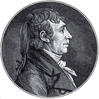
James Taylor V (1769–1848) was an American banker, Quartermaster general, and one of the wealthiest early settlers of Kentucky. He was a founder of the city of Newport, Kentucky.
Cincinnati Public Schools is the U.S. state of Ohio's third-largest public school district, by enrollment, after Columbus City Schools and Cleveland Metropolitan School District. Cincinnati Public Schools is the largest Ohio school district rated as 'effective'. Founded in 1829 as the Common Schools of Cincinnati, it is governed by the Cincinnati Board of Education.
Evergreen Cemetery is the largest cemetery in Campbell County, Kentucky. It is still in operation and is located at 25 Alexandria Pike in Southgate, Kentucky. The Cemetery was begun in the 1840s, to replace the Newport, Cemetery. The cemetery was located a few miles south of Newport, in a rural area, which is now the City of Southgate, Kentucky.

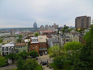
Mount Adams is one of the 52 neighborhoods of Cincinnati, Ohio. Located on a hill immediately east of downtown Cincinnati, it is south of Walnut Hills, southwest of East Walnut Hills, and west of the East End. The population was 1,578 at the 2020 census.

The Licking River is a partly navigable, 303-mile-long (488 km) tributary of the Ohio River in northeastern Kentucky. The river and its tributaries drain much of the region of northeastern Kentucky between the watersheds of the Kentucky River to the west and the Big Sandy River to the east. The North Fork Licking River, in Pendleton County, Kentucky, is one of its tributaries. The South Fork Licking River, in counties including Harrison County, Kentucky, is another.

Riverbend Music Center is an outdoor amphitheater located in Cincinnati, Ohio, along the banks of the Ohio River. It has a capacity of 20,500 and was built for the Cincinnati Symphony Orchestra, to allow them to play in an outdoor venue during the summer months. Its location is directly adjacent to Coney Island water park and Belterra Park. Famed architect and 2012 Driehaus Prize winner Michael Graves designed the building. The venue is owned by the Cincinnati Symphony Orchestra, booked and operated by its subsidiary, Music and Event Management Incorporated (MEMI) and also partners with Live Nation.

The Banks is a mixed-use development along the Ohio River in downtown Cincinnati, Ohio, on the land between Paycor Stadium and Great American Ball Park.

Westwood is one of the 52 neighborhoods of Cincinnati, Ohio. Annexed in 1896 and located in the western part of the city, it is the city's largest neighborhood in both area and population. The population was 33,774 at the 2020 census.

Sedamsville is one of the 52 neighborhoods of Cincinnati, Ohio. Established in 1795 and annexed in 1870, the neighborhood lies along the Ohio River in the western part of the city. The population was 1,256 at the 2020 census.

Piatt Park is the oldest park in Cincinnati, Ohio. The urban park stretches two blocks between Elm Street and Vine Street on Garfield Place/8th Street. The park is owned and maintained by the Cincinnati Park Board.

Downtown Cincinnati is one of the 52 neighborhoods of Cincinnati, Ohio. It is the central business district of the city, as well the economic and symbiotic center of the Cincinnati metropolitan area. Originally the densely populated core of the city, the neighborhood was transformed into a commercial zone in the mid-20th century. The population was 5,835 at the 2020 census.

Mt. Echo Park is an 84-acre (34 ha) urban park in the Price Hill neighborhood of Cincinnati, Ohio, United States. Located on a hilltop, the park offers scenic overlooks of Downtown Cincinnati, the Ohio River, and Northern Kentucky.

Sawyer Point Park & Yeatman's Cove are a pair of side-by-side parks on the riverfront of downtown Cincinnati, Ohio, United States. The two linear parks stretch one mile along the north shore of the Ohio River. Since 2012, the parks have been the location for the annual Bunbury Music Festival.
Taylors Creek is a stream in Campbell County, Kentucky, in the United States. A variant name is Duck Creek. It is a tributary of the Ohio River. Taylors Creek forms the border between the towns of Bellevue, Kentucky and Newport, Kentucky.

The Cincinnati metropolitan area is a metropolitan area with its core in Ohio and Kentucky. Its largest city is Cincinnati and includes surrounding counties in the U.S. states of Ohio, Kentucky, and Indiana.


