
Downsview is a neighbourhood in the north end of Toronto, Ontario, Canada, located in the district of North York. The area takes its name from the Downs View farm established around 1842 near the present-day intersection of Keele Street and Wilson Avenue. It now extends beyond the intersection of Sheppard Avenue and Dufferin Street, though it is popularly seen as including the areas to the north right up to the Toronto city limit at Steeles Avenue. The area includes several large post-World War II subdivisions. Within the area is Downsview Airport, the former site of Canadian Forces Base Downsview, which has since been largely converted following the end of the Cold War into an urban park known as Downsview Park. The airport is still used as a manufacturing and testing facility for Bombardier Aerospace.

York Centre is a federal electoral district in Ontario, Canada, that has been represented in the House of Commons of Canada from 1904 to 1917 and since 1953.

St. George is a station on Line 1 Yonge–University and Line 2 Bloor–Danforth of the Toronto subway. It is located north of Bloor Street West between St. George Street and Bedford Road. It is the second-busiest station in the system after Bloor–Yonge station, serving a combined total of approximately 260,647 people a day. Wi-Fi service is available at this station.

Sheppard Avenue is an east–west principal arterial road in Toronto, Ontario, Canada. The street has two distinct branches near its eastern end, with the original route being a collector road leading to Pickering via a turnoff, and the main route following a later-built roadway which runs south to Kingston Road. To avoid name duplication, the Toronto portion of the northern branch was renamed Twyn Rivers Drive. The section of the street entirely in Toronto is (34.2 km) in length, while the Pickering section and Twyn Rivers Dr. is (5.4 km) long.

Downsview Park is a large urban park located in the Downsview neighbourhood of Toronto, Ontario, Canada. The park's name is officially bilingual due to it being federally owned and managed, and was first home to de Havilland Canada, an aircraft manufacturer, and later was a Canadian Forces base. The park still contains Downsview Airport. In 1999, the Government of Canada declared it as "Canada's first urban national park". However, unlike the Rouge National Urban Park in eastern Toronto, Downsview Park is managed by the federal Crown corporation Canada Lands Company rather than Parks Canada.

The Bank of Upper Canada Building is a former bank building in Toronto, Ontario, Canada, and one of the few remaining buildings in Toronto that predate the 1834 incorporation of the city. It is located at 252 Adelaide Street East, in the Old Town district. Opened in 1827, in what was then the town of York, the building housed the Bank of Upper Canada until the bank's collapse in 1866. It was then used for school purposes and later for various commercial and industrial purposes before being restored in 1982 as commercial office space. The building has been designated a National Historic Site of Canada since 1977.

George Brown House is a historic building in the Grange Park neighbourhood of Toronto, Ontario, Canada. It was home to Father of Confederation, Reform Party politician and publisher George Brown. Its current address is 186 Beverley Street.

The Dominion Public Building is a five-storey Beaux-Arts neoclassical office building built between 1926 and 1935 for the government of Canada at southeast corner of Front and Bay streets in Toronto, Ontario, Canada.
Canadian Forces Base Toronto is a former Canadian Forces base in Toronto, Ontario. The airfield is currently operated as Toronto / Downsview Airport.

Clanton Park is a neighbourhood in Toronto, Ontario, Canada. Located in the district of North York, it is part of federal and provincial electoral district York Centre, and Toronto electoral wards 9: York Centre (West) and 10: York Centre (East). In 2016, it had a population of 16,472, a 12.7% rise from 2011.

The Runnymede Theatre is a historic building located in Bloor West Village, an affluent west end Toronto neighbourhood. The building has operated as a vaudeville theatre, a movie theatre, a bingo hall, and a Chapters bookstore. The building is now a Shoppers Drug Mart.
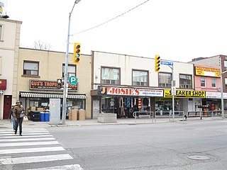
Little Jamaica, also known as Eglinton West, is an ethnic enclave in Toronto, Ontario, Canada. It is located along Eglinton Avenue West, from Marlee Ave to Keele Street, and is part of four neighbourhoods: Silverthorn, Briar Hill–Belgravia, Caledonia–Fairbank, and Oakwood–Vaughan. The commercial main street has been recognized to be of great cultural heritage significance to the city of Toronto, as a distinct ethnic and cultural hub for Afro-Caribbean immigrants for many decades.
Wychwood Park is a neighbourhood enclave and private community in Toronto, Ontario, Canada. It is located west of Bathurst Street on the north side of Davenport Road, within the larger area of Bracondale Hill. It is considered part of the overall Wychwood official neighbourhood as designated by the City of Toronto.

Walnut Hall was a row of four Georgian-style terraced homes in Toronto, Ontario, Canada. Constructed in 1856, it was recognized by both the Government of Canada and the City of Toronto as being of historic significance, but portions of it collapsed and it had to be demolished in 2007 due to neglect. At the time of its demolition, it was Toronto's last remaining complete row of 19th century Georgian townhomes.

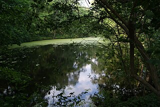
Runnymede Park is a medium-sized public park located in The Junction neighbourhood of Toronto, Canada, one block east of Runnymede Road. Its southern boundary is the West Toronto Yard used by the Canadian Pacific Railway, its northern boundary is Ryding Avenue, while a laneway and parking lot make up the western and eastern boundaries respectively. It is relatively flat, and features many soaring mature oak trees.
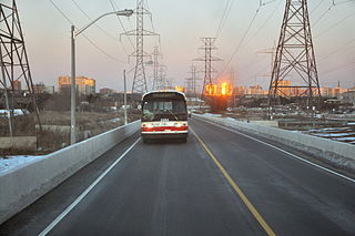
The York University Busway is a bus-only roadway in Toronto, Ontario, Canada, which stretches 1.8 kilometres (1.1 mi) from Finch West subway station to Dufferin Street. It is used by the Toronto Transit Commission's 939B Finch Express bus route.
The Downsview Complex is a provincial office site located in the Downsview neighbourhood of Toronto, Ontario, Canada.

Humber River—Black Creek is a provincial electoral district in Ontario, Canada, that has been represented in the Legislative Assembly of Ontario since 1999. Prior to the 2018 election, the riding was known as York West.

The National Hotel was a hotel built on the southeast corner of King and Sherbourne streets, in Toronto, Ontario, Canada. Under pressure for condominium apartment redevelopment, the City of Toronto attempted to preserve the building, designating it a heritage site in 2009, but the building was eventually torn down in 2013. The hotel's north and west facades were preserved as part of the new condominium development, examples of "facadism" in Toronto.

The John Irwin House is a historic structure located in Toronto, one of the oldest surviving residential buildings in its neighbourhood. The house is listed on the City of Toronto government's registry of historic properties. The city describes the house as being an example of "Second Empire" style. The house is located at 21 Grenville Street. That part of the city, east of Queen's Park, was opened for residential development in 1860, and the house was recorded on city records as being owned by John Irwin in 1873.
