| ||||
|---|---|---|---|---|
 | ||||
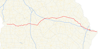
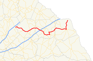
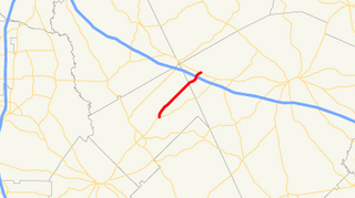
| Route information | ||||
| Maintained by GDOT | ||||
| Length | 7.6 mi [1] (12.2 km) | |||
| Existed | 1950 [2] [3] – present | |||
| Major junctions | ||||
| West end | ||||
| East end | ||||
| Location | ||||
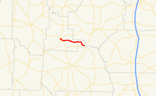
| Counties | Schley, Sumter | |||
| Highway system | ||||
| ||||

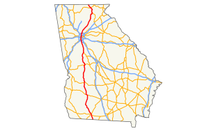
State Route 271 (SR 271) is a west-east state highway located in the west-central part of the U.S. state of Georgia. Its route is within Schley and Sumter counties.
A state highway, state road, or state route is usually a road that is either numbered or maintained by a sub-national state or province. A road numbered by a state or province falls below numbered national highways in the hierarchy. Roads maintained by a state or province include both nationally numbered highways and un-numbered state highways. Depending on the state, "state highway" may be used for one meaning and "state road" or "state route" for the other.

In the United States, a state is a constituent political entity, of which there are currently 50. Bound together in a political union, each state holds governmental jurisdiction over a separate and defined geographic territory and shares its sovereignty with the federal government. Due to this shared sovereignty, Americans are citizens both of the federal republic and of the state in which they reside. State citizenship and residency are flexible, and no government approval is required to move between states, except for persons restricted by certain types of court orders. Four states use the term commonwealth rather than state in their full official names.

Georgia is a state in the Southeastern United States. It began as a British colony in 1733, the last and southernmost of the original Thirteen Colonies to be established. Named after King George II of Great Britain, the Province of Georgia covered the area from South Carolina south to Spanish Florida and west to French Louisiana at the Mississippi River. Georgia was the fourth state to ratify the United States Constitution, on January 2, 1788. In 1802–1804, western Georgia was split to the Mississippi Territory, which later split to form Alabama with part of former West Florida in 1819. Georgia declared its secession from the Union on January 19, 1861, and was one of the original seven Confederate states. It was the last state to be restored to the Union, on July 15, 1870. Georgia is the 24th largest and the 8th most populous of the 50 United States. From 2007 to 2008, 14 of Georgia's counties ranked among the nation's 100 fastest-growing, second only to Texas. Georgia is known as the Peach State and the Empire State of the South. Atlanta, the state's capital and most populous city, has been named a global city. Atlanta's metropolitan area contains about 55% of the population of the entire state.