List of Interstate Highways in Georgia (U.S. state)

Last updated

Interstate Highways of the Georgia State Route System

I-75.svg

I-285.svg

Business Loop 75.svg

Highway shields for Interstate 75, Interstate 285, and Interstate 75 Business Loop
List of Interstate Highways in Georgia (U.S. state)
Interstate Highways highlighted in red
System information
Maintained by GDOT
FormedAugust 14, 1957 (1957-08-14) [1]
Highway names
Interstates Interstate nn (I-nn)
State State Route nn (SR nn)
System links
  • Georgia State Highway System

The Interstate Highways in Georgia comprise seven current primary Interstate Highways and eight auxiliary Interstates. In addition, two primary Interstates are currently under proposal, and three auxiliary Interstates were once proposed and then cancelled. Each Interstate has a hidden state route number; for example, Interstate 75 (I-75) is also State Route 401 (SR 401) and Interstate 16 (I-16) is also State Route 404 (SR 404, the Jim Gillis Historic Savannah Parkway). This highway system uses the Georgia Peach Pass for toll lanes.

Contents

Primary Interstate Highways

NumberLength (mi) [2] Length (km)Southern or western terminusNorthern or eastern terminusFormedRemovedNotes
I-3.svg I-3 Savannah Tennessee state lineproposedProposal for the Third Infantry Division Highway
I-14.svg I-14 Alabama state line Augusta proposedProposal for the Fourteenth Amendment Highway
I-16.svg I-16 166.81268.45 I-75 in Macon Montgomery Street in Savannah 01966-01-011966 [3] currentSR 404
I-20.svg I-20 201.21323.82 I-20 at Alabama state line I-20 at South Carolina state line01963-01-011963 [4] currentSR 402
I-24.svg I-24 4.106.60 I-24 at Tennessee state line I-24 at Tennessee state line01968-01-011968 [5] currentSR 409
I-59.svg I-59 20.6733.27 I-59 at Alabama state line I-24 near Wildwood 01970-01-011970 [6] currentSR 406
I-75.svg I-75 355.11571.49 I-75 at Florida state line I-75 at Tennessee state line01963-01-011963 [4] currentSR 401
I-85.svg I-85 179.90289.52 I-85 at Alabama state line I-85 at South Carolina state line01960-01-011960 [7] currentSR 403
I-95.svg I-95 112.03180.29 I-95 at Florida state line I-95 at South Carolina state line01967-01-011967 [8] currentSR 405
  •       Proposed and unbuilt

Auxiliary Interstate Highways

NumberLength (mi) [9] Length (km)Southern or western terminusNorthern or eastern terminusFormedRemovedNotes
I-175.svg I-175 39.062.8 Albany I-75 at Cordele 01975-01-01197501978-01-011978 [10] SR 412
I-185.svg I-185 49.3079.34Lindsey Creek Parkway in Columbus I-85 near LaGrange 01979-01-011979 [11] currentSR 411
I-285.svg I-285 63.98102.97Beltway around Atlanta 01963-01-011963 [4] currentSR 407
I-420.svg I-420 5.408.69 I-20 in Douglasville Near Atlanta 01983-01-011983 [12] 01985-01-011985SR 414
I-475.svg I-475 15.8325.48 I-75 near Macon I-75 near Bolingbroke 01965-01-011965 [3] currentSR 408
I-485.svg I-485 5.909.50 I-75/I-85 in Atlanta I-85 in Atlanta01964-01-011964 [13] 01975-01-011975SR 410
I-516.svg I-516 6.4910.44 SR 21 in Garden City SR 21 in Savannah 01985-01-011985 [14] currentSR 421
I-520.svg I-520 15.6225.14 I-20 in Augusta I-520 at South Carolina state line01980-01-011980 [15] currentSR 415
I-575.svg I-575 30.9749.84 I-75 in Kennesaw SR 5 / SR 5 Bus. / SR 372 / SR 515 west of Nelson 01980-01-011980 [15] currentSR 417
I-675.svg I-675 11.0417.77 I-75 in Stockbridge I-285 near Forest Park 01987-01-011987 [16] currentSR 413
I-985.svg I-985 24.0438.69 I-85 / SR 365 in Suwanee US 23 / SR 365 in Gainesville 01985-01-011985 [14] currentSR 419
  •       Former

Business routes

NumberLength (mi)Length (km)Southern or western terminusNorthern or eastern terminusFormedRemovedNotes
Business Loop 75.svg I-75 BL 10.0 [17] 16.1 I-75 / US 84 / US 221 / SR 38 in Valdosta I-75 / U.S. Route 41 / SR 7 in Valdosta Serves Valdosta
Business Loop 75.svg I-75 BL 4.9 [18] 7.9 I-75 near Adel I-75 in Sparks Formally served Adel and Sparks
Business Loop 75.svg I-75 BL 5.2 [19] 8.4 I-75 south of Tifton I-75 / U.S. Route 41 / SR 7 north of Tifton Serves Tifton
Business Loop 75.svg I-75 BL 6.9 [20] 11.1 I-75 / US 280 / SR 30 / Georgia State Route 90 in Cordele I-75 north of Cordele Serves Cordele
Business Loop 95.svg I-95 BL 15.7 [21] 25.3 I-95 / US 17 / US 82 / SR 25 / SR 520 near Brunswick I-95 / SR 25 Spur near Brunswick 01990-04-19199002006-01-012006Was a boulevard grade business loop that formally served Brunswick.
Business Loop 95.svg I-95 BL 8.1 [22] 13.0 I-95 / SR 99 near Darien I-95 / SR 251 near Darien Serves Darien
  •       Former

See also

Related Research Articles

<span class="mw-page-title-main">Interstate 985</span> Highway in Georgia

Interstate 985 (I-985) is a 24.04-mile-long (38.69 km) auxiliary Interstate Highway in Northeast Georgia. It links the Atlanta metropolitan area to the city of Gainesville via Suwanee. I-985 is also known as the Sidney Lanier Parkway, after the musician and poet, and is also designated as unsigned State Route 419 (SR 419). The roadway was designated as I-985 in 1985. I-985 and SR 365 are concurrent for I-985's entire length, but only the I-985 signs are displayed. I-985 is also concurrent with US Route 23 (US 23) from exit 4 northward. I-985 is the highest-numbered spur route of a north–south Interstate and is second only to I-990, which serves the Buffalo–Niagara Falls metropolitan area.

<span class="mw-page-title-main">Georgia State Route 3</span> State highway in southern and central Georgia

State Route 3 (SR 3) is a 351-mile-long (565 km) state highway that travels south-to-north through portions of the western part of the U.S. state of Georgia, roughly paralleling Interstate 75 (I-75). The highway travels from its southern terminus at the Florida state line, where SR 3 and SR 300 both reach their southern terminus, concurrent with US 19. Here, US 19 travels concurrent with State Road 57, 12 miles (19 km) south-southeast of Thomasville. SR 3 travels through portions of Thomas, Mitchell, Dougherty, Lee, Sumter, Schley, Taylor, Upson, Pike, Spalding, Henry, Clayton, Fulton, Cobb, Bartow, Gordon, Whitfield, and Catoosa counties to its northern terminus at the Tennessee state line, in East Ridge, where US 41/US 76 continue, concurrent with State Route 8. It travels through Thomasville, Albany, Griffin, Atlanta, Calhoun, and Dalton.

<span class="mw-page-title-main">Georgia State Route 5</span> State highway in northern Georgia

State Route 5 (SR 5) is a 155.325-mile-long (249.971 km) state highway that travels south-to-north through portions of Carroll, Douglas, Cobb, Cherokee, Pickens, Gilmer, and Fannin counties in the western and northern parts of the U.S. state of Georgia. The highway travels from its southern terminus at SR 48 at the Alabama state line, north-northwest of Ephesus, to its northern terminus at SR 60 and SR 68 at the Tennessee state line on the McCaysville–Copperhill line, bisecting the northwestern portion of the state.

<span class="mw-page-title-main">Georgia State Route 6</span> State highway in west-central Georgia

State Route 6 (SR 6) is a 72.1-mile-long (116.0 km) state highway that travels northwest-to-southeast in the U.S. state of Georgia. It is known as Jimmy Lee Smith Parkway, Jimmy Campbell Parkway, Nathan Dean Parkway, and Wendy Bagwell Parkway in Paulding County; C.H. James Parkway in Cobb County; Thornton Road in Douglas County; and Camp Creek Parkway and honorarily as Tuskegee Airmen Parkway in Fulton and Clayton counties. It begins at the Alabama state line, where it is concurrent with US 278. Here, US 278 enters Alabama, concurrent with the unsigned state highway SR 74. Its eastern terminus is at an interchange with Interstate 85 (I-85) west of the Hartsfield–Jackson Atlanta International Airport.

<span class="mw-page-title-main">Georgia State Route 10</span> State highway in central Georgia

State Route 10 (SR 10) is a 172.3-mile-long (277.3 km) state highway in the U.S. state of Georgia. It travels from Downtown Atlanta to the South Carolina state line in Augusta. This highway, along with U.S. Route 78 (US 78), connect three of the biggest metro areas of the state together: Atlanta, Athens, and Augusta. It travels concurrently with US 78 in three sections: from Atlanta to Druid Hills; from near Stone Mountain to near Athens; and from Athens to its eastern terminus, for a total of 149.2 miles (240.1 km), or approximately 86.6 percent of its route.

<span class="mw-page-title-main">Georgia State Route 13</span> State highway in northeastern Georgia

State Route 13 (SR 13) is a 49.5-mile-long (79.7 km) state highway in the north-central part of the U.S. state of Georgia, that travels through portions of Fulton, DeKalb, Gwinnett, and Hall counties.

<span class="mw-page-title-main">Georgia State Route 120</span> State highway in Georgia

State Route 120 (SR 120) is a 90.7-mile-long (146.0 km) state highway that runs west-to-east through portions of Haralson, Paulding, Cobb, Fulton, and Gwinnett counties in northwestern part of the U.S. state of Georgia.

<span class="mw-page-title-main">Georgia State Route 300</span> Highway in Georgia, United States

State Route 300, is a 107-mile-long (172 km) state highway in the southern part of the U.S. state of Georgia. Its southern terminus is at the Florida state line south-southeast of Thomasville, where the roadway continues as US 19/SR 57. This is also the southern terminus of SR 3, with which US 19 and SR 300 travel concurrently through the southern part of the state. Its northern terminus is at Interstate 75 (I-75) in Cordele.

<span class="mw-page-title-main">Georgia State Route 166</span> Highway in Georgia

State Route 166 (SR 166) is a state highway in the U.S. state of Georgia. It connects the Alabama state line with the city of Atlanta. The highway travels through Carrollton, McWhorter, and East Point. Except for the Carrollton and East Point/Atlanta areas, the highway is fairly rural. In Atlanta, it has a limited-access freeway portion that is known as the Arthur B. Langford Jr. Parkway.

<span class="mw-page-title-main">Interstate 75 in Georgia</span> Highway in Georgia

Interstate 75 (I-75) in the US state of Georgia travels north–south along the U.S. Route 41 (US 41) corridor in the central part of the state, traveling through the cities of Valdosta, Macon, and Atlanta. It is also designated—but not signed—as State Route 401 (SR 401).

<span class="mw-page-title-main">Georgia State Route 7</span> State highway in Georgia

State Route 7 (SR 7) is a 216.0-mile-long (347.6 km) state highway that travels in a southeast-to-northwest orientation through portions of Lowndes, Cook, Tift, Turner, Crisp, Dooly, Houston, Peach, Crawford, Monroe, Lamar, Pike, and Spalding counties in the southern and central parts of the U.S. state of Georgia. The highway connects the Florida state line southeast of Lake Park to the Griffin area, via Valdosta, Tifton, Cordele, Perry, and Barnesville. The highway is concurrent with either US 41 or US 341 for its entire length, and closely parallels I-75 for much of its length.

<span class="mw-page-title-main">Georgia State Route 17</span> State highway in eastern Georgia

State Route 17 (SR 17) is a 300-mile-long (480 km) state highway that travels northwest–southeast in the east-central and northeastern parts of the U.S. state of Georgia. The highway connects the Savannah metro area to the North Carolina state line, northwest of Hiawassee and runs roughly parallel to the South Carolina state line.

<span class="mw-page-title-main">Georgia State Route 19</span> State highway in central Georgia

State Route 19 (SR 19) is a 152-mile-long (245 km) state highway that travels southeast-to-northwest through portions of Bacon, Jeff Davis, Appling, Telfair, Wheeler, Laurens, Twiggs, Bibb, and Monroe counties in the central part of the U.S. state of Georgia. The highway travels from its southern terminus at US 1/US 23/SR 4 north of Alma to its northern terminus at US 41/SR 18 in Forsyth. It also travels through Hazlehurst, Lumber City, Dublin, and Macon.

<span class="mw-page-title-main">Georgia State Route 21</span> State highway in east-central Georgia

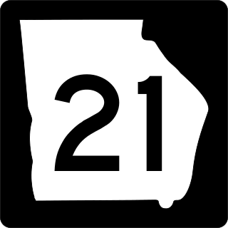
State Route 21 (SR 21) is an 84.4-mile-long (135.8 km) state highway that travels southeast-to-northwest through portions of Chatham, Effingham, Screven, and Jenkins counties in the eastern part of the U.S. state of Georgia. The highway connects the Savannah and Millen areas, via Garden City, Port Wentworth, Rincon, Springfield, and Sylvania.

<span class="mw-page-title-main">Georgia State Route 26</span> State highway in Georgia

State Route 26 (SR 26) is a 271.1-mile-long (436.3 km) state highway that travels west-to-east through portions of Chattahoochee, Marion, Schley, Macon, Houston, Pulaski, Bleckley, Laurens, Johnson, Emanuel, Bulloch, Bryan, Effingham, and Chatham counties through the central part of the U.S. state of Georgia. It crosses nearly the entire width of the state, connecting Cusseta, on the southeastern edge of Fort Benning, near Columbus to Tybee Island on the Atlantic coast near Savannah, via Buena Vista, Ellaville, Oglethorpe, Hawkinsville, Cochran, Dublin, Swainsboro, Statesboro, and Savannah.

<span class="mw-page-title-main">Georgia State Route 27</span> State highway in Georgia

State Route 27 (SR 27) is a 264-mile-long (425 km) state highway that travels west-to-east through portions of Quitman, Stewart, Webster, Sumter, Dooly, Pulaski, Dodge, Telfair, Jeff Davis, Appling, Wayne, and Glynn counties in the southern part of the U.S. state of Georgia, crossing nearly the entire state from Georgetown, just east of the Alabama state line to Brunswick, just west of the Atlantic coast. The route connects US 82/SR 39/SR 50 in Georgetown with US 17/SR 25 in Brunswick, via Lumpkin, Preston, Americus, Vienna, Hawkinsville, Eastman, Helena–McRae, Hazlehurst, Baxley, and Jesup. The highway is concurrent with US 280 and US 341 for most of its length.

<span class="mw-page-title-main">Georgia State Route 33</span>

State Route 33 (SR 33) is an 81-mile-long (130 km) state highway that travels south-to-north through portions of Thomas, Brooks, Colquitt, Worth, and Crisp counties in the south-central part of the U.S. state of Georgia. The highway travels from its southern terminus, an intersection with US 84/SR 38 in Boston, to its northern terminus, an intersection with US 41/SR 7 north of Wenona. It also travels through Moultrie and Sylvester.

<span class="mw-page-title-main">Georgia State Route 257</span> State highway in Georgia

State Route 257 (SR 257) is a southwest–to–northeast state highway located in the central part of the U.S. state of Georgia. It travels from Cordele to Dublin, via Hawkinsville. Its routing is located within portions of Crisp, Dooly, Wilcox, Pulaski, Bleckley, Dodge, and Laurens counties.

<span class="mw-page-title-main">Georgia State Route 98</span> State highway in Georgia

State Route 98 (SR 98) is a 36.6-mile-long (58.9 km) state highway that travels southeast-to-northwest through portions of Madison, Jackson, and Banks counties in the northeastern part of the U.S. state of Georgia. The highway connects Comer and Homer, via Danielsville, Commerce, and Maysville.

<span class="mw-page-title-main">Georgia State Route 230</span>

State Route 230 (SR 230) is a 59.2-mile-long (95.3 km) west–east state highway in the central part of the U.S. state of Georgia. It travels in a northern arc through portions of Dooly, Pulaski, and Dodge counties.

References

  1. Official Route Numbering for the National System of Interstate and Defense Highways (Map). American Association of State Highway Officials. August 14, 1957. Retrieved November 22, 2010.
  2. Staff (October 31, 2002). "Tabel 1: Main Routes of the Eisenhower National System Of Interstate and Defense Highways". Route Log and Finder List. Federal Highway Administration . Retrieved July 31, 2011.
  3. 1 2 State Highway Department of Georgia (January 1966). Official Highway Map (PDF) (Map). Scale not given. Atlanta: State Highway Department of Georgia. Retrieved February 8, 2017.
  4. 1 2 3 State Highway Department of Georgia (1963). State Highway System and Other Principal Connecting Roads (PDF) (Map). Scale not given. Atlanta: State Highway Department of Georgia. OCLC   5673161 . Retrieved February 8, 2017. (Corrected to June 1, 1963.)
  5. State Highway Department of Georgia (January 1968). Official Highway Map (PDF) (Map). Scale not given. Atlanta: State Highway Department of Georgia. Retrieved February 8, 2017.
  6. State Highway Department of Georgia (January 1970). Official Highway Map (PDF) (Map). Scale not given. Atlanta: State Highway Department of Georgia. Retrieved February 8, 2017.
  7. State Highway Department of Georgia (1960). State Highway System and Other Principal Connecting Roads (PDF) (Map) (1960–1961 ed.). Scale not given. Atlanta: State Highway Department of Georgia. OCLC   5673161 . Retrieved February 8, 2017. (Corrected to June 1, 1960.)
  8. State Highway Department of Georgia (January 1967). Official Highway Map (PDF) (Map). Scale not given. Atlanta: State Highway Department of Georgia. Retrieved February 8, 2017.
  9. Staff. "Table 2: Auxiliary Routes of the Dwight D. Eisenhower National System Of Interstate and Defense Highways as of October 31, 2002". Federal Highway Administration . Retrieved October 9, 2013.
  10. Georgia Department of Transportation (January 1977). Official Highway Map (PDF) (Map) (1977–1978 ed.). Scale not given. Atlanta: Georgia Department of Transportation. Retrieved July 12, 2016.
  11. Georgia Department of Transportation (January 1978). Official Highway Map (PDF) (Map) (1978-79 ed.). Scale not given. Atlanta: Georgia Department of Transportation. Retrieved April 5, 2017.
  12. Georgia Department of Transportation (1983). Official Highway and Transportation Map (PDF) (Map) (1983–1984 ed.). Scale not given. Atlanta: Georgia Department of Transportation. Retrieved April 5, 2017.
  13. State Highway Department of Georgia (1964). State Highway System (PDF) (Map). Scale not given. Atlanta: State Highway Department of Georgia. Archived from the original (PDF) on March 4, 2016. Retrieved April 5, 2017. (Corrected to June 1, 1963.)
  14. 1 2 Georgia Department of Transportation (1984). Official Highway and Transportation Map (PDF) (Map) (1984–1985 ed.). Scale not given. Atlanta: Georgia Department of Transportation. Retrieved April 5, 2017.
  15. 1 2 Georgia Department of Transportation (1980). Official Highway and Transportation Map (PDF) (Map) (1980–1981 ed.). Scale not given. Atlanta: Georgia Department of Transportation. Retrieved April 5, 2017.
  16. Georgia Department of Transportation (1987). Official Highway and Transportation Map (PDF) (Map) (1987–1988 ed.). Scale not given. Atlanta: Georgia Department of Transportation. Retrieved April 5, 2017.
  17. Google (March 21, 2017). "Business Loop I-75 (Valdosta)" (Map). Google Maps . Google. Retrieved March 21, 2017.
  18. Google (March 21, 2017). "Business Loop I-75 (Adel–Sparks)" (Map). Google Maps. Google. Retrieved March 21, 2017.
  19. Google (March 21, 2017). "Business Loop I-75 (Tifton)" (Map). Google Maps. Google. Retrieved March 21, 2017.
  20. Google (March 10, 2017). "Business Loop I-75 (Cordele)" (Map). Google Maps. Google. Retrieved March 10, 2017.
  21. Google (September 5, 2016). "Business Loop I-95 (Brunswick)" (Map). Google Maps . Google. Retrieved September 5, 2016.
  22. Google (March 21, 2017). "Business Loop I-95 (Darien)" (Map). Google Maps. Google. Retrieved March 21, 2017.