In Downtown Atlanta, the Downtown Connector or 75/85 is the concurrent section of Interstate 75 and Interstate 85 through the core of the city. Beginning at the I-85/Langford Parkway interchange, the Downtown Connector runs generally due north, meeting the west–east I-20 in the middle. Just north of this is the Grady Curve around Grady Memorial Hospital. Continuing north, the terminus of the Downtown Connector is the Brookwood Interchange or Brookwood Split in the Brookwood area of the city. The overall length of the Downtown Connector is approximately 7.5 miles (12 km). Since the 2000s, it has been officially named James Wendell George Parkway for most of its length, although it is still designated the Connector in the mainstream. It also has unsigned designations State Route 401 (I-75) and State Route 403 (I-85) along its length, due to I-75 and I-85 having 400-series reference numbers.
Interstate 285 (I-285) is an Interstate Highway loop encircling Atlanta, Georgia, for 63.98 miles (102.97 km). It connects the three major interstate highways to Atlanta: I-20, I-75 and I-85. Colloquially referred to as The Perimeter, it also carries unsigned State Route 407 (SR 407), and is signed as Atlanta Bypass on I-20, I-75, and I-85.
Stone Mountain Freeway is a freeway in the north-central part of the U.S. state of Georgia. It connects Interstate 285 (I-285) east of Atlanta, with the suburbs of Stone Mountain and Snellville before transitioning into an arterial road that continues to Athens. The freeway is signed as U.S. Route 78 (US 78) for its entire length, with the western half signed as State Route 410 (SR 410), and the eastern half also being signed as SR 10. It begins at the US 29/US 78 split northeast of Decatur, and continues east through eastern DeKalb and southern Gwinnett counties.
Interstate 185 (I-185) is a 49.30-mile-long (79.34 km) Auxiliary Interstate Highway in the west-central part of the U.S. state of Georgia. I-185 also carries the unsigned State Route 411 (SR 411), and is named the Chet Atkins Parkway for its entire length. It provides a freeway connection between Columbus and I-85, which continues on to the Atlanta metropolitan area.
Interstate 985 (I-985) is a 25.01-mile-long (40.25 km) Auxiliary Interstate Highway in the northeastern part of the U.S. state of Georgia. It links the Atlanta metropolitan area to the city of Gainesville via Suwanee. I-985 is also known as the Sidney Lanier Parkway and is also designated as unsigned State Route 419. The roadway was designated as I-985 in 1985. I-985 and SR 365 are concurrent for I-985's entire length, but only the I-985 signs are displayed. I-985 is also concurrent with US 23 from exit 4 northward. I-985 is the highest-numbered spur route of a north-south Interstate, and is second only to I-990, which serves the Buffalo metropolitan area.
Interstate 516 is a 6.49-mile-long (10.44 km) auxiliary Interstate Highway mostly in the coastal city of Savannah, located in the east-central portion of the U.S. state of Georgia. It is the only auxiliary route of I-16. For its entire length, I-516 is concurrent with State Route 21 (SR 21), which I-516 superseded in 1985. It was formerly also signed as State Route 26 Loop. The highway also carries unsigned State Route 421 (SR 421) to ensure that all Interstates in Georgia had 400-series reference numbers.
Interstate 520 (I-520) is a 23.34-mile (37.56 km) auxiliary Interstate Highway that encircles most of Augusta, Georgia, and North Augusta, South Carolina, as a three-quarter beltway around the western, southern, and eastern parts of the main part of the Augusta metropolitan area. It begins at I-20 and State Route 232 (SR 232) in the northern part of Augusta, Georgia, and ends at I-20 in the northern part of North Augusta, South Carolina. I-520 is also known as Bobby Jones Expressway and the Deputy James D. Paugh Memorial Highway in Georgia and Palmetto Parkway in South Carolina. On the Georgia side, the road also carries the internal designation State Route 415 (SR 415).

State Route 10 Loop is a 19.1-mile-long (30.7 km) state highway in the form of a beltway around downtown Athens in the U.S. state of Georgia built to freeway standards. Much of SR 10 Loop is concurrent with other highways. It also carries the unsigned SR 422. The only numbered routes to travel through downtown Athens are US 78 Bus., SR 10, and SR 15 Alt. Inner/outer directions are used to sign the loop.
Interstate 675 (I-675) is an 11.04-mile-long (17.77 km) auxiliary Interstate Highway in the southeast part of the Atlanta metropolitan area. It travels from I-75 in Stockbridge in the south to I-285 in the north. I-675 is also designated as the Terrell Starr Parkway and also has the unsigned internal state route designation of State Route 413 (SR 413).

State Route 10 (SR 10) is a 172.3-mile-long (277.3 km) state highway in the U.S. state of Georgia. It travels from Downtown Atlanta to the South Carolina state line in Augusta. This highway, along with U.S. Route 78 (US 78), connect three of the biggest metro areas of the state together: Atlanta, Athens, and Augusta. It travels concurrently with US 78 in three sections: from Atlanta to Druid Hills; from near Stone Mountain to near Athens; and from Athens to its eastern terminus, for a total of 149.2 miles (240.1 km), or approximately 86.6 percent of its route.

State Route 13 (SR 13) is a 49.5-mile-long (79.7 km) state highway in the north-central part of the U.S. state of Georgia, that travels through portions of Fulton, DeKalb, Gwinnett, and Hall counties.

State Route 166 (SR 166) is a state highway in the U.S. state of Georgia. It connects the Alabama state line with the city of Atlanta. The highway travels through Carrollton, McWhorter, and East Point. Except for the Carrollton and East Point/Atlanta areas, the highway is fairly rural. In Atlanta, it has a limited-access freeway portion that is known as the Arthur B. Langford Jr. Parkway.
Interstate 75 (I-75) in the US state of Georgia travels north–south along the U.S. Route 41 (US 41) corridor in the central part of the state, traveling through the cities of Valdosta, Macon, and Atlanta. It is also designated—but not signed—as State Route 401 (SR 401).
Interstate 85 (I-85) is a major Interstate Highway that travels northeast-to-southwest in the U.S. state of Georgia. It enters the state at the Alabama state line near West Point, and Lanett, Alabama, traveling through the Atlanta metropolitan area and to the South Carolina state line, where it crosses the Savannah River near Lake Hartwell. I-85 connects northern Georgia with Montgomery, Alabama, to the southwest, and with South Carolina, North Carolina, and Virginia to the northeast. Within Georgia, I-85 is also designated as the unsigned State Route 403 (SR 403).
The Fall Line Freeway is a 215-mile-long (346 km) highway designed to span the width of the U.S. state of Georgia from Columbus at the Alabama state line to Augusta, travelling ng through several cities including Macon, Fort Valley, Sandersville, and Wrens. Though it is called a freeway, it is composed of both limited-access and high-speed divided highway portions. There are also two segments of the highway that are two lanes, separated by a centre turn lane: a brief portion in west-central Washington County and another brief portion in northern Jefferson County. As of August 2018, the Fall Line Freeway is 100% open to traffic. Between August 2017 and July 2018, the highway was completed. The Georgia Department of Transportation (GDOT) announced that the highway was officially signed as SR 540 on September 24, 2018 as the newest state route in the state.
Interstate 95 (I-95), the main Interstate Highway on the east coast of the United States, serves the Atlantic coast of the U.S. state of Georgia. It crosses into the state from Florida at the St. Marys River near Kingsland and travels to the north past the cities of Brunswick and Savannah to the South Carolina state line at the Savannah River near Port Wentworth. The route also passes through the cities of Richmond Hill, Darien and Woodbine. I-95 in Georgia has the unsigned designation of State Route 405 (SR 405).

State Route 365 (SR 365) is a 69.5-mile-long (111.8 km) state highway that travels within portions of Gwinnett, Hall, Habersham, and Stephens counties. It begins at exit 113 on Interstate 85 (I-85), at the southeastern edge of Suwanee. This is also the southern terminus of I-985. It continues from that point concurrent with I-985 for the entire length of that freeway. Eventually, U.S. Route 23 (US 23) also joins the concurrency. The highway heads northeast through Gainesville and Toccoa, before it terminates at the South Carolina state line, southwest of Westminster, South Carolina.

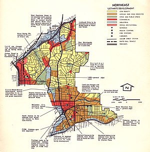
There have been multiple freeway revolts in Atlanta, Georgia. The longest and most famous examples of Interstate opposition were against I-485 and the Stone Mountain Freeway through Intown Atlanta, lasting over 30 years, from the early 1960s until the final construction of Freedom Parkway on a small portion of the contested routes in 1994.