Martin County is a county in the U.S. state of Texas. As of the 2010 census, its population was 4,799. Its county seat is Stanton. The county was created in 1876 and organized in 1884. It is named for Wylie Martin, an early settler.

Howard County is a county located in the U.S. state of Texas. At the 2010 census, its population was 35,012. Its county seat is Big Spring. The county was created in 1876 and organized in 1882. It is named for Volney E. Howard, a U.S. Congressman from Texas.

Borden County is a rural county located in the U.S. state of Texas. As of the 2010 census, its population was 641, making it the fourth-least populous county in Texas. Its county seat is Gail. The county was created in 1876 and later organized in 1891. Gail and Borden County are named for Gail Borden, Jr., businessman, publisher, surveyor, and inventor of condensed milk. Borden County is one of six prohibition or entirely dry counties in the state of Texas.

Lamesa is a city in and the county seat of Dawson County, Texas, United States. The population was 9,422 at the 2010 census, down from 9,952 at the 2000 census. Located south of Lubbock on the Llano Estacado, Lamesa was founded in 1903. Most of the economy is based on cattle ranching and cotton farming. The Preston E. Smith prison unit, named for the former governor of Texas, is located just outside Lamesa.

Edmonson is a town in Hale County, Texas, United States. The population was 111 at the 2010 census.

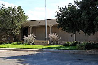
Stanton is a city in and the county seat of Martin County, Texas, United States. The population was 2,492 at the 2010 census.
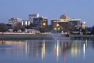
Midland is a city in and the county seat of Midland County, Texas, United States, on the Southern Plains of the state's western area. A small portion of the city extends into Martin County.

Cherokee Falls is an unincorporated community 5 miles (8 km) south of the town of Blacksburg in Cherokee County, South Carolina, United States. A former mill community along the Broad River, Cherokee Falls was a town until disincorporation in the 1990s. The former Cherokee Falls Cotton Mill is now a major fireworks distribution center for Herbie's Famous Fireworks.

Bushland is an unincorporated community in southwestern Potter County, Texas, United States. According to the Handbook of Texas, the community had an estimated population of 130 in 2000. The community is part of the Amarillo, Texas Metropolitan Statistical Area.
Greenwood is an unincorporated community in Midland County, Texas, United States. It is a small suburb of Midland and is part of the Midland Metropolitan Statistical Area.
KROO is a radio station with a news/talk format, licensed to Breckenridge, Texas.

Mariemont is an unincorporated community in El Dorado County, California. It lies at an elevation of 1158 feet.
Sawyer, New York is a hamlet in the town of Wheatfield in Niagara County, New York, United States.
KTXC is a Spanish language radio station airing a regional Mexican format, licensed to Lamesa, Texas, broadcasting on 104.7 MHz FM. KTXC serves the areas of Lamesa, Texas, Midland, Texas, Big Spring, Texas, and Odessa, Texas, and is owned by Gray Television.
Halls is an unincorporated community in Bartow County, in the U.S. state of Georgia.
Vealmoor, Texas is a small town in Howard County, Texas.
Bayard is an unincorporated community in Columbiana County, in the U.S. state of Ohio.
Palm Canyon Wash is an arroyo and tributary ephemeral stream or wash running east from the Jacumba Mountains in San Diego County, California to its confluence with Coyote Wash, east northeast of Ocotillo in the Yuha Desert of Imperial County, California at an elevation of 239 feet / 73 meters. Its source is on the east slope of the Jacumba Mountains at 32°42′28″N116°10′10″W, at an elevation of 4,000 feet.
Morrill is an unincorporated area that formerly held a distinct community in Cherokee County, Texas, United States. The site is along Farm to Market Road 1911 near Rusk.


