Related Research Articles

Rockdale County is a county located in the North Central portion in the U.S. state of Georgia. As of the 2020 census, the population was 93,570 up from 85,215 in 2010. The county seat is Conyers.

Whitesburg is a town in Carroll County, Georgia, United States. The population was 596 in 2020.

Gibson is a city and the county seat of Glascock County, Georgia, United States, and is home to the Glascock County Courthouse, a National Register of Historic Places listed site. The population was 663 at the 2010 census, and 630 in 2020.

Hartwell is a city in Hart County, Georgia, United States. The population was 4,469 at the 2010 census. The city is the county seat of Hart County.

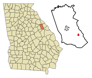
Commerce is a city in Jackson County and Banks County, Georgia, 70 miles (110 km) northeast of Atlanta. As of the 2020 census, the city had a population of 7,387.

Wrens is a city in Jefferson County, Georgia, United States. The population was 2,217 at the 2020 census. It is located on U.S. Route 1, thirty miles south of Augusta.

Lincolnton is a city and the county seat of Lincoln County, Georgia, United States. The population was 1,480 at the 2020 census. It contains numerous houses and historic districts listed on the National Register of Historic Places. Both the city and the county were named for General Benjamin Lincoln, who served in the Continental Army during the American Revolution.
Dearing is a town in McDuffie County, Georgia, United States. The population was 529 at the 2020 census. It is part of the Augusta metropolitan area.

Deepstep is a town in Washington County, Georgia, United States. The population was 117 in 2020.
Sweetwater Creek is a 45.6-mile-long (73.4 km) stream in the U.S. state of Georgia, west of Atlanta. It begins in southwestern Paulding County, flowing generally eastward into southwestern Cobb County, then turning south into eastern Douglas County. It is a tributary of the Chattahoochee River, and near its end it is the centerpiece of Sweetwater Creek State Park.
Alligator Creek is a 48.6-mile-long (78.2 km) tributary of the Little Ocmulgee River in the U.S. state of Georgia.
Rocky Comfort Creek is a 62.4-mile-long (100.4 km) tributary of the Ogeechee River in the U.S. state of Georgia. Rising in Warren County 9 miles (14 km) northwest of Warrenton, it flows southeast, entering Glascock County and passing the town of Gibson, then continuing south into Jefferson County, where it reaches the Ogeechee River at Louisville.

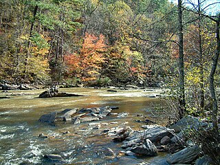
The Towaliga River is a 52.3-mile-long (84.2 km) tributary of the Ocmulgee River in central Georgia. The Towaliga begins in Henry County and passes through High Falls State Park in northwestern Monroe County, then traverses the county and joins the Ocmulgee near the town of Juliette. The river begins north of Cole Reservoir in Henry County where it is joined by multiple creeks, including Thompson Creek, Troublesome Creek in Spalding County, Long Branch, and Lee Creek to gain size. The river is fairly muddy above High Falls Lake, but it clears once below the falls where most of the river is rock bottomed. This region is about 50 miles (80 km) south of Atlanta and about 35 miles (56 km) north of Macon.
The Carrizo Creek and Carrizo Wash in California are a stream and an arroyo that the stream flows into, in San Diego County, California, and Imperial County, California.
Childers Creek is a stream in the U.S. state of Georgia. It is a tributary to Middle Creek.
Falling Creek is a stream in the U.S. state of Georgia. It is a tributary to the Broad River.
Fulsome Creek is a stream located in the U.S. state of Georgia. It serves as a tributary to the Ogeechee River.
Hillman is an unincorporated community in Taliaferro County, in the U.S. state of Georgia.
Raysville is an unincorporated community in McDuffie County, in the U.S. state of Georgia. The community is on a peninsula jutting into Lake Strom Thurmond between Big Creek and Germany Creek arms of the lake. Georgia Route 43 passes through the community.
Vesta is an unincorporated community in Oglethorpe County, in the U.S. state of Georgia.
References
- 1 2 U.S. Geological Survey Geographic Names Information System: Germany Creek
- 1 2 Krakow, Kenneth K. (1975). Georgia Place-Names: Their History and Origins (PDF). Macon, GA: Winship Press. p. 93. ISBN 0-915430-00-2.
- ↑ Winfield, GA, 7.5 Minute Topographic Quadrangle, USGS, 1979 (1985 rev.)
33°38′09″N82°27′40″W / 33.63583°N 82.46111°W