Gethsemane Man-made Forest

Last updated
Gethsemane Man-made Forest
Reserve Forest
Bhairabkunda JFMC
Map of Assam outline.svg
Area
  Total735 ha (1,816 acres)

Gethsemane Man-made Forest is a community led forest conservation initiative by the JFMC comprising six nearby villages under the Dhansiri Reserve Forest division. [1] It is a Plantation Centre consisting of more than 14 lakh plants of over 35 species, spread across 5500 bigha. [1] The initiative of regeneration of forest began in 2005 to transform the barren forest land impacted by illegal afforestation during the 1980s.

Contents

Impact

The man-made forest now has over 14 lakh plants such as khoir, gomari, simul, shisham etc. Many wild animals have returned to the forest. [2] Animals such as elephant, leopard, wild boar, tiger, deer, etc. and reptiles such as paradise flying snake and python are found in the forest. [3] [4] The Lepidiota Mansueta beetle specie is also commonly found in the forest along with various species of butterflies and dragonflies. It is also home to various himalayan, native and migratory birds. [5] The emergence of forest has also contributed towards the reduction of man-elephant conflict in the area. [6]

Aerial view of Gethsemane man-made forest Ariel View of Gethsemanene Man-made forest.jpg
Aerial view of Gethsemane man-made forest

Eco-Tourism

The forest is growing as an eco-tourism destination in the region. Thus helping local communities in the process. It has many trekking trails as well as cycling strips for adventure sports enthusiasts.
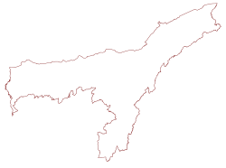
Geography

The man-made forest is spread across 5500 bighas beside the river Dhansiri on the foothills of Bhutan and Arunachal Pradesh. There are also various brooks inside the forest which are dug to satiate the trees during drought seasons.

History

Barren land prior to plantation Barren land at Gethsemane Man-made forest.jpg
Barren land prior to plantation

The 35 members of the JFMC began working the barren land under the name “Sonaigaon Multipurpose farm” for cultivation as well as farming purposes in 2003. Their effort gained support through the initiative of the then Forest Range Officer Naba Kumar Bordoloi of Bhairabkunda RF. He inducted the group into six JFMC and in 2005 a proposal was submitted to Ministry of Environment and Forest India. It was approved and the plantation under the Ministerial support extended from 2007 to 2011. [7]

Awards and recognition

KWS Award Ceremony KWS award for Gethsemane Man-made forest.jpg
KWS Award Ceremony

The JFMC has been awarded the ‘Lifetime Achievement Award’ by the Kaziranga Wildlife Society (KWS) in 2016 and ‘Eastern Himalayan Conservation Award’ by Balipara Foundation in 2017. [8]

See also

Related Research Articles

<span class="mw-page-title-main">Reforestation</span> Land regeneration method (replacement of trees)

Reforestation is the practice of restoring previously existing forests and woodlands that have been destroyed or damaged. The prior forest destruction might have happened through deforestation, clearcutting or wildfires. Two important purposes of reforestation programs are for harvesting of wood or for climate change mitigation purposes. Reforestation can also help with ecosystem restoration. One method for reforestation is to establish tree plantations, also called plantation forests. They cover about 131 million ha worldwide, which is 3% of the global forest area and 45% of the total area of planted forests.

<span class="mw-page-title-main">Kaziranga National Park</span> National park in the state of Assam, India

Kaziranga National Park is a national park in the Golaghat and Nagaon districts of the state of Assam, India. The park, which hosts two-thirds of the world's Indian rhinoceroses, is a UNESCO World Heritage Site. According to the census held in March 2018 which was jointly conducted by the Forest Department of the Government of Assam and some recognized wildlife NGOs, the rhino population in Kaziranga National Park is 2,613. It comprises 1,641 adult rhinos ; 387 sub-adults ; and 385 calves.

<span class="mw-page-title-main">Bodoland Territorial Region</span> Autonomous Administrative Region in Assam, India

The Bodoland Territorial Region (BTR) is an autonomous division in Assam, India, and a proposed state in Northeast India. It is made up of four districts on the north bank of the Brahmaputra River below the foothills of Bhutan and Arunachal Pradesh. It is administered by an elected body known as the Bodoland Territorial Council which came into existence under the terms of a peace agreement signed in February 2003 and its autonomy was further extended by an agreement signed in January 2020. The region covers an area of over nine thousand square kilometres and is predominantly inhabited by the Bodo people and other indigenous communities of Assam.

<span class="mw-page-title-main">Dooars</span> Alluvial floodplains in eastern-northeastern India

The Dooars or Duars are the alluvial floodplains in eastern-northeastern India and southern Bhutan that lie south of the outer foothills of the Himalayas and north of the Brahmaputra River basin. This region is about 30 km (19 mi) wide and stretches over about 350 km (220 mi) from the Teesta River in West Bengal to the Dhansiri River in Udalguri district of Assam. The region forms the gateway to Bhutan. It is part of the Terai-Duar savanna and grasslands ecoregion.

<span class="mw-page-title-main">Periyar National Park</span> Protected area in Kerala

Periyar National Park and Wildlife Sanctuary (PNP) is a protected area located in the districts of Pathanamthitta and Idukki in Kerala, India. It is a renowned Elephant and Tiger reserve. The protected area encompasses 925 km2 (357 sq mi), of which 305 km2 (118 sq mi) of the main zone was declared as the Periyar National Park in 1982. The park is a repository of rare, endemic, and endangered flora and fauna and forms the major watershed of two important rivers of Kerala: the Periyar and the Pamba.

<span class="mw-page-title-main">Ministry of Environment, Forest and Climate Change</span> Ministry of the Government of India

The Ministry of Environment, Forest and Climate Change (MoEFCC) is an Indian government ministry. The ministry portfolio is currently held by Bhupender Yadav, Union Minister of Environment, Forest and Climate Change.

<span class="mw-page-title-main">Tai Po Kau Nature Reserve</span> Nature reserve in Hong Kong

The Tai Po Kau Nature Reserve, also called Tai Po Kau Special Area, is a nature reserve in the Tai Po area of the New Territories in northern Hong Kong. The area comprises a dense, hilly woodland with over 100 species of trees and numerous streams and rivers. It is one of the most biologically diverse forests in Hong Kong. It is noted by the Hong Kong Bird Watching Society and others as one of the best locations for seeing forest birds in Hong Kong.

Forest management is a branch of forestry concerned with overall administrative, legal, economic, and social aspects, as well as scientific and technical aspects, such as silviculture, forest protection, and forest regulation. This includes management for timber, aesthetics, recreation, urban values, water, wildlife, inland and nearshore fisheries, wood products, plant genetic resources, and other forest resource values. Management objectives can be for conservation, utilisation, or a mixture of the two. Techniques include timber extraction, planting and replanting of different species, building and maintenance of roads and pathways through forests, and preventing fire.

<span class="mw-page-title-main">Robin Banerjee</span> Science Museum in Mission Road, Golaghat

Robin Banerjee was a wildlife expert, environmentalist, painter, photographer and documentary filmmaker who lived at Golaghat in the Indian state of Assam.

Kaziranga National Park is an Indian national park and a World Heritage Site in Golaghat and Nagaon districts of Assam, India. It is refuge for the world's largest population of great one-horned rhinoceros. Kaziranga has the highest density of tigers among protected areas in the world and was declared a Tiger Reserve in 2006. The park has large breeding populations of elephant, wild Asiatic water buffalo and swamp deer. Kaziranga is recognized as an Important Bird Area by Birdlife International for conservation of avifaunal species. The park has achieved notable progress in wildlife conservation with respect to other protected areas in India.Kaziranga was declared a Tiger Reserve in 2006

<span class="mw-page-title-main">Tourism in Assam</span> Tourism in Assam, India

Assam is the main and oldest state in the North-East Region of India and as the gateway to the rest of the Seven Sister States. The land of red river and blue hills, Assam comprises three main geographical areas: the Brahmaputra Valley which stretching along the length of the Brahmaputra river, the Barak Valley extending like a tail, and the intervening Karbi Plateau and North Cachar Hills. Assam shares its border with Meghalaya, Arunachal Pradesh, Nagaland, Manipur, Tripura, Mizoram and West Bengal; and there are National Highways leading to their capital cities. It also shares international borders with Bhutan and Bangladesh and is very close to Myanmar. In ancient times Assam was known as Pragjyotisha or Pragjyotishpura, and Kamarupa.

Bhairabkunda is a popular picnic spot in Udalguri district in the State of Assam, India. It is situated on the border of Bhutan.

<span class="mw-page-title-main">Udalguri district</span> District of Assam in India

Udalguri district (Pron:ˌʊdʌlˈgʊəri), also known as Odalguri, is a district in the Bodoland Territorial Region of the state of Assam in Northeastern India. Udalguri town is the headquarters of the district.

<span class="mw-page-title-main">Jadav Payeng</span> Indian environmentalist, nature scientist (born 1959)

Jadav "Molai" Payeng is an environmental activist and forestry worker from Majuli, popularly known as the Forest Man of India. Over the course of several decades, he has planted and tended trees on a sandbar of the river Brahmaputra turning it into a forest reserve. The forest, called Molai forest after him, is located near Kokilamukh of Jorhat, Assam, India and encompasses an area of about 1,360 acres / 550 hectares. In 2015, he was honoured with Padma Shri, the fourth highest civilian award in India. He was born in the indigenous Mising tribe of Assam.

<span class="mw-page-title-main">Aaranyak</span>

Aaranyak is a leading wildlife NGO based in Guwahati. It was founded by Bibhab Kumar Talukdar. It is a Scientific, Industrial Research and frontline environmental organization of India. It works all over the eastern Himalayan region on nature conservation, natural resources management, climate change, disaster management and livelihood enhancement of marginalized communities through research, education and advocacy.

Telangana Ku Haritha Hāram is the afforestation program undertaken by the Telangana government. Haritaharam 2015 was officially inaugurated by Telangana State Chief Minister Kalvakuntla Chandrasekhar Rao on 3 July 2015 at Chilukur Balaji Temple. The Telangana Government has designed this program with the objective of planting trees and greening the whole of Telangana. 46 crore saplings were planted in 2016 alone.

Assam – 16th largest, 15th most populous and 26th most literate state of the 28 states of the democratic Republic of India. Assam is at 14th position in life expectancy and 8th in female-to-male sex ratio. Assam is the 21st most media exposed states in India. The Economy of Assam is largely agriculture based with 69% of the population engaged in it. Growth rate of Assam's income has not kept pace with that of India's during the Post-British Era; differences increased rapidly since the 1970s. While the Indian economy grew at 6 percent per annum over the period of 1981 to 2000, the same of Assam's grew only by 3.3 percent.

<span class="mw-page-title-main">Sonia Jabbar</span>

Sonia Jabbar is an Indian plantation owner and wildlife conservationist. Starting in 2012, she transformed her tea plantation in Darjeeling to accommodate and facilitate the safe passage of elephants during their migration between Nepal and Assam. The Wildlife Trust of India recognised the plantation as the Green Corridor Champion of North Bengal; the University of Montana, US, certified it Elephant Friendly. She then initiated additional projects for elephant conservation, including a re-wilding project to create a 100-acre forest, and a pilot crop insurance project for neighbouring farms. In 2019, she was awarded the Nari Shakti Puraskar, India's highest civilian award for women.

Bhairabkunda Shiva Mandir or Daifam Shiv Mandir is one of the most important Hindu temples in Bhutan. It is the only Shakti Peetha in Bhutan. It is located in the south east corner of Bhutan near the town of Jomotsangkha (Daifam) and it shares border with the Indian states of Arunachal Pradesh to East and Assam to the South. It is located 24 km from the Indian town of Udalguri in Assam.

<span class="mw-page-title-main">Kalamati</span> Place in Assam, India

Kalamati is a popular picnic spot located north of Chirang district,Bodoland Territorial Region,Assam, India, and shares a border with Bhutan.

References

  1. 1 2 "J.F.M.C. Plantation Centre, Bhairabkunda, R.F. | Udalguri District | Government Of Assam, India". udalguri.assam.gov.in. Retrieved 2020-12-04.
  2. "Barren forest land regenerated at Bhairabkunda". The Assam Tribune Online. Retrieved 2020-12-04.
  3. "Man-made forest at Bhairabkunda". Assam Times. 2016-07-20. Retrieved 2020-12-04.
  4. "Flying snake found at Bhairabkunda". Assam Times. 2016-04-03. Retrieved 2020-12-04.
  5. "Afforestation changes life and landscape: How a district in Assam lost a forest, gained a future". The Indian Express. 2017-12-25. Retrieved 2020-12-04.
  6. "Regenerated Bhairabkunda forest easing human-elephant conflict". The Assam Tribune Online. Retrieved 2020-12-04.
  7. "Once fighting for Bodoland, 35 men divert their efforts to grow a forest". Mongabay-India. 2020-01-28. Retrieved 2020-12-04.
  8. "Lifetime Achievement Award to JFMC Bhairabkunda". Assam Times. 2016-08-14. Retrieved 2020-12-04.

Further reading