Ghiran | |
|---|---|
Town | |
 Ghiran Location in Libya | |
| Coordinates: 32°21′00″N15°02′00″E / 32.35000°N 15.03333°E | |
| Country | |
| Region | Tripolitania |
| District | Misrata |
| Time zone | UTC+2 (EET) |
Ghiran is a coastal town in Libya, located on the outskirts of Misrata.
Ghiran | |
|---|---|
Town | |
| Ghiran Location in Libya | |
| Coordinates: 32°21′00″N15°02′00″E / 32.35000°N 15.03333°E | |
| Country | |
| Region | Tripolitania |
| District | Misrata |
| Time zone | UTC+2 (EET) |
Ghiran is a coastal town in Libya, located on the outskirts of Misrata.
Ghiran lies near the proposed Libyan Railways line.
The earthworks for the new lines under construction can be seen on the aerial photographs.
There is also an airport nearby.

Buse Lake Protected Area, informally known as Buse Lake Provincial Park, is a provincial park in British Columbia, Canada, 23 km east-southeast of Kamloops near Monte Creek. It was created in 2000 as part of the outcome of the Kamloops Landuse and Resource Management Plan (KLRMP) and is 228 hectares in size.
Malaspina Provincial Park is a provincial park in British Columbia, Canada, located on the northeast side of the Malaspina Peninsula facing Desolation Sound in the northernmost area of that province's Sunshine Coast region.
Ruth Lake Provincial Park is a provincial park in British Columbia, Canada, located northeast of 100 Mile House.
Smelt Bay Provincial Park is a provincial park in British Columbia, Canada. It is located at the south end of Cortes Island, and has twenty-two camping sites. Eight are reservable and the rest are first-come, first-served. There is also an overflow parking lot directly next to the beach for any excess campers.
Mandranwala (Urdu/Punjabi:مندرانوالہ) is a village near Daska in Sialkot District in the Punjab province of Pakistan. Mandranwala is a medium-sized village situated only three kilometers Daska City. It is 28 kilometers from Sialkot City.

This is a list of the extreme points of Luxembourg, the points that are farther north, south, east or west, higher or lower than any other location in the territory of the state.

The Gwa'Sala-Nakwaxda'xw Nations are a union of two Kwakwaka'wakw peoples in a band government based on northern Vancouver Island in British Columbia, Canada, whose main reserve community is near the town of Port Hardy in the Queen Charlotte Strait region of the Central Coast region of British Columbia, Canada. The band government is a member of the Kwakiutl District Council and, for treaty negotiation purposes, the Winalagalis Treaty Group which includes three other members of the Kwakiutl District Council.
The Esk'etemc First Nation, also known as the Alkali Lake Indian Band, is a First Nations government of the Secwepemc (Shuswap) people, located at Alkali Lake in the Cariboo region of the Central Interior of the Canadian province of British Columbia. It was created when the government of the then-Colony of British Columbia established an Indian reserve system in the 1860s. It is one of three Secwepemc bands that is not a member of either the Shuswap Nation Tribal Council or the Northern Shuswap Tribal Council.
A health care crisis currently exists in Libya due to the ongoing conflict.
Sahna is a village and union council of Mandi Bahauddin District in the Punjab province of Pakistan. It is located at 32°32'60N 73°20'60E and has an altitude of 211 metres.

Año Nuevo State Marine Conservation Area (SMCA) is one of two adjoining marine protected areas off the coast of San Mateo and Santa Cruz Counties, on California’s central coast. The area is approximately 55 miles south of San Francisco. The SMCA is 11.07 square miles. Except for limited taking of giant kelp, all living marine resources are protected.
Gribbell Island is an island on the North Coast of British Columbia, Canada, located on the east side of the entrance to Douglas Channel at Wright Sound. Gribble Island Indian Reserve No. 10 is on its west coast, between Verney Passage and Ursula Channel at 53°21′00″N129°08′00″W. The small Wimbledon Range is on the south side of the island, facing the northern extremities of Princess Royal Island to the south, at 53°21′00″N129°02′00″W
Edgegrain Mountain is a mountain in the Continental Ranges of British Columbia, Canada, located between the headwaters of Jarvis and Kitchi Creeks. The name was adopted in 1965 and was given in relation to its strata of sedimentary rock being tilted nearly at a right angle. Its closest neighbour is Mount Ida.
Gbako is a Local Government Area in Niger State, Nigeria. Its headquarters are in the town of Lemu in the north of the area at9°24′00″N6°02′00″E. The Kaduna River forms its western boundary.
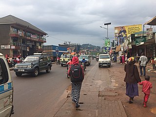
Bwaise is a neighborhood within Kampala, Uganda's capital, and largest city. Due to lack of proper urban planning, it has grown into a commercial, industrial and residential township with poor infrastructure. The lack of developed infrastructure and poor service provision has exposed the town dwellings and residents to several challenges including flooding and water borne diseases.
Ouaouizeght is a small town and rural commune in Azilal Province, Béni Mellal-Khénifra, Morocco. At the time of the 2004 census, the commune had a total population of 13,940 people living in 2,885 households.
Bhikhi Khurd is a small village in the Bhalwal Tehsil area of Sargodha District in Pakistan, two kilometres from the M2 motorway. Most of the population are farmers. There are two primary schools, one private school, and three private clinics. The village also has three mosques. Khurd and Kalan are Persian words which mean small and big, respectively. When two villages have the same name, they are distinguished by these words in their names.
The 2011 Mogadishu bombing occurred on 4 October 2011, when a suicide bomber drove a truck into the gate of the Transitional Federal Government's ministerial complex in Mogadishu, Somalia. The resulting explosion killed 100 people and injured over 110 others. Al-Shabaab, an Islamist group, claimed responsibility for the attack. The attack is reported to be the largest since Al-Shabaab launched an insurgency in Somalia in early 2007. It also follows the withdrawal of Al-Shabaab's forces from the area in August after an AMISOM intervention to bring aid to the country during a season of drought.
The Al-Ghiran Brigade(s), originating from Misrata, was a brigade formed with the purpose of safeguarding the Al-Ghiran region against pro-Gaddafi factions during the battle of Misrata. This brigade is known for being the one to capture Muammar Gaddafi, and eventually killing him after 8 months of fighting.
| Capital | ||
|---|---|---|
| Towns and villages | ||
32°21′00″N15°02′00″E / 32.35000°N 15.03333°E
| | This Libya location article is a stub. You can help Wikipedia by expanding it. |