Related Research Articles
Interstate 94 (I-94) is an east–west Interstate Highway connecting the Great Lakes and northern Great Plains regions of the United States. Its western terminus is in Billings, Montana, at a junction with I-90; its eastern terminus is in Port Huron, Michigan, where it meets with I-69 and crosses the Blue Water Bridge into Sarnia, Ontario, Canada, where the route becomes Ontario Highway 402. It thus lies along the primary overland route from Seattle to Toronto, and is the only east–west Interstate highway to form a direct connection into Canada. I-94 intersects with I-90 several times: at its western terminus; Tomah to Madison in Wisconsin; in Chicago, and in Lake Station, Indiana. All together the major cities that I-94 connects to are Billings; Bismarck; Fargo; Minneapolis–Saint Paul; Madison; Milwaukee; Chicago; and Detroit.
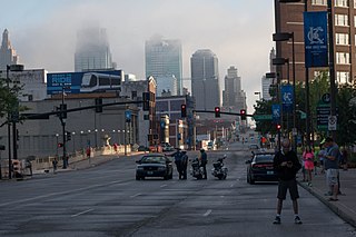
Crown Center is a shopping center and neighborhood located near Downtown Kansas City, Missouri between Gillham Road and Main Street to the east and west, and between OK/E 22nd St and E 27th St to the north and south. The shopping center is anchored by Halls, a department store which is owned and operated by Hallmark Cards. The neighborhood contains numerous residences, retail establishments, entertainment venues, and restaurants including the American Restaurant, the only Forbes Travel Guide four-star restaurant in Missouri. It is home to Hallmark Cards, and the headquarters of Shook, Hardy & Bacon and Lathrop & Gage, two of Kansas City's largest law firms.

Interstate 275 (I-275), located in Florida, is a 60-mile-long (97 km) auxiliary Interstate Highway serving the Tampa Bay Area. Its southern terminus is at Interstate 75 near Palmetto, where I-275 heads west towards the Sunshine Skyway Bridge crossing over Tampa Bay. From that point, I-275 passes through St. Petersburg before crossing Tampa Bay again on the Howard Frankland Bridge, then continues through the city of Tampa, where it connects to an interchange with Interstate 4 in Downtown Tampa. After the interchange, I-275 passes north through the Tampa suburbs to its northern terminus at Interstate 75 in Wesley Chapel.
Minnesota State Highway 23 (MN 23) is a state highway that stretches from southwestern to northeastern Minnesota. At 343.723 miles (553.169 km) in length, it is the second longest state route in Minnesota, after MN 1.
The name "M Street" refers to two major roads in the United States capital of Washington, D.C. Because of the Cartesian coordinate system used to name streets in Washington, the name "M Street" can be used to refer to any east-west street located twelve blocks north or south of the dome of the United States Capitol. Thus, in all four quadrants of the city there are streets called "M Street", which are disambiguated by quadrant designations, namely, M Street NW, NE, SW, and SE.
State Road 933, locally known as West 12th Avenue, and Ronald W. Reagan Avenue, is a 4.25-mile (6.84 km) long north–south street entirely within the city limits of Miami, Florida. Its southern terminus is an intersection with Coral Way as Coral Way changes from Southwest 22nd Street to Southwest Third Avenue; its northern terminus is an interchange with the Airport Expressway. North of Dolphin Expressway, reassurance signage is virtually nonexistent, and the only indication of SR 933 existing north of Northwest 14th Street is a pair of trailblazer signs on Northwest 36th Street.
State Road 990 is the 2.97-mile-long (4.78 km) central section of the approximately 11.6-mile-long (18.7 km) Killian Drive, also known as Killian Parkway, Southwest 104th Street and Southwest 112th Street and historically South Kendall Drive, located in southern Miami-Dade County, Florida. Running from east to west, it serves to connect the community of The Hammocks with the village of Pinecrest via the community of Kendall, with State Road 990 connecting Southwest 107th Avenue and the Don Shula Expressway to the South Dixie Highway. Recognising the role the road played in southern Miami-Dade County's history and development, the section of State Road 990 between the Expressway and US 1 was designated the Killian Drive State Historic Highway by the Florida Senate in 1995.
Sunset Drive, also known as Southwest 72nd Street is a 12.5-mile-long (20.1 km) east–west arterial road traversing the southwestern suburbs of Miami, Florida, from the northwestern portions of the Kendall area to Coral Gables. A central portion of Sunset Drive is maintained by the Florida Department of Transportation as State Road 986, which runs from the Homestead Extension (HEFT) underpass to Southwest 69th Avenue and is signed through South Miami to US 1.

San Fernando Road is a major street in the City of Los Angeles and Los Angeles County. Within the Burbank city limits it is signed as San Fernando Boulevard, and north of Newhall Pass it is signed as The Old Road. It was previously designated as Business Loop 5 in the 1970s.

Southwest Philadelphia is a section of Philadelphia, Pennsylvania, United States. The section can be described as extending from the western side of the Schuylkill River to the city line, with the SEPTA. The northern border is defined by the Philadelphia City Planning Commission as east from the city line along Baltimore Avenue moving south along 51st Street to Springfield Ave. It follows the train tracks until 49th Street. From 49th and Kingsessing Ave the line moves east along Kingsessing Ave. The line then moves south along 46th St to Paschall Ave where it jogs to join Grays Ferry where the line runs to the Schuylkill River.

Ward Parkway is a boulevard in Kansas City, Missouri, United States, near the Kansas-Missouri state line. Ward Parkway begins at Brookside Boulevard on the eastern edge of the Country Club Plaza and continues westward along Brush Creek as U.S. Route 56 until it turns southward across the creek just before the Kansas-Missouri state line. It then continues south for four miles, terminating at Wornall Road near West 95th Street.

Dyer Avenue is a short, north-south thoroughfare in the Hell's Kitchen neighborhood of Manhattan in New York City, located between Ninth Avenue and Tenth Avenue. It is primarily used by traffic exiting the Lincoln Tunnel. Dyer Avenue runs between 30th Street and 42nd Street but functions as three distinct sections due to its connections with the south and center tubes of the Lincoln Tunnel. The southernmost section, between 30th and 31st Streets, leads to and from the Lincoln Tunnel Expressway. Dyre Avenue also exists between 34th and 36th Streets, and between 40th and 42nd Streets; both sections lead directly from the tunnel, but the 34th-36th Streets section also contains a roadway leading to the tunnel. The avenue is owned by the Port Authority of New York and New Jersey.
Stony Island Avenue is a major street on South Side of the city of Chicago, designated 1600 East in Chicago's street numbering system. It runs from 56th Street south to the Calumet River. Stony Island Avenue continues sporadically south of the Calumet in the southern suburbs, running alongside the Bishop Ford Freeway, sometimes as a frontage road. It terminates at County Line Road on the border of Will and Kankakee Counties.
Midtown Marketplace is a shopping center located in Kansas City, Missouri on Linwood Boulevard & Main Street across the street from a Gates Bar.B.Q. restaurant in Union Hill. The location surrounds the area from Linwood Boulevard to 34th Street on the north/south and Main Street to Gillham Road on the west/east.

Hyde Park is a historic neighborhood and city park in Kansas City, Missouri.

Union Hill is a historic neighborhood in Kansas City, Missouri. The neighborhood is located between 27th Street and 31st Street and Main Street to Gillham Road.
Hospital Hill is a neighborhood in Kansas City, Missouri. The neighborhood is located between 22nd Street to 25th Street and Gillham Road to Troost Avenue. This name reflects not only the geography on which the buildings rest, but also a history of public hospitals on the same site dating back to 1870. Hospital Hill grew in concordance with the construction of local hospitals, and was further populated as the University of Missouri–Kansas City School of Medicine was established.
There are 19 business routes of Interstate 94 (I-94) in the United States. These business routes connect the downtown business districts of cities to the freeway along Interstate 94.
References
| | This Missouri road-related article is a stub. You can help Wikipedia by expanding it. |