The Inn is a river in Switzerland, Austria and Germany. The 518 km (322 mi) long river is a right tributary of the Danube, being the third largest tributary of the Danube by discharge. The highest point of its drainage basin is the summit of Piz Bernina at 4,049 m (13,284 ft). The Engadine, the valley of the En, is the only Swiss valley whose waters end up in the Black Sea.
Miesbach is a Landkreis (district) in Bavaria, Germany. It is bounded by the districts of Bad Tölz-Wolfratshausen, Munich and Rosenheim, and by the Austrian state of Tyrol.

The Bavarian Alps is a collective name for several mountain ranges of the Northern Limestone Alps within the German state of Bavaria.

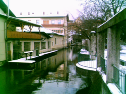
Bad Aibling is a spa town and former district seat in Bavaria on the river Mangfall, located some 56 km (35 mi) southeast of Munich. It features a luxury health resort with a peat pulp bath and mineral spa.

The Amper, called the Ammer upstream of the Ammersee, through which it runs, is the largest tributary of the Isar in southern Bavaria, Germany. It flows generally north-eastward, reaching the Isar in Moosburg, about 185 kilometres (115 mi) from its source in the Ammergau Alps, with a flow of 45 m³/s. Including its tributary, Linder, it is 209.5 km (130.2 mi) long. Major tributaries are the Glonn, which rises near Augsburg; the Würm, which is the outflow of Lake Starnberg; and the Maisach.

Glonn is a market town in the Ebersberg district in Upper Bavaria, Germany, about 30 km (19 mi) southeast of Munich.
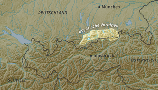
The Bavarian Prealps are a mountain range within the Northern Limestone Alps along the Austria–Germany border. They include the Bavarian Prealp region between the river Loisach to the west and the river Inn to the east; the range is about 80 kilometres (50 mi) long and 20–30 kilometres (12–19 mi) wide. The term is not defined politically, but alpine-geographically because, although the range is mostly located in Bavaria, southeast Germany, small areas of the Bavarian Prealps lie in the state of Tyrol, Austria.

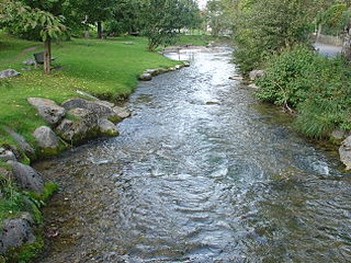
The Mangfall is a river of Upper Bavaria, Germany. It is a left tributary of the Inn. The Mangfall is the outflow of the Tegernsee lake and discharges into the Inn in Rosenheim. The Mangfall is 63 km (39 mi) long.

Braunau is a river of Bavaria, Germany. It flows into the Glonn near Tuntenhausen.
Festenbach is a river of Bavaria, Germany. It flows into the Mangfall near Thalmühl.
The Glonn is a river of Upper Bavaria, Bavaria, Germany.

Weißach is a river of Bavaria, Germany. It flows into the Tegernsee, which is drained by the Mangfall, near Rottach-Egern.

Rottach is a river of Bavaria, Germany. It flows into the Tegernsee, which is drained by the Mangfall, in Rottach-Egern.

Leitzach is a river of Bavaria, Germany. It flows into the Mangfall near Feldkirchen-Westerham.
Schlierach is a river of Bavaria, Germany. It is the outflow of the Schliersee, and flows into the Mangfall near Weyarn.

Söllbach is a river of Bavaria, Germany. It flows into the Tegernsee, which is drained by the Mangfall, near Bad Wiessee.

Zeitlbach is a river of Bavaria, Germany. It flows into the Glonn near Erdweg.
The Munich–Holzkirchen railway is a continuously-electrified, double-track, railway in the German state of Bavaria. It runs from Munich to Holzkirchen via Deisenhofen.

Kaltenbach is a river of Bavaria, Germany. It is a right tributary of the Mangfall at Rosenheim.