The Arctic Archipelago, also known as the Canadian Arctic Archipelago, is an archipelago lying to the north of the Canadian continental mainland, excluding Greenland and Iceland.
The Patuxent Range or macizo Armada Argentina is a major range of the Pensacola Mountains, comprising the Thomas Hills, Anderson Hills, Mackin Table and various nunataks and ridges bounded by the Foundation Ice Stream, Academy Glacier and the Patuxent Ice Stream. Discovered and partially photographed on January 13, 1956 in the course of a transcontinental nonstop plane flight by personnel of U.S. Navy Operation Deep Freeze I from McMurdo Sound to Weddell Sea and return.

The Leverett Glacier is about 50 nautical miles (90 km) long and 3 to 4 nautical miles wide, flowing from the Antarctic Plateau to the south end of the Ross Ice Shelf through the Queen Maud Mountains. It is an important part of the South Pole Traverse from McMurdo Station to the Admundson–Scott South Pole Station, providing a route for tractors to climb from the ice shelf through the Transantarctic Mountains to the polar plateau.
New Ulster was a province of the Colony of New Zealand that existed between 1841 and 1853. It was named after the Irish province of Ulster.
Zavadovskiy Island, also known as Penguin Island, is an ice-covered island in the West Ice Shelf near Antarctica located at 66°43′S86°24′E. It rises to 200 meters and is located 12 miles east of Mikhaylov Island. It was discovered by the Soviet expedition of 1956 which named it for Ivan Zavadovsky, second in command of the Imperial Russian Navy sloop-of-war Vostok in the Bellingshausen expedition in 1819–21.
Seaton Glacier is a glacier 17 miles (27 km) long, flowing southeast into Edward VIII Ice Shelf at the northwest part of Edward VIII Bay. It was mapped by Norwegian cartographers from aerial photos taken by the Lars Christensen Expedition, 1936–37, remapped, 1954–58, by ANARE and named by ANCA in 1958 for Flight Lt. John Seaton, RAAF, pilot with ANARE at Mawson in 1956.

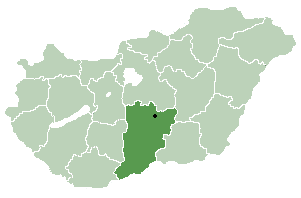
Páhi is a village in Bács-Kiskun county, in the Southern Great Plain region of southern Hungary.

Sotragero is a municipality and town located in the province of Burgos, Castile and León, Spain. According to the 2007 census (INE), the municipality has a population of 230 inhabitants. Sotragero is 8 km north from Burgos, and it is a member of the Alfoz de Burgos in the valley of the Ubierna river.
Yule Bay is a bay indenting the coast of northern Victoria Land between Cape Hooker and Cape Dayman. An inner (western) portion of the bay is circumscribed by Bates Point and Ackroyd Point.
Cerro Ciénaga Grande is a mountain in the Andes of Argentina. It has a height of 6,030 metres (19,780 ft).
Ipaumirim is a municipality in the state of Ceará in the Northeast region of Brazil.
Potiretama is a municipality in the state of Ceará in the Northeast region of Brazil.
On the continent of Antarctica, the Aramis Range is the third range south in the Prince Charles Mountains, situated 11 miles southeast of the Porthos Range and extending for about 30 miles in a southwest–northeast direction. It was first visited in January 1957 by Australian National Antarctic Research Expeditions (ANARE) southern party led by W.G. Bewsher, who named it for a character in Alexandre Dumas' novel The Three Musketeers, the most popular book read on the southern journey.

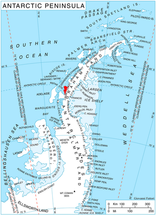
Widdowson Glacier is a glacier situated between Drummond and McCance Glaciers and flowing into Darbel Bay south of Sokol Point, on the west coast of Graham Land.

Drummond Glacier is a glacier 10 nautical miles (18 km) long and 2 nautical miles (4 km) wide, on the west coast of Graham Land, situated south of Hopkins Glacier and flowing west-northwest between Voit Peak and Sherba Ridge into Darbel Bay east of Sokol Point.
Moider Glacier is a glacier flowing west into the east side of Dalgliesh Bay, Pourquoi Pas Island, in Marguerite Bay, Antarctica. It was named by the UK Antarctic Place-Names Committee in 1979 in association with nearby Perplex Ridge; the word "moider" can be a synonym for "perplex".

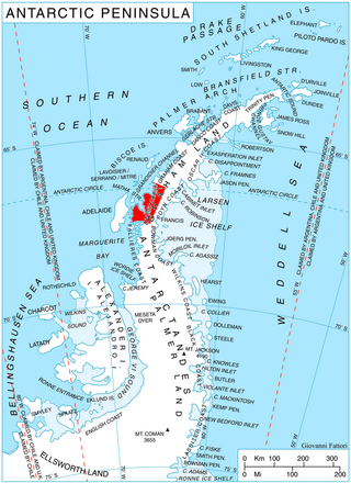
McCance Glacier is the 30-km long and 5 km wide glacier draining the Hutchison Hill area on the west slopes of Avery Plateau on Loubet Coast in Graham Land, Antarctica. It flows north-northwestwards along the west side of Osikovo Ridge, Kladnitsa Peak and Rubner Peak and enters Darbel Bay.
Remus Glacier is a glacier, 8 nautical miles (15 km) long, which flows from the north slopes of Mount Lupa northwestward along the northeast side of the Blackwall Mountains into Providence Cove, Neny Fjord, on the west coast of Graham Land. The lower reaches of the glacier were first roughly surveyed in 1936 by the British Graham Land Expedition (BGLE) under Rymill. Resurveyed in 1948-49 by the Falkland Islands Dependencies Survey (FIDS), who so named it for its association with Romulus Glacier, whose head lies near the head of this glacier.


