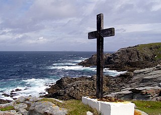
This is a list of the extreme points of the United Kingdom: the points that are farther north, south, east or west than any other location. Traditionally the extent of the island of Great Britain has stretched "from Land's End to John o' Groats".

This is a list of the extreme points of Ireland – the points that are furthest north, south, east or west in Ireland. It includes the Republic of Ireland and Northern Ireland.

Joinville Island is the largest island of the Joinville Island group, about 40 nautical miles long in an east–west direction and 12 nautical miles wide, lying off the northeastern tip of the Antarctic Peninsula, from which it is separated by the Antarctic Sound.

The Usarp Mountains are a major mountain range in North Victoria Land, Antarctica. They are west of the Rennick Glacier and trend north to south for about 190 kilometres (118 mi). The mountains are bounded to the north by Pryor Glacier and the Wilson Hills. They are west of the Bowers Mountains.
San Cristóbal is a district of the Alto Paraná Department, Paraguay.

Coronel Murta is a Brazilian municipality located in the northeast of the state of Minas Gerais. Its population as of 2020 was estimated to be 9,215 people living in a total area of 813 km². The city belongs to the mesoregion of Jequitinhonha and to the microregion of Araçuaí. It became a municipality in 1953.
Marcelino Ramos is a municipality in the state of Rio Grande do Sul, Brazil. As of 2020, the estimated population was 4,319.

Rodeio Bonito is a municipality in the state of Rio Grande do Sul, Brazil. As of 2020, the estimated population was 5,868.
Ifanirea is a town and commune in Madagascar. It belongs to the district of Ikongo, which is a part of Vatovavy-Fitovinany Region. The population of the commune was estimated to be approximately 19,000 in 2001 commune census.
Anilobe is a town and commune in Madagascar. It belongs to the district of Vangaindrano, which is a part of Atsimo-Atsinanana Region. The population of the commune was estimated to be approximately 2,000 in 2001 commune census.
Marilac is a municipality in the state of Minas Gerais in the Southeast region of Brazil.
San Miguel (La Rioja) is a municipality and village in La Rioja Province in northwestern Argentina.
Davis Valley is an ice-free valley just east of Floridas Ridge in north-east Dufek Massif, in the Pensacola Mountains, Antarctica.

Eadie Island is an island 2 km (1.2 mi) long which lies between Aspland Island and O'Brien Island, in the South Shetland Islands of Antarctica. A strong marine channel, named Tasman Rip, runs between Eadie Island and O'Brien Island.

Ecology Glacier is a glacier flowing northeast into Admiralty Bay, King George Island, north of Llano Point. It was named by the Polish Antarctic Expedition, 1980, after the Institute of Ecology of the Polish Academy of Sciences, the sponsor of nearby Arctowski Station.
Mount Holdgate is a prominent mountain, 960 metres (3,150 ft) high, with steep icefalls and rock buttresses which provides a clear landmark at the southeast end of Cook Island in the South Sandwich Islands. It was named by the UK Antarctic Place-Names Committee for Martin W. Holdgate, organizer and senior scientist of the survey of the South Sandwich Islands from HMS Protector in 1964.

Quéntar is a municipality in the province of Granada, Spain. As of 2020, it has a population of 947 inhabitants.
Serra do Cachimbo is a low mountain range in the southern part of the state of Pará, Brazil. It is located mostly in the municipalities of Altamira, Itaituba, Jacareacanga, and Novo Progresso.
The Little River, a perennial river that is part of the Hawkesbury-Nepean catchment, is located in the Southern Highlands region of New South Wales, Australia.


