
New England is a geographical region in the north of the state of New South Wales, Australia, about 60 km inland from the Tasman Sea. The area includes the Northern Tablelands and the North West Slopes regions. As of 2021, New England had a population of 185,560, with over a quarter of the people living in the area of Tamworth Regional Council.

Gwydir River, a major inland perennial river of the Barwon catchment within the Murray–Darling basin, is located in the Northern Tablelands, North West Slopes, and Orana districts of New South Wales, Australia.
Moree is a town in Moree Plains Shire in northern New South Wales, Australia. It is located on the banks of the Mehi River, in the centre of the rich black-soil plains. The town is located at the junction of the Newell Highway and Gwydir Highway and can be reached by daily train and air services from Sydney.

Newell Highway is a national highway in New South Wales (NSW), Australia. It provides the major road link between southeastern Queensland and Victoria via central NSW and as such carries large amounts of freight. At 1,058 kilometres (657 mi) in length, the Newell is the longest highway in NSW, and passes through fifteen local government areas.
Gwydir Highway is a 568-kilometre (353 mi) state highway in northern New South Wales, Australia. The highway was named after the Gwydir River, which in turn was named after a locale in Wales.

Kamilaroi Highway is a 605-kilometre (376 mi) state highway located in the north-western region of New South Wales, Australia, and links Bourke via Walgett and Narrabri to Willow Tree. The highway is named after the Kamilaroi Indigenous Australian people who live in the area.

Carnarvon Highway is a state highway in Queensland and New South Wales, Australia, linking the township of Rolleston in Queensland's Central Highlands Region, via the town of St George, eventually to Moree in northern New South Wales. It is the main access road to the Carnarvon National Park, and serves as a strategic route to take B-doubles and other large vehicles to the Queensland ports north of Rockhampton.

Mungindi is a town and locality on the border of New South Wales (NSW) and Queensland, Australia. The town is within Moree Plains Shire in New South Wales. Within Queensland, the locality is split between the Shire of Balonne and the Goondiwindi Region with the town in the Shire of Balonne. It possesses a New South Wales postcode. Mungindi sits on the Carnarvon Highway and straddles the Barwon River which is the border between New South Wales and Queensland. At the 2016 census, Mungindi had a population of 601 on the New South Wales side, while the population on the Queensland side was 146.

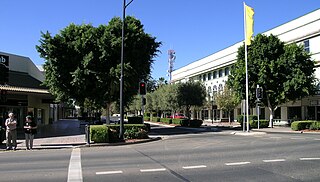
Finley is a town in the Murray region of New South Wales, Australia. It is the largest town in the Berrigan Shire local government area. At the 2016 census, Finley had a population of 2,519 people. The town is located approximately 140 kilometres (87 mi) west of Albury on the intersection of the Newell Highway and Riverina Highways.

Moree Plains Shire is a local government area in the North West Slopes region of New South Wales, Australia. The northern boundary of the Shire is located adjacent to the border between New South Wales and Queensland. The Shire is located adjacent to the Newell and Gwydir Highways and the North West railway line.
Ashley is a small rural locality of 339 people on the Carnarvon Highway, 17 km north of Moree, New South Wales, Australia and 692 km from Sydney. The village boundaries are within the Moree Plains Shire local government area. The village is at a height of 201.4 metres and is in Bogree parish, Courallie County.
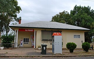
Garah is a town in north western New South Wales, Australia. The town is in the Moree Plains Shire local government area. At the 2016 census, Garah and the surrounding area had a population of 306.

Bellata is a small village in north-central New South Wales, Australia, in Narrabri Shire. At the 2006 census, Bellata had a population of 529. The place name Bellata could be derived from the local Aboriginal word meaning "kangaroo" or possibly "home of belar trees".

The Central West is a region in central New South Wales, Australia. The region is situated west of Sydney, which stretches from Lithgow in the east and to as far west as Lake Cargelligo, on the Lachlan River. The Central West is known for its attractions such as the Jenolan Caves, near Oberon and also wineries, as well as rural farmland and natural landscapes. The region includes major towns like, Bathurst, Orange, Mudgee, Lithgow, Parkes and Cowra. It has an area of 63,262 square kilometres (24,426 sq mi). The region also includes the sub-region known as the Central Tablelands, located in the eastern part of the region. The region known as the Orana, which includes the area surrounding Dubbo is typically classed as being a part of the Central West also.
The North West Slopes region of New South Wales, Australia, refers generally to the area west of the Northern Tablelands, to the north of the Central West region and to the east of the Far West region. Despite its name, the region is in north-central New South Wales, corresponding generally to the Australian Bureau of Meteorology's forecast area of North West Slopes and Plains. The administrative areas of the region include the city of Tamworth, Gunnedah, Moree, Narrabri and Inverell.
Moree Airport is an airport in Moree, New South Wales, Australia. The airport is 5 km (3.1 mi) from the city center. The airport has some scheduled services but mainly provides general aviation facilities, maintenance and support for agricultural aviation in the local area. The Moree Aero Club has been based at the airport since 1952, and today provides aircraft hire and flight training. The club was instrumental in providing many early improvements to the aerodrome facilities, including hangars and a terminal building. In the 2021-22 Financial Year, Moree Airport handled 18,073 passengers, down from approximately 35,000 per year before travel restrictions were introduced as a result of the response to the COVID-19 pandemic.
Moree was an electoral district of the Legislative Assembly in the Australian state of New South Wales, created in 1894 largely replacing Gwydir and including the town of Moree. The district was abolished in 1904 as a result of the 1903 New South Wales referendum, which reduced the number of members of the Legislative Assembly from 125 to 90, and was largely replaced by a recreated Gwydir.

The Mehi River is a perennial watercourse that is part of the Barwon catchment within the Murray–Darling basin, located in the Orana district of New South Wales, Australia.

The Gwydir Wetlands comprise a system of irregularly inundated wetlands associated with the Gwydir River in the North West Slopes region of north-eastern New South Wales, Australia. When flooded they form an important site for breeding waterbirds.
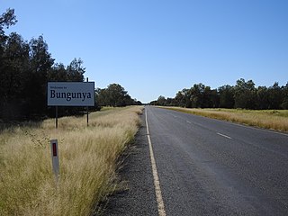
Bungunya is a rural town and locality in the Goondiwindi Region, Queensland, Australia. The locality is on the border of Queensland and New South Wales. In the 2016 census, Bungunya had a population of 75 people.