
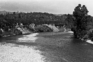
The Waimakariri River is one of the largest rivers in Canterbury, on the eastern coast of New Zealand's South Island. It flows for 151 kilometres (94 mi) in a generally southeastward direction from the Southern Alps across the Canterbury Plains to the Pacific Ocean.
The Inangahua River is located in the north-west of New Zealand’s South Island. It is a major tributary of the Buller River, where it joins at the town of Inangahua Junction.

Crooked River is a river that flows from headwaters in the Southern Alps to Lake Brunner in the West Coast region of New Zealand's South Island. It is named for the erratic path it takes. Near Lake Brunner, it passes through reasonably flat farmland, but closer to its source, it rushes through gorges and rapids. One tributary is the Poerua River from Lake Poerua.
The Eastern Hohonu River is a river of New Zealand. It rises in the Hohonu Range, an outlying range of the Southern Alps 28 kilometres southeast of Greymouth, flowing north then east before reaching its outflow into Lake Brunner. It is named the Eastern Hohonu River to differentiate it from the nearby Big Hohonu River, which is also called the Greenstone River.
The Evans River is a short river in New Zealand's South Island. It arises near Mount O'Shanessy in the Kaimata Range of the Southern Alps and flows north-west and then south-west, joining the Crooked River several kilometres before the latter's outflow into Lake Brunner.

The Glentui River is a river in the Canterbury region of New Zealand. It arises on the slopes of Mount Richardson and flows south-east through the locality of Glentui and into Ashley River / Rakahuri, which exits in the Pacific Ocean. The river was earlier called Tui Creek, and the locality named from the station Glentui established by H.C.H. Knowles in 1854.
The Gunn River is a river on the West Coast of New Zealand. It starts in the Price Range and flows east into the Whataroa River, which eventually drains into the Tasman Sea.
The Hae Hae Te Moana River is a river in the Canterbury region of New Zealand. It originates in the Four Peaks Range of the Southern Alps, with a North Branch and South Branch merging to the north of Pleasant Valley. The river runs south-east to join the Waihi River near Winchester. The combined river is called the Temuka River, which flows past Temuka to join the Ōpihi River shortly before it runs into the Canterbury Bight.
The Hall River is a river on the West Coast of New Zealand. It drains Lake Paringa, flowing north to the Paringa River, which drains into the Tasman Sea.
The Hapuka River is a river of Westland District, New Zealand. It flows from near The Woolsack north-west to join the Okuru and Turnbull Rivers just before they enter the Tasman Sea. The river is slow-moving and drains swampy land. There are brown trout in the lagoon area.

The Harman River is a river of New Zealand. It starts in the Browning Range of the Southern Alps and becomes the Arahura River, which flows into the Tasman Sea north of Hokitika.

The Haupiri River is a river of New Zealand. It starts near Mount Dixon in the Kaimata Range of the Southern Alps and flows north-west near to Lake Haupiri, then north-east to join the Ahaura River. The Ahaura joins the Grey River which flows into the Tasman Sea at Greymouth.

The Mathias River is a river of the Canterbury region of New Zealand's South Island. It flows from its origins in three rivers in the Southern Alps. Of these, the North Mathias River is the longest, flowing predominantly southwards from its source northeast of Mount Williams. After 18 kilometres (11 mi) its waters combine with those of the West Mathias River, which flows predominantly southwest for 13 kilometres (8 mi) from its sources 10 kilometres (6 mi) west of Mount Williams. The South Mathias River, a tributary of the West Mathias River, is a 6-kilometre (4 mi) long easterly-flowing river which meets the West Mathias 5 kilometres (3 mi) from its confluence with the North Mathias.

The Whitcombe River is a river of the West Coast Region of New Zealand's South Island. It flows north to reach the Hokitika River 30 kilometres south of Hokitika.

The Wilkinson River is a short river of the West Coast Region of New Zealand's South Island. It is a tributary of the Whitcombe River.
The Eyre River is a river in the Canterbury region of New Zealand. It arises in the Puketeraki Range and flows south-east into the Waimakariri River near Christchurch International Airport. The connection with the Waimakariri is via a diversion channel running south-west, replacing the Eyre's original easterly flow. The river is named after Edward John Eyre, the Lieutenant-Governor of New Munster from 1848 to 1853.
Canterbury's Esk River is a tributary of the Waimakariri River. It rises in the Dampier Range near Esk Head, and flows southwest on the western side of the Puketeraki Range to reach the upper Waimakariri some 20 kilometres (12 mi) north of Springfield.

Ashburton District Council is the territorial authority for the Ashburton District of New Zealand. The council consists of the mayor of Ashburton and nine ward councillors.

Lauriston is a lightly populated locality in the Canterbury region of New Zealand's South Island. It is situated on the Canterbury Plains south of the Rakaia River, some 20 kilometres (12 mi) inland from Rakaia. It was named after one of its pioneer settlers with the name of Laurie.

Mount Peel is a mountain located in South Canterbury, New Zealand. It consists of three peaks, Mount Peel, Middle Mt Peel and Little Mt Peel/Huatekerekere. Mt Peel is 1,743 metres (5,719 ft) tall and is owned by the Department of Conservation and Mt Peel Station. It lies just south of the Rangitata river and is 22 kilometres (14 mi) north-west of Geraldine.
