
The Tamar is a river in south west England that forms most of the border between Devon and Cornwall. A part of the Tamar Valley is a World Heritage Site due to its historic mining activities.

Cape Cornwall is a small headland in West Cornwall, England. It is 4 miles (6.4 km) north of Land's End near the town of St Just. Until the first Ordnance Survey in the early 19th-century, Cape Cornwall was believed to be the most westerly point in Cornwall.

Kelly Bray is a village in east Cornwall, England, United Kingdom. It is situated one mile (1.6 km) north of Callington, immediately west of Kit Hill in a former mining area. Kelly Bray is in the parish of Callington and lies within the St Dominick, Harrowbarrow and Kelly Bray division on Cornwall Council. The population was 3,949 at the 2011 census. Kelly Bray is first recorded ca. 1286 as Kellibregh.

North Petherwin is a civil parish and village in the historic county of Devon and the ceremonial county of Cornwall, England, United Kingdom. The village is situated five miles (8 km) northwest of Launceston on a ridge above the River Ottery valley.

Virginstow is a village and civil parish in the Torridge district of Devon, England. It is situated about 7 miles north of Launceston in Cornwall. According to the 2001 census, it had a population of 115.

Caradon Hill is on Bodmin Moor in the former Caradon district of Cornwall, England, United Kingdom. The summit is 371 metres (1,217 ft) above mean sea level. Caradon Hill is on the southeastern edge of the moor; it is between the villages of Minions (northwest), Upton Cross (northeast), Pensilva (southeast) and Darite (southwest).
Boduel is a hamlet in east Cornwall, England, United Kingdom. It is situated west of Moorswater, one mile (1.6 km) west of Liskeard in the civil parish of Dobwalls.

Albaston is a hamlet in Cornwall, England, United Kingdom. It is in the civil parish of Calstock. It is located at Ordnance Survey grid reference SX 423 704.

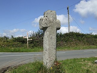
Luckett is a hamlet in east Cornwall, England. It is situated in a former mining area beside the River Tamar approximately three miles (5 km) north of Callington. According to the Post Office the population at the 2011 census was included in the civil parish of Stokeclimsland

Colliford Lake is a reservoir on Bodmin Moor, Cornwall, England, United Kingdom. Covering more than 900 acres (3.6 km2), it is the largest lake in Cornwall. It is situated south of the A30 trunk road near the village of Bolventor, the approximate centre of the lake being at OS grid reference SX179730. Dozmary Pool outfalls into the lake and the lake's own outfall forms one of the tributaries of the River Fowey.
Carnebone is a small hamlet and farm in the parish of Wendron in Cornwall, England. It lies to the east of Wendron, to the northeast of Trevenen, just to the west of Seworgan, along the A394 road, 3.8 miles (6.1 km) northeast of Helston.

Common Moor or Commonmoor is a hamlet in Cornwall, England. It is about a mile north of St Cleer. It does not have a public telephone box or post office but does have a letter box. The village meeting place in Commonmoor is a small village hall. It is a very old mining village founded by the Davy family, traces of its past are still visible from placenames like "Davy's Row".

Crow's Nest is a village in Cornwall, England. It is located within the civil parish of St Cleer, on the southeastern edge of Bodmin Moor, 3 miles (4.8 km) north of the town of Liskeard.

Degibna is a hamlet and farm in the parish of Helston, Cornwall, England, UK. It lies on the eastern bank of the largest natural freshwater lake in Cornwall, The Loe, and forms part of the Penrose Estate.

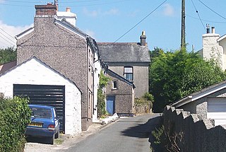
Harrowbarrow is a village in the parish of Calstock in east Cornwall, England.

Holmbush is a village in Cornwall, England that is situated in the suburban area of St Austell. It was a centre for tin and copper mining in the eighteenth and nineteenth centuries, with a few houses to the south of the A390 road. It was developed in the 1970s, with the construction of housing and an industrial estate to the north of the road. Since 1974, the site of Cuddra mine has been developed as Pinetum Gardens, an attraction holding over 6,000 varieties of plants, many collected by the owner on plant hunting expeditions.
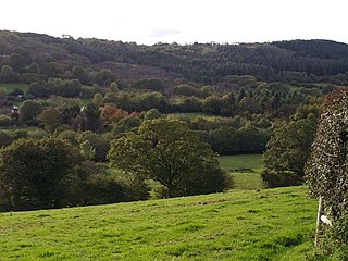
Middlewood is a small village in the parish of North Hill, Cornwall, England, UK. Middlewood is in the valley of the River Lynher and on the B3254 road between Launceston and Liskeard. There was formerly a Bible Christian chapel at Middlewood.
Norris Green is a village in Cornwall, England, UK. It was enlarged from a farming hamlet so that it now adjoins the neighbouring village of Higher Metherell. Both settlements are within the civil parish of Calstock which borders the River Tamar, the county boundary with Devon in south-east Cornwall.
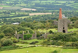
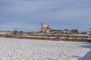
Phoenix United Mine is a disused 19th century copper and tin mine in Cornwall, England, UK. Heavy metals left over in the soil from the mining operations have allowed mosses and lichens to flourish, and today the site is a Site of Special Scientific Interest (SSSI), noted for its biological characteristics.
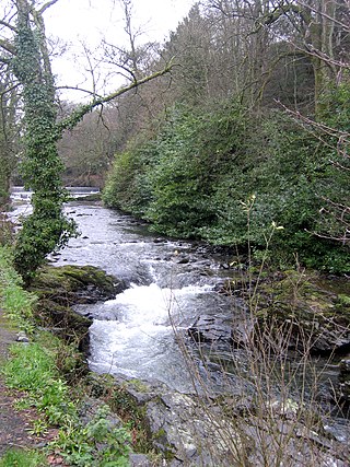
The River Seaton is a river in east Cornwall, England, UK which flows southwards for 11 miles (17 km) into the English Channel.

