
Trimble County is a county located in the north central part of the U.S. state of Kentucky. Its county seat is Bedford. The county was founded in 1837 and is named for Robert Trimble. Trimble is no longer a prohibition or dry county. Trimble County is part of the Louisville/Jefferson County, KY–IN Metropolitan Statistical Area.

Jefferson County is a county located in the north central portion of the U.S. state of Kentucky. As of the 2020 census, the population was 782,969. It is the most populous county in the commonwealth.

Murray Hill is a home rule-class city in Jefferson County, Kentucky, United States, and a part of the Louisville Metro government. The population was 582 during the 2010 census.

St. Matthews is a city in Jefferson County, Kentucky, United States. It forms part of the Louisville Metro government but is separately incorporated as a home rule-class city. The population was 17,472 at the 2010 census, up from 15,852 at the 2000 census. It is the 23rd-largest city in the state. St. Matthews is one of the state's major shopping areas, home to the fifth-largest mall in Kentucky along with many smaller shopping centers along Shelbyville Road.

Prospect is a home rule-class city in Jefferson and Oldham counties in the U.S. state of Kentucky. The Jefferson County portion is a part of the Louisville Metro government. The population was 4,592 as of the 2020 census, down from 4,698 at the time of the 2010 census. It is one of the wealthiest communities in Kentucky.

The Kentucky River is a tributary of the Ohio River, 260 miles (418 km) long, in the U.S. Commonwealth of Kentucky. The river and its tributaries drain much of the central region of the state, with its upper course passing through the coal-mining regions of the Cumberland Mountains, and its lower course passing through the Bluegrass region in the north central part of the state. Its watershed encompasses about 7,000 square miles (18,000 km2). It supplies drinking water to about one-sixth of the population of the Commonwealth of Kentucky.
The Little Kentucky River is a tributary of the Ohio River, approximately 37 miles (60 km) long, in northern Kentucky in the United States.
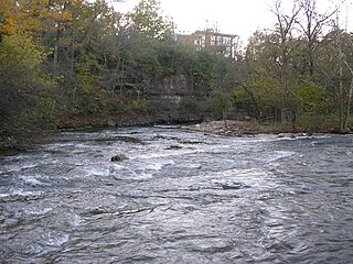
Clifton Heights is a neighborhood two miles east of downtown Louisville, Kentucky USA. It was named because of its hilly location atop a ridge about 100 feet above the Ohio River floodplain, overlooking the adjacent community of Clifton. Though first planned in the 1890s as Summit Park, actual growth didn't begin until after World War I when automobiles made the hilly area accessible. Clifton Heights has had an African American presence since its founding, in 2000 they accounted for 21% of the population. Housing stock includes a variety of styles and time frames, from older shotgun houses and bungalows to suburban ranch homes built in the 1970s.

The Salt River is a 150-mile-long (240 km) river in the U.S. state of Kentucky that drains 2,920 square miles (7,600 km2). It begins near Parksville, Kentucky, rising from the north slope of Persimmon Knob south of KY 300 between Alum Springs and Wilsonville, and ends at the Ohio River near West Point. Taylorsville Lake is formed from the Salt River, and Guist Creek Lake is also in its drainage basin.
The Point was a thriving 19th century neighborhood in Louisville, Kentucky, east of Downtown Louisville and opposite Towhead Island along the Ohio River. It was also located north of the present day Butchertown area.

Louisville is a city in Jefferson County, in the U.S. state of Kentucky. It is located at the Falls of the Ohio River.

Harrods Creek is a neighborhood of Louisville, Kentucky centered near Harrods Creek at the intersection of River Road and Wolf Pen Branch Road. It is roughly bordered by the Ohio River to the west and US 42 to the east. Its ZIP code is 40027. Formerly an unincorporated community, it was designated a neighborhood of Louisville when the city merged with Jefferson County in 2003.
Lake Dreamland is a neighborhood of Louisville, Kentucky located along Campground Road and the Ohio River.
Springdale is a neighborhood in Louisville, Kentucky located along Brownsboro Road and Barbour Lane. The community is named for the family farm purchased by Laurence Young and his family in 1830, which was intersected by present-day Brownsboro Road, with the estate on the south side of the road. The Young family's Springdale farm today is the site of the Standard Country Club, as well as portions of Barbourmeade, Goose Creek and Brownsboro Farm. Though it is not a formally recognized neighborhood or district within Louisville, nor does it have official boundaries, older businesses and institutions in the community still retain the Springdale name, and the name was used to refer to the area until it was subdivided in the 1950s and '60s.
Goose Creek is a neighborhood of Louisville, Kentucky located where Goose Creek meets the Ohio River. It should not be confused with the adjacent incorporated city of Goose Creek.
Beargrass Creek is the name given to several forks of a creek in Jefferson County, Kentucky. The Beargrass Creek watershed is one of the largest in the county, draining over 60 square miles (160 km2). It is fairly small, with an average discharge of 103 cubic feet per second at River Road in Louisville.

Devil's Backbone is a rock formation and peninsula formed by the flow of Fourteen Mile Creek into the Ohio River, and is currently situated in Charlestown State Park near Charlestown, Indiana and across the Ohio River from Louisville, Kentucky. According to local legend, on this bedrock ridge once stood a stone fortress that was built by Welsh explorers led by Prince Madoc sometime in the 12th century.

Fourteen Mile Creek, shown as Fourteenmile Creek on federal maps, is a 22.7-mile-long (36.5 km) creek in Clark County, Indiana, close to Charlestown. It is so named because its mouth on the Ohio River is 14 miles (23 km) upstream from the Falls of the Ohio; similar to how Eighteen Mile Island, Twelve Mile Island, and Six Mile Island got their names. It is navigable for 2.9 miles (4.7 km) from the Ohio River. It is a State Heritage Program Site and a popular canoe trail.

Fort Nelson, built in 1781 by troops under George Rogers Clark including Captain Richard Chenoweth, was the second on-shore fort on the Ohio River in the area of what is now downtown Louisville, Kentucky. Fort-on-Shore, the downriver and first on-shore fort, had proved to be insufficient barely three years after it was established. In response to continuing attacks from Native Americans and the threat of British attacks during the Revolutionary War, Fort Nelson was constructed between what is currently Main Street and the river, with its main gate near Seventh Street. It was named after Thomas Nelson Jr., then the governor of Virginia.
Wolf Creek is a neighborhood in far eastern Jefferson County, Kentucky, United States. Located directly east of Louisville along the Ohio River, Wolf Creek is bordered by Harrods Creek, Green Spring and Little Goose Creek. Its zip code is 40241. The neighborhood is quietly nestled amongst rolling hills and features heavy tree density, many small tributaries and natural wildlife.