Rio de Janeiro, or simply Rio, is the capital of the state of Rio de Janeiro. It is the second-most-populous city in Brazil and the sixth-most-populous city in the Americas.

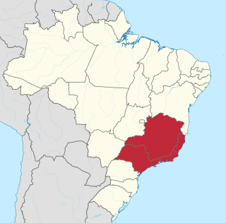
Rio de Janeiro is one of the 27 federative units of Brazil. It has the second largest economy of Brazil, with the largest being that of the state of São Paulo. The state, which has 8.2% of the Brazilian population, is responsible for 9.2% of the Brazilian GDP.

Niterói is a municipality in the state of Rio de Janeiro, in the southeast region of Brazil. It lies across Guanabara Bay, facing the city of Rio de Janeiro and forming part of the Rio de Janeiro Metropolitan Area. It was the capital of Rio de Janeiro, as marked by its golden mural crown, from 1834 to 1894 and again from 1903 to 1975. It has an estimated population of 515,317 inhabitants (2020) and an area of 129.375 km2 (49.952 sq mi), making it the fifth most populous city in the state. It has the highest Human Development Index in the state and the seventh highest among Brazil's municipalities in 2010. Individually, it is the second municipality with the highest average monthly household income per capita in Brazil and appears in 13th place among the municipalities of the country according to social indicators related to education. The city has the nicknames of Cidade Sorriso.
Carioca is a demonym used to refer to anything related to the City of Rio de Janeiro, in Brazil. The original meaning of the term is controversial, maybe from Tupi language "kari' oka", meaning "white house" as the whitewashed stone houses of European settlers or even the colonists themselves, by merging "kara'iwa" and "oka" (house). Currently, the more accepted origin in academia is the meaning derived from "kariîó oka", which comes from the indigenous tupi "house of carijó", which was Guaraní, a native tribe of Rio de Janeiro who lived in the vicinity of the Carioca River, between the neighborhoods of Glória and Flamengo.

José Maria da Silva Paranhos Júnior, Baron of Rio Branco was a Brazilian noble, diplomat, geographer, historian, politician and professor, considered to be the "father of Brazilian diplomacy". He was the son of statesman José Paranhos, Viscount of Rio Branco. The Baron of Rio Branco was a member of the Brazilian Academy of Letters, occupying its 34th chair from 1898 until his death in 1912. As a representative of Brazil, he managed to peacefully resolve all Brazil's border disputes with its South American neighbours and incorporate 900 thousand square kilometers through his diplomacy alone.

Duque de Caxias is a city on Guanabara Bay and part of Rio de Janeiro metropolitan area, southeastern Brazil.

Ipanema is a neighbourhood located in the South Zone of the city of Rio de Janeiro, Brazil, between Leblon and Arpoador. The beach at Ipanema became known internationally with the popularity of the bossa nova song, "The Girl from Ipanema", written by Antônio Carlos Jobim and Vinícius de Moraes.

The Southeast Region of Brazil is composed of the states of Espírito Santo, Minas Gerais, Rio de Janeiro and São Paulo. It is the richest region of the country, responsible for approximately 60% of the Brazilian GDP, as São Paulo, Rio de Janeiro, and Minas Gerais are the three richest states of Brazil, the top three Brazilian states in terms of GDP. The Southeast of Brazil also has the highest GDP per capita among all Brazilian regions.

Nova Iguaçu is a municipality in Rio de Janeiro state in Brazil.

Três Rios is a municipality located in the Brazilian state of Rio de Janeiro. As of 2020 its population was an estimated 82,142 inhabitants, and its area is around 322 square kilometres (124 sq mi). The current mayor of Três Rios is Joacir Barbaglio Pereira of the Liberal Party, elected in 2020 to a four-year term.

Jacarezinho is a favela in Rio de Janeiro, with more than 60,300 residents living in an area of 40 hectares. It is located in the North Zone of the city, and borders the neighborhoods of Jacaré, Méier, Engenho Novo and Triagem. It is the third-largest favela in Rio de Janeiro, behind Rocinha and Complexo do Alemão. The favela expanded as the city industrialized, and it became the biggest favela in Rio de Janeiro by the mid-20th century, with a population of 23,000 in 1960. The crucial element in its growth was the industrial boom in the nearby Méier district after World War II, according to the historian Julio Cesar Pino, author of a book about the favelas of Rio de Janeiro.

Laranjeiras is an upper-middle-class neighborhood located in the South Zone of Rio de Janeiro, Brazil. Primarily residential, It is one of the city's oldest neighborhoods, having been founded in the 17th century, with the construction of country houses in the valley located around the Carioca River, which bordered Corcovado Mountain. Because of this, the neighborhood was previously called Vale do Carioca, or Carioca Valley.
Maracanã most commonly refers to the Maracanã Stadium in Rio de Janeiro, Brazil. It may also refer to:

Belford Roxo is a city in the state of Rio de Janeiro, Brazil. It is a part of the metropolitan region of the city of Rio de Janeiro and was created in 1990. Its population was 513,118 in 2020 and its area is 79 km². Belford Roxo is one of the less prosperous cities in the state, due to its low GDP and relatively large population. Its climate is tropical with an average temperature of 18 °C (63 °F). Bayer and Lubrizol are the biggest companies in the municipality. It was named after Engineer Raimundo Teixeira Belfort Roxo. While serving as General Construction and Building Inspector for the city of Rio de Janeiro, Belfort Roxo, together with fellow engineer Paulo de Frontin, solved the water shortage problems of the area during the summer of 1889.

Purian is a pair of extinct languages of eastern Brazil:

Lapa is a neighborhood in the city of Rio de Janeiro, in Brazil. It is located in the centre of Rio and is famous for its historical monuments and nightlife.
Taça do Atlântico was a national football team's competition held between 1956 and 1976 on an irregular basis, contested by the national football teams from South America.

Brazil has competed at every edition of the Pan American Games since the first edition of the multi-sport event in 1951.The Brazil Olympic Committee (COB) is the National Olympic Committee for Brazil.
Pavuna is a neighbourhood in the North Zone of Rio de Janeiro, Brazil. It is one of the oldest places in Rio de Janeiro.

The Battle of Curuzú occurred between September 1 and 3, 1866 during the Paraguayan War. After the first Battle of Tuyutí, won by the Allies on 24 May 1866, an Allied council of war decided to use their navy to bombard and capture the Paraguayan battery at Curupayty.


