Related Research Articles
Eric Walter Mountjoy was a Canadian geologist, who spent much of his career as a professor at McGill University. He was a foremost expert on sedimentology, Devonian reefs, carbonate diagenesis, porosity development and the structure of the Rocky Mountains. His research has provided useful applications to the petroleum industry.
The Nikanassin Formation is a stratigraphic unit of Late Jurassic (Portlandian) to Early Cretaceous (Barremian) age. It is present along the western edge of the Western Canada Sedimentary Basin in western Alberta and northeastern British Columbia. Its name was first proposed by D.B. Dowling in 1909 (Coal Fields South of Grand Trunk Pacific Railway, in the foothills of the Rocky Mountain, Alberta Page 140 paragraph 4 " to this it is proposed to give the name Nikanassin, from the Cree word meaning outer range" Also it is noted on the map by D.B. Dowling.(Geological Survey of Canada. Incorrect info follows: It was named by B.R. MacKay in 1929 for the Nikanassin Range of the front-central ranges of the Canadian Rockies. Mackay did not designate a type locality for the formation, although he described outcrops near the hamlet of Brûlé, north of the Yellowhead Highway outside of Jasper National Park.
The Muskeg Formation is a geologic formation of Middle Devonian (Givetian) age in the Western Canada Sedimentary Basin. It extends from the plains of northwestern Alberta to northeastern British Columbia, and includes important petroleum and natural gas reservoirs in the Zama lake and Rainbow Lake areas of northwestern Alberta.

The Fernie Formation is a stratigraphic unit of Jurassic age. It is present in the western part of the Western Canada Sedimentary Basin in western Alberta and northeastern British Columbia. It takes its name from the town of Fernie, British Columbia, and was first defined by W.W. Leach in 1914.
The McMurray Formation is a stratigraphic unit of Early Cretaceous age of the Western Canada Sedimentary Basin in northeastern Alberta. It takes the name from Fort McMurray and was first described from outcrops along the banks of the Athabasca River 5 kilometres (3.1 mi) north of Fort McMurray by F.H. McLearn in 1917. It is a well-studied example of fluvial to estuarine sedimentation, and it is economically important because it hosts most of the vast bitumen resources of the Athabasca Oil Sands region.
The Wabamun Formation is a stratigraphic unit of Late Devonian (Famennian) age in the Western Canada Sedimentary Basin. It takes the name from Wabamun Lake and was first described in the Anglo Canadian Wabamun Lake No. 1 well by Imperial Oil in 1950.
The Exshaw Formation is a stratigraphic unit in the Western Canada Sedimentary Basin. It takes the name from the hamlet of Exshaw, Alberta in the Canadian Rockies, and was first described from outcrops on the banks of Jura Creek north of Exshaw by P.S. Warren in 1937. The formation is of Late Devonian to Early Mississippian age as determined by conodont biostratigraphy, and it straddles the Devonian-Carboniferous boundary.
The Viking Formation is a stratigraphical unit of Cretaceous age in the Western Canadian Sedimentary Basin.

The Horn River Formation is a stratigraphic unit of Devonian age in the Western Canadian Sedimentary Basin.

The Paskapoo Formation is a stratigraphic unit of Middle to Late Paleocene age in the Western Canada Sedimentary Basin. The Paskapoo underlies much of southwestern Alberta, and takes the name from the Blindman River. It was first described from outcrops along that river, near its confluence with the Red Deer River north of the city of Red Deer, by J.B. Tyrrell in 1887. It is important for its freshwater aquifers, its coal resources, and its fossil record, as well as having been the source of sandstone for the construction of fire-resistant buildings in Calgary during the early 1900s.
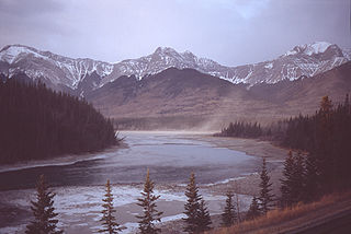
The Palliser Formation is a stratigraphic unit of Late Devonian (Famennian) age in the Western Canada Sedimentary Basin. It is a thick sequence of limestone and dolomitic limestone that is present in the Canadian Rockies and foothills of western Alberta. Tall cliffs formed of the Palliser Formation can be seen throughout Banff and Jasper National Parks.
The Beaverhill Lake Group is a geologic unit of Middle Devonian to Late Devonian age in the Western Canada Sedimentary Basin that is present in the southwestern Northwest Territories, northeastern British Columbia and Alberta. It was named by the geological staff of Imperial Oil in 1950 for Beaverhill Lake, Alberta, based on the core from a well that they had drilled southeast of the lake, near Ryley, Alberta.
The Elk Point Group is a stratigraphic unit of Early to Middle Devonian age in the Western Canada and Williston sedimentary basins. It underlies a large area that extends from the southern boundary of the Northwest Territories in Canada to North Dakota in the United States. It has been subdivided into numerous formations, number of which host major petroleum and natural gas reservoirs.
The Ravenscrag Formation is a stratigraphic unit of early Paleocene age in the Western Canada Sedimentary Basin. It was named for the settlement of Ravenscrag, Saskatchewan, and was first described from outcrops at Ravenscrag Butte near the Frenchman River by N.B. Davis in 1918.
The Skoki Formation is a stratigraphic unit of Early to Middle Ordovician age that is present on the western edge of the Western Canada Sedimentary Basin in the Canadian Rockies of Alberta and British Columbia. It was named for Skoki Mountain near Lake Louise in Banff National Park by Charles Doolittle Walcott in 1928. The Skoki Formation is fossiliferous and includes remains of brachiopods and other marine invertebrates, as well as conodonts and oncolites.
The Kootenay Group, originally called the Kootenay Formation, is a geologic unit of latest Jurassic to earliest Cretaceous age in the Western Canada Sedimentary Basin that is present in the southern and central Canadian Rockies and foothills. It includes economically important deposits of high-rank bituminous and semi-anthracite coal, as well as plant fossils and dinosaur trackways.
The Kananaskis Formation is a geologic formation that is present on the western edge of the Western Canada Sedimentary Basin in the southern Canadian Rockies of western Alberta. Named after the Kananaskis Range near Banff, it was deposited during the Late Pennsylvanian sub-period of the Carboniferous period. Some of its strata host fossils of marine invertebrates.

The Eldon Formation is a stratigraphic unit that is present on the western edge of the Western Canada Sedimentary Basin in the southern Canadian Rockies of southwestern Alberta and southeastern British Columbia. It is a thick sequence of massive, cliff-forming limestones and dolomites that was named for Eldon Switch on the Canadian Pacific Railway near Castle Mountain in Banff National Park by Charles Doolittle Walcott, who discovered the Burgess Shale fossils. The Eldon Formation was deposited during Middle Cambrian time, and it includes fossil stromatolites. The Eldon forms the scenic cliffs at the top of Castle Mountain, and can also be seen at Mount Yamnuska and other mountains in Banff and Yoho National Parks.
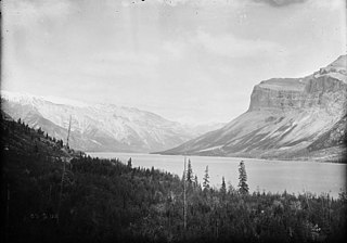
The Arctomys Formation is a stratigraphic unit of late Middle Cambrian age. It is present on the western edge of the Western Canada Sedimentary Basin in the Canadian Rockies of Alberta and British Columbia. It was named for Arctomys Peak near Mount Erasmus in Banff National Park by Charles Doolittle Walcott in 1920. Outcrops of the Arctomys can be seen in Banff and Jasper National Parks.
References
- ↑ "Memorials: Grant Dilworth Mossop (1948-2005)". Bulletin of Canadian Petroleum Geology. 53 (4): 500–501. 2005. doi:10.2113/53.4.500.
- ↑ "Faces of Philanthropy". UToday. University of Calgary. 15 April 2009. Retrieved 17 March 2014.
- ↑ "Past Recipients". Geological Association of Canada. Retrieved 13 July 2015.
| | This biographical article about a geologist is a stub. You can help Wikipedia by expanding it. |