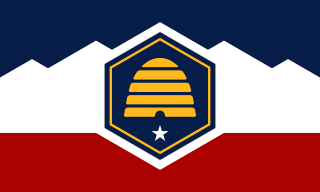
Utah is a landlocked state in the Mountain West subregion of the Western United States. It is one of the Four Corners states, sharing a border with Arizona, Colorado, and New Mexico. It also borders Wyoming to its northeast, Idaho to its north, and Nevada to its west. In comparison to all the U.S. states and territories, Utah, with a population of just over three million, is the 13th largest by area, the 30th most populous, and the 11th least densely populated. Urban development is mostly concentrated in two regions: the Wasatch Front in the north-central part of the state, which includes the state capital, Salt Lake City, and is home to roughly two-thirds of the population; and Washington County in the southwest, which has somewhat more than 180,000 residents. Most of the western half of Utah lies in the Great Basin.

Salt Lake City, often shortened to Salt Lake or SLC, is the capital and most populous city of the U.S. state of Utah. It is the county seat of Salt Lake County, the most populous county in the state. The city is the core of the Salt Lake City Metropolitan Statistical Area (MSA), which had a population of 1,257,936 at the 2020 census. Salt Lake City is further situated within a larger metropolis known as the Salt Lake City–Ogden–Provo Combined Statistical Area, a corridor of contiguous urban and suburban development stretched along a 120-mile (190 km) segment of the Wasatch Front, comprising a population of 2,746,164, making it the 22nd largest in the nation. With a population of 200,133 in 2020, it is the 117th most populous city in the United States. It is also the central core of the larger of only two major urban areas located within the Great Basin.

Juab County is a county in western Utah, United States. As of the 2020 United States Census, the population was 11,786. Its county seat and largest city is Nephi.
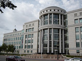
Salt Lake County is located in the U.S. state of Utah. As of the 2020 United States census, the population was 1,185,238, making it the most populous county in Utah. Its county seat and largest city is Salt Lake City, the state capital. The county was created in 1850. Salt Lake County is the 37th most populated county in the United States and is one of four counties in the Rocky Mountains to make it into the top 100. Salt Lake County has been the only county of the first class in Utah – under the Utah Code is a county with a population of 700,000 or greater. Although, Utah County directly to the south has recently reached this threshold.

Tooele County is a county in the U.S. state of Utah. As of the 2020 United States Census, the population was 72,698. Its county seat and largest city is Tooele. The county was created in 1850 and organized the following year.
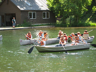
Scouting in Utah has a long history, from the 1910s to the present day, serving thousands of youth in programs that suit the environment in which they live.
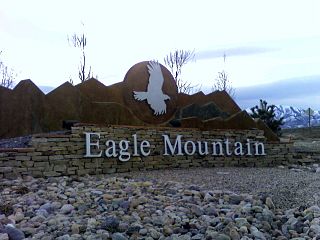
Eagle Mountain is a city in Utah County, Utah. It is part of the Provo–Orem metropolitan area. The city is located to the west as well as north of the Lake Mountains, which are west of Utah Lake. It was incorporated in December 1996 and is rapidly growing. The population was 43,623 at the 2020 census. Eagle Mountain was a town in 2000. It has since been classified as a third-class city in September 2001. In its short history, the city has become known for its rapid growth.

St. George is a city in and the county seat of Washington County, Utah, United States. Located in southwestern Utah on the Arizona border, it is the principal city of the St. George Metropolitan Statistical Area (MSA). The city lies in the northeasternmost part of the Mojave Desert, immediately south of the Pine Valley Mountains, which mark the southern boundary of the Great Basin. St. George lies slightly northwest of the Colorado Plateau, which ends at the Hurricane Fault. The city is 118 miles (190 km) northeast of Las Vegas, Nevada, and 300 miles (480 km) south-southwest of Salt Lake City, Utah, on Interstate 15.

The State of Deseret was a proposed state of the United States, promoted by leaders of the Church of Jesus Christ of Latter-day Saints who had founded settlements in what is today the state of Utah. A provisional state government operated for nearly two years in 1849–50, but was never recognized by the United States government. The name Deseret derives from the word for "honeybee" in the Book of Mormon.

The Wasatch Front is a major metropolitan region in the north-central part of the U.S. state of Utah. It consists of a chain of mostly contiguous cities and towns stretched along the Wasatch Range from Santaquin in the south to Logan in the north, and containing the cities of Salt Lake City, Provo, Orem, Bountiful, Layton, and Ogden.
A salt lake is a lake containing a high concentration of salt.

Originally, the Salt Lake Valley was inhabited by the Shoshone, Paiute, Goshute and Ute Native American tribes. At the time of the founding of Salt Lake City the valley was within the territory of the Northwestern Shoshone, who had their seasonal camps along streams within the valley and in adjacent valleys. One of the local Shoshone tribes, the Western Goshute tribe, referred to the Great Salt Lake as Pi'a-pa, meaning "big water", or Ti'tsa-pa, meaning "bad water". The land was treated by the United States as public domain; no aboriginal title by the Northwestern Shoshone was ever recognized by the United States or extinguished by treaty with the United States. Father Silvestre Vélez de Escalante, a Spanish Franciscan missionary is considered the first European explorer in the area in 1776, but only came as far north as Utah valley (Provo), some 60 miles south of the Salt Lake City area. The first US visitor to see the Salt Lake area was Jim Bridger in 1824. U.S. Army officer John C. Frémont surveyed the Great Salt Lake and the Salt Lake Valley in 1843 and 1845. The Donner Party, a group of ill-fated pioneers, traveled through the Great Salt Lake Valley a year before the Mormon pioneers. This group had spent weeks traversing difficult terrain and brush, cutting a road through the Wasatch Mountains, coming through Emigration canyon into the Salt Lake Valley on August 12, 1846. This same path would be used by the vanguard company of Mormon pioneers, and for many years after that by those following them to Salt Lake.

The History of Utah is an examination of the human history and social activity within the state of Utah located in the western United States.

The Great Salt Lake Council was a local council of the BSA (BSA) which is now part of the Crossroads of the West Council. The Great Salt Lake Council served the Utah counties of Salt Lake, Tooele and Summit, as well as much of Davis County. In April 2020, it combined with the former Trapper Trails and Utah National Parks councils.
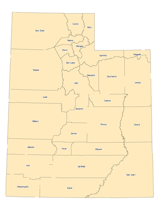
The landlocked U.S. state of Utah is known for its natural diversity and is home to features ranging from arid deserts with sand dunes to thriving pine forests in mountain valleys. It is a rugged and geographically diverse state at the convergence of three distinct geological regions: the Rocky Mountains, the Great Basin, and the Colorado Plateau.
The Trapper Trails Council is a former local council of the Boy Scouts of America that served areas in Northern Utah, Southern Idaho and Western Wyoming serving 18 districts. In April 2020, it combined with the former Great Salt Lake and Utah National Parks councils to create the new Crossroads of the West Council.

The Utah National Parks Council (UNPC) is a former local council of the Boy Scouts of America (BSA) that served youth in areas of Utah who live south of Salt Lake County and in some isolated areas of Nevada and Arizona. It was headquartered in Orem. As of December 31, 2013, UNPC was the largest of 272 local councils and is geographically within the Western Region of BSA. In 2011, the UNPC was recognized by the Utah Best of State Foundation as Utah's Best Humanitarian Organization. UNPC is a non-profit corporation governed by Scouting policies and a local community-based Executive Board. In April 2020, it combined with the former Great Salt Lake and Trapper Trails councils to create the new Crossroads of the West Council.


