
Cheviot is a town in the Hurunui District of north Canterbury, on the east coast of the South Island of New Zealand. It is located on State Highway 1, approximately 112 kilometres (70 mi) north of Christchurch and 68 kilometres (42 mi) south of Kaikōura.

The Conway River is part of the traditional boundary between the Canterbury and Marlborough regions in the South Island of New Zealand.

Hurunui District is a territorial local government district within the Canterbury Region on the east coast of New Zealand's South Island, north of Christchurch. It stretches from the east coast to the Main Divide. Its land area is 8,640.96 square kilometres (3,336.29 sq mi).
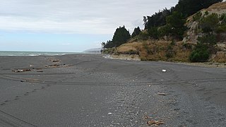
Hundalee is a rural locality in the Hurunui District of the Canterbury region of New Zealand's South Island. It straddles the Conway River, the traditional boundary between Canterbury and Marlborough and is in the Hundalee Hills.

The Hurunui River is the fourth largest of the four principal rivers in north Canterbury, New Zealand, with a catchment area of 2,670 square kilometres (1,030 sq mi). The river flows from the eastern side of the Southern Alps, to the Pacific Ocean.

Amuri County is one of the former counties of New Zealand, in the area that is now the north of Canterbury region.
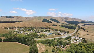
Greta Valley is a town in North Canterbury, 83 km north of Christchurch, New Zealand. It was named after the River Greta in Yorkshire by local runholders Sir Charles Clifford and Sir Frederick Weld in the 1850s, but it is to the east of the Greta River and on the south bank of the Waikari River.
The Glenrae River is a river in the Canterbury region of New Zealand. It arises in the Glynn Wye Range near Mount Skiddaw and flows through the Lake Sumner Forest Park south and then south-east into the Hurunui River, which exits in the Pacific Ocean. Its tributaries include Devils Creek and Robyne Creek.
The Gloster River is a river in the Marlborough region of New Zealand. It arises on the northern slope of Dillon Cone in the Inland Kaikōura Range and flows north, then south-east and east to join the Waiau Toa / Clarence River which eventually exits into the Pacific Ocean.
The Guide River is a river in the Marlborough Region of New Zealand. It starts near Barefell Pass on the eastern side of the Rachel Range and flows south-east to join the Acheron River, which joins the Waiau Toa / Clarence River and eventually drains into the Pacific Ocean.

The Hanmer River is a river in the Hurunui District of New Zealand. It originates in the Hossack Saddle between the Hanmer Range and the Amuri Range, and flows south-west into the Waiau Uwha River about 8 kilometres (5.0 mi) south-west of Hanmer Springs.

The Jed River is a river of New Zealand's South Island. It flows to the Pacific Ocean close to the town of Cheviot adjacent to Gore Bay. It combines with Buxton Creek behind a rocky beach before draining through the shingle. The waterways break through the rocks after heavy rain and establish a direct outflow into the sea.
The Kaiwara River is a river of the northern South Island of New Zealand. The river is a tributary of the Hurunui River, its outflow being 17 kilometres (11 mi) southwest of Cheviot. The river flows initially east before turning southwest, twisting through a valley in the Lowry Peaks Range which lies between Cheviot and Culverden.
The Gelt River is a river in the Canterbury region of New Zealand. It arises near Mount Peter in the Black Hills and flows south, then east and north-east into Conway River.
Cheviot County was one of the counties of New Zealand in the South Island.
The 1901 Cheviot earthquake occurred at 07:47 NZT on 16 November 1901 with an estimated magnitude of 6.9, centred near the township of Cheviot in the Canterbury region of New Zealand.
Hurunui District Council is the territorial authority for the Hurunui District of New Zealand.
The Waikari River is a river of the northern Canterbury region of New Zealand's South Island. It flows generally east through a broad strath from its sources south of Hawarden, gradually veering northeast to reach the Hurunui 20 kilometres (12 mi) southwest of Cheviot. The name Waikari comes from the Maori word wai meaning "water" and kari meaning "dig".
The Blythe River is a river in Canterbury, New Zealand. It flows east for 13 kilometres (8 mi), reaching the Pacific Ocean 12 kilometres (7 mi) south of the town of Cheviot. The river's course roughly parallels that of the larger Hurunui River, which lies 5 kilometres (3 mi) to the north.
The Hurunui River South Branch is a river in the Hurunui District of Canterbury, New Zealand.
