Related Research Articles

Brownsville is an unincorporated community and census-designated place (CDP) that is part of the Miami metropolitan area of South Florida. As of the 2020 US census, the population was 16,583, up from 15,313 in 2010. After three decades of population loss, Brownsville gained population for the first time in over 40 years in the 2010 US Census.
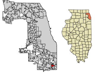
Ford Heights is a village in Cook County, Illinois, United States. The population was 1,813 at the 2020 census. A suburb of Chicago, many of the area's first settlers were African American and since its incorporation in 1949 the village has remained predominantly Black. Due to the lack of commercial activity and financial stability, the village has declined over the years. Urban renewal efforts were attempted in the 1960s, although the village has continued to decline.

Columbia Heights is a neighborhood in Washington, D.C., located in Northwest D.C. Bounded by 16th Street NW, W Street NW, Florida Avenue NW, Barry Place NW, Sherman Avenue NW, Spring Road NW, and New Hampshire Avenue NW. neighborhood is an important retail hub for the area, as home to DC USA mall and to numerous other restaurants and stores, primarily along the highly commercialized 14th Street. Columbia Heights is home to numerous historical landmarks, including Meridian Hill Park, National Baptist Memorial Church, All Souls Church, along with a number of embassy buildings.

Shepherd Park is a neighborhood in the northwest quadrant of Washington, D.C. In the years following World War II, restrictive covenants which had prevented Jews and African Americans from purchasing homes in the neighborhood were no longer enforced, and the neighborhood became largely Jewish and African American. Over the past 40 years, the Jewish population of the neighborhood has declined but the neighborhood has continued to support a thriving upper and middle class African American community. The Shepherd Park Citizens Association and Neighbors Inc. led efforts to stem white flight from the neighborhood in the 1960s and 1970s, and it has remained a continuously integrated neighborhood, with very active and inclusive civic groups.
Arden Heights is a name increasingly applied to the western part of Annadale, a neighborhood located on the South Shore of Staten Island, New York City, USA. The name "Arden Heights" is found on most maps of New York City, including Hagstrom's.

Rossville is a neighborhood of Staten Island, New York, on the island's South Shore. It is located to the north of Woodrow, to the west of Arden Heights, and to the south and east of the Arthur Kill. Rossville is located within Staten Island Community Board 3.

Normal Heights is a neighborhood in the mid-city region of San Diego, California.
Clifton Heights is a neighborhood two miles east of downtown Louisville, Kentucky USA. It was named because of its hilly location atop a ridge about 100 feet above the Ohio River floodplain, overlooking the adjacent community of Clifton. Though first planned in the 1890s as Summit Park, actual growth didn't begin until after World War I when automobiles made the hilly area accessible. Clifton Heights has had an African American presence since its founding, in 2000 they accounted for 21% of the population. Housing stock includes a variety of styles and time frames, from older shotgun houses and bungalows to suburban ranch homes built in the 1970s.

Acres Homes is a neighborhood located in northwest Houston, Texas. The 9-square-mile (23 km2) mile area is loosely bounded by the city limits and West Gulf Bank Road to the north; Pinemont Drive to the south; North Shepherd Drive to the east; and Alabonson Drive to the west. Historically, it has been predominantly African American. Unincorporated for decades, it was annexed to Houston in 1967.
Mechanicsville is a neighborhood in Knoxville, Tennessee, United States, located northwest of the city's downtown area. One of the city's oldest neighborhoods, Mechanicsville was established in the late 1860s for skilled laborers working in the many factories that sprang up along Knoxville's periphery. The neighborhood still contains a significant number of late-19th-century Victorian homes, and a notable concentration of early-20th-century shotgun houses. In 1980, several dozen properties in Mechanicsville were added to the National Register of Historic Places as the Mechanicsville Historic District. The neighborhood was also designated as a local historic district in 1991, subject to historic zoning and design standards.
Pecan Park is a neighborhood in Houston, Texas.
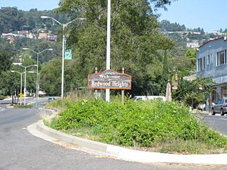
Redwood Heights is a primarily middle-class and highly diverse residential neighborhood in the hills of East Oakland, California. It is centered on Redwood Road, which was once a logging road. Redwood Road is the designation for 35th Avenue, starting about one mile north of MacArthur Boulevard between Victor Avenue and the Warren Freeway. It lies at an elevation of 476 feet.
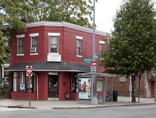
Park View is a neighborhood in Washington, D.C., located in Northwest D.C. The neighborhood is primarily residential with its main commercial corridor of shops and restauarants located along Georgia Avenue.
Independence Heights is a community in Houston, Texas, bordered by 40th Street to the north, Yale Street to the west, the 610 Loop to the south, and Airline Drive to the east. The Super Neighborhood boundary created by the City of Houston is bordered by Tidwell to the north, Shepherd Drive to the west, the 610 Loop to the south, and Interstate 45 to the east.
Eastland is a neighborhood in Charlotte, North Carolina, USA. The area is named after the former eponymous mall, that was demolished in 2014. Eastland is almost seven and a half miles from Uptown, Charlotte.

The Cotswold neighborhood of Charlotte, North Carolina, United States, was named after the region of the same name in England. It is well-known for a large shopping center, Cotswold Village Shops, located at the intersection of Randolph and Sharon Amity Roads. Originally known as Cotswold Mall, it was one of Charlotte's first suburban malls. Cotswold is emerging as one of the more desirable areas for living and shopping with close proximity to Uptown. Many 1950s and 1960s homes are being remodeled and sold.
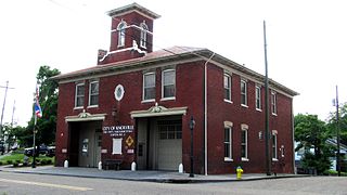
North Sacramento is a community that is part of the city of Sacramento, California, United States. It was a city from its incorporation in 1924 until it was merged in 1964 into the City of Sacramento. Incorporation was led by the North Sacramento Chamber of Commerce, incorporated the year before, in 1923.
East César Chávez, historically and originally named Masontown or Masonville, is a neighborhood in Austin, Texas. It is located in the central-east part of Austin's urban core on the north bank of the Colorado River. The neighborhood encompasses much of ZIP code 78702.
Blackland is a historically black neighborhood on the east side of Austin, Texas, located north of Martin Luther King, Jr. Blvd, south of Manor Road, east of I-35, and west of Chestnut Street. The neighborhood was originally known as Blacklands and was settled by Swedish immigrants, but evolved into a predominantly African-American neighborhood following the 1928 Austin city plan, which called for the relocation of non-white residents to the east side of the city. Up until the 1980s, the neighborhood was targeted for demolition to make way for an expansion of the University of Texas campus. In 1983, the Blackland Community Development Corporation was formed to build, purchase and maintain housing for low-income families and special populations.