Related Research Articles

Brown County is a county in the U.S. state of South Dakota. As of the 2020 census, the population was 38,301, making it the fourth most populous county in South Dakota. Its county seat is Aberdeen. The county is named for Alfred Brown, of Hutchinson County, South Dakota, a Dakota Territory legislator in 1879.

Wells County is a county in the U.S. state of North Dakota. As of the 2020 census, the population was 3,982. Its county seat is Fessenden.

Stutsman County is a county in the U.S. state of North Dakota. As of the 2020 census, the population was 21,593, making it the 8th most populous county in North Dakota. Its county seat is Jamestown.
Steele County is a county in the U.S. state of North Dakota. As of the 2020 census, the population was 1,798, making it the fifth-least populous county in North Dakota. Its county seat since 1919 is Finley.
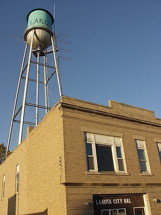
Nelson County is a county in the U.S. state of North Dakota. As of the 2020 census, the population was 3,015. Its county seat is Lakota.

LaMoure County is a county in the U.S. state of North Dakota. As of the 2020 census, the population was 4,093. Its county seat is LaMoure.

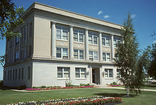
Griggs County is a county in the U.S. state of North Dakota. As of the 2020 census, the population was 2,306. Its county seat is Cooperstown.

Foster County is a county in the U.S. state of North Dakota. As of the 2020 census, the population was 3,397. Its county seat is Carrington.

Eddy County is a county in the U.S. state of North Dakota. As of the 2020 census, the population was 2,347. Its county seat is New Rockford.

Norman County is a county in the northwestern part of the U.S. state of Minnesota. As of the 2020 census, the population was 6,441. Its county seat is Ada. The county is in Minnesota's Red River Valley region.

Cooperstown is a city in Griggs County, North Dakota, United States. It is the county seat of Griggs County. The population was 983 at the 2020 census. Cooperstown was founded in 1882.
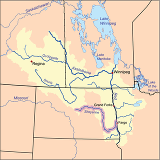
The Sheyenne River is one of the major tributaries of the Red River of the North, meandering 591 miles (951 km) across eastern North Dakota, United States.
North Dakota's 2nd congressional district is an obsolete congressional district in the state of North Dakota that was created by reapportionments in 1913, and eliminated by the reapportionments in 1933. North Dakota elected its two Representatives in a two-member at large district from 1932 to 1960, but then resurrected single-member districts in 1962. The district was eliminated by the reapportionment as a result of the 1970 redistricting cycle after the 1970 United States census. The seat was last filled from 1971 to 1973 by Arthur A. Link, who sought the office of Governor of North Dakota after not being able to run again for the defunct seat.

Albert N. Carlblom was a North Dakota public servant and politician with the Republican Party who served as the North Dakota State Auditor from 1899 to 1902.
Edna Township is a civil township in Barnes County in the U.S. state of North Dakota. As of the 2000 Census, its population was 74. It is the 20th largest township in the county in terms of both total population and population density.
Walum is an unincorporated community in Griggs County, in the U.S. state of North Dakota.
Mose is a ghost town in Griggs County, in the U.S. state of North Dakota.

North Dakota Highway 65 (ND 65) is a 9.383-mile-long (15.100 km) east–west state highway in the U.S. state of North Dakota. ND 65's western terminus is at ND 1 east of Binford, and the eastern terminus is at ND 45 north of Cooperstown.

David Bartlett was an American lawyer and politician in the state of North Dakota. He served as the sixth lieutenant governor of North Dakota from 1901 to 1907 under Governors Frank White and Elmore Y. Sarles.
Cooperstown Township is a township in Griggs County, North Dakota, United States.
References
47°26′28″N98°07′08″W / 47.441°N 98.119°W
| | This North Dakota museum-related article is a stub. You can help Wikipedia by expanding it. |