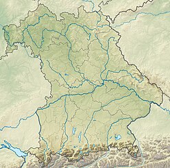
Schmalkalden-Meiningen is a Landkreis in the southwest of Thuringia, Germany. Its neighboring districts are the districts Wartburgkreis, Gotha, Ilm-Kreis, the district-free city Suhl, the district Hildburghausen, the Bavarian district Rhön-Grabfeld, and the district Fulda in Hesse.

The Wasserkuppe (help·info) is a mountain within the German state of Hesse. The elevation, which is a large plateau formation, is the highest peak in the Rhön Mountains. Between the First and Second World Wars great advances in sailplane development took place on the mountain during the interwar period. Near the summit there is still an airfield used by gliding clubs and pilots of light aircraft.

The Rhön Mountains are a group of low mountains in central Germany, located around the border area where the states of Hesse, Bavaria and Thuringia come together. These mountains, which are at the extreme southeast end of the East Hesse Highlands, are partly a result of ancient volcanic activity. They are separated from the Vogelsberg Mountains by the river Fulda and its valley. The highest mountain in the Rhön is the Wasserkuppe which is in Hesse. The Rhön Mountains are a popular tourist destination and walking area.
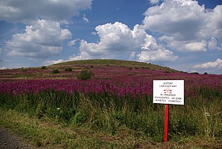
At 927.9 m above sea level (NN) the Dammersfeldkuppe in Bavaria is the second highest mountain after the Wasserkuppe in the Rhön, a low mountain range straddling the states of Bavaria, Hesse and Thuringia in Germany.

The Dreistelzberg, also called the Dreistelzkopf and frequently shortened to Dreistelz, is a mountain, 660.4 m above sea level (NHN), in the Bavarian part of the Rhön Mountains.

The Sinn Valley Railway was a branch line that began in the Hessian village of Jossa and ran to Wildflecken via Altengronau in the Bavarian borough of Bad Brückenau.
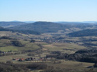
The Auersberg is a mountain, 756.9 m above sea level (NN), in the Rhön, that rises immediately north of Hilders. East of the wooded peak lies Simmershausen, a village in the municipality of Hilders, and to the north is Lahrbach, in the municipality of Tann (Rhön). On the southwestern slopes of the mountain are the ruins of Auersburg Castle. Like the western side of the peak these are on the Main-Werra Way, a tourist path managed by the Rhön Club. The Ulster flows past the Auersberg just to the west. The Auersberg near Hilders should not be confused with the Großer and Kleiner Auersberg near Wildflecken in the Bavarian part of the Rhön.
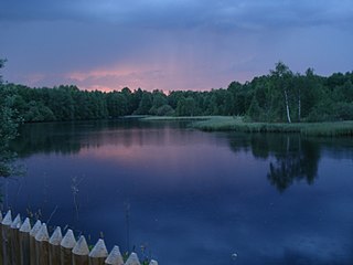
The Red Moor is a raised bog in the Hessian part of the Rhön Mountains in Germany. It lies within the eponymous nature reserve in the Rhön Biosphere Reserve and is part of the Europe-wide conservation system, Natura 2000. The Red Moor has an area of 50 hectares and is the second largest raised bog in the High Rhön after the Black Moor (66.4 hectares). For 175 years, until 1984, peat was cut here. The interior of the raised bog is severely damaged, especially as a result of the many years of peat cutting. Its perimeters are however still largely undisturbed areas that are better and more typically developed than the Black Moor, 8 kilometres away. In 1979 large-scale renaturalisation measures began.

The Long Rhön is a ridge in the Central Rhön which forms part of the High Rhön within the Rhön Mountains. The Long Rhön is an elongated basalt plateau in the centre, roughly 800 metres above sea level, which is only occasional interrupted by mountain peaks. Its highest mountain is the Heidelstein. A majority of the area is part of the Long Rhön Nature Reserve. In this area of the Rhön is the Black Moor.
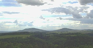
The Gleichberge, which mainly comprise the Großer and Kleiner Gleichberg, are a small, inselberg-like mountain range, up to 679 m above sea level (NHN), in the southwestern part of the German state of Thuringia. They rise just east of the little ancient town of Römhild in the county of Hildburghausen.
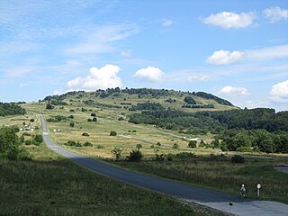
The Kleiner Auersberg is a mountain, 808 m above sea level (NN), in the Bavarian part of the Rhön mountains. It is situated five kilometres southwest of the centre of Wildflecken in the county of Bad Kissingen on the watershed between the Sinn and Kleiner Sinn.

The Black Mountains are part of the High Rhön in Germany, in particular of the Southern High Rhön, which lies south of the Kreuzberg Group and is thus the southernmost part of the High Rhön. Since 1993, most of the region has been protected by the Black Mountain Nature Reserve, the second largest in Bavaria outside of the Alps, in order to counteract its afforestation by coniferous forest.

The Kreuzberg Group is a small range of low mountains in northern Bavaria, Germany, which is named after its highest peak, the Kreuzberg. The group is part of the Southern High Rhön, which is in turn part of the High Rhön, a mountain region within the East Hesse Highlands. The natural region is drained by the Sinn in the west, the Brend in the east and the Schmalwasserbach and Kellersbach in the south. The mountains form part of the Central Upland range known as the Rhön Mountains.
The Dammersfeld Ridge is a low mountain chain in the High Rhön in Germany, which begins on a line from Bischofsheim to Gersfeld and runs in a southwesterly direction to Riedenberg – Werberg – Maria Ehrenberg. The majority of this area today is a military out-of-bounds area, the Wildflecken Training Area. Its highest point is the Dammersfeldkuppe, the second-highest mountain in the Rhön. The Bavarian-Hessian state border runs along the crest of the mountain chain.
The Southern High Rhön (German: Südliche Hochrhön, also Südliche Hohe Rhön is a natural region of the 5th level which, together with the Central Rhön, forms the region called the High Rhön. This low mountainous region has several peaks over 900 metres high, including the Dammersfeldkuppe, the Kreuzberg and the Eierhauckberg