Womenswold is a village and civil parish centred 7 miles (11 km) south-east of Canterbury, Kent, England, 1 mile to the east of the A2 road. The parish consists of three hamlets: Womenswold, Woolage Village and Woolage Green.

Barabatum is a town in the Syunik Province of Armenia.

Altana is a village in the administrative district of Gmina Dobre, within Radziejów County, Kuyavian-Pomeranian Voivodeship, in north-central Poland. It lies approximately 11 kilometres (7 mi) north-east of Radziejów and 37 km (23 mi) south of Toruń.
Kolonia is a village in the administrative district of Gmina Żmudź, within Chełm County, Lublin Voivodeship, in eastern Poland.
Wiewiórka is a village in the administrative district of Gmina Bolesławiec, within Wieruszów County, Łódź Voivodeship, in central Poland. It lies approximately 4 kilometres (2 mi) north-east of Bolesławiec, 12 km (7 mi) south-east of Wieruszów, and 107 km (66 mi) south-west of the regional capital Łódź.
Rudniki is a village in the administrative district of Gmina Łopuszno, within Kielce County, Świętokrzyskie Voivodeship, in south-central Poland. It lies approximately 5 kilometres (3 mi) north-west of Łopuszno and 31 km (19 mi) west of the regional capital Kielce.
Nowa Łagowica is a village in the administrative district of Gmina Iwaniska, within Opatów County, Świętokrzyskie Voivodeship, in south-central Poland. It lies approximately 8 kilometres (5 mi) south-west of Iwaniska, 21 km (13 mi) south-west of Opatów, and 45 km (28 mi) south-east of the regional capital Kielce.
Święcica is a village in the administrative district of Gmina Obrazów, within Sandomierz County, Świętokrzyskie Voivodeship, in south-central Poland. It lies approximately 5 kilometres (3 mi) west of Obrazów, 13 km (8 mi) west of Sandomierz, and 71 km (44 mi) east of the regional capital Kielce.
Dębowola is a village in the administrative district of Gmina Magnuszew, within Kozienice County, Masovian Voivodeship, in east-central Poland. It lies approximately 7 kilometres (4 mi) south of Magnuszew, 20 km (12 mi) north-west of Kozienice, and 62 km (39 mi) south-east of Warsaw.
Gruben has different meanings:
Kościerzyn Wielki is a village in the administrative district of Gmina Wyrzysk, within Piła County, Greater Poland Voivodeship, in west-central Poland. It lies approximately 7 kilometres (4 mi) north of Wyrzysk, 36 km (22 mi) east of Piła, and 93 km (58 mi) north of the regional capital Poznań.

Olbrachcice is a village in the administrative district of Gmina Biała, within Prudnik County, Opole Voivodeship, in south-western Poland. It lies approximately 5 kilometres (3 mi) south-east of Biała Prudnicka, 11 km (7 mi) north-east of Prudnik, and 38 km (24 mi) south-west of the regional capital Opole.
Nowe Monasterzysko is a village in the administrative district of Gmina Młynary, within Elbląg County, Warmian-Masurian Voivodeship, in northern Poland.
Łopienica is a village in the administrative district of Gmina Będzino, within Koszalin County, West Pomeranian Voivodeship, in north-western Poland. It lies approximately 11 kilometres (7 mi) west of Będzino, 24 km (15 mi) west of Koszalin, and 121 km (75 mi) north-east of the regional capital Szczecin.

Rataje is a municipality and village in Benešov District in the Central Bohemian Region of the Czech Republic.
Läti is a village in Märjamaa Parish, Rapla County in western Estonia.

Đurevići is a village in the municipality of Višegrad, Bosnia and Herzegovina.

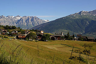
The Turtmannsee is a reservoir located south of Gruben/Meiden at the foot of the Turtmann Glacier, in the Swiss canton of Valais. The lake has a surface area of 0.092 km² and is located at 2,177 metres above sea level. It is split between the municipalities of Oberems (west) and Turtmann-Unterems (east). Just above the Turtmannsee lies a smaller reservoir.
Shankargarhi is a village located near Bajna in the district of Mathura, Uttar Pradesh, India.