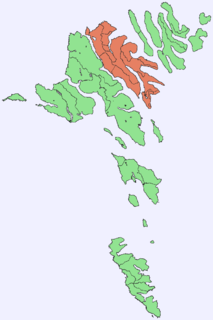
The Faroe Islands are an island group consisting of eighteen islands between the Norwegian Sea and the North Atlantic, about half-way between Iceland and Norway. Its coordinates are 62°N7°W. It is 1,393 square kilometres in area, and includes small lakes and rivers, but no major ones. There are 1,117 kilometres of coastline, and no land boundaries with any other country.

Slættaratindur is the highest mountain in the Faroe Islands, at an elevation of 880 metres. It is located in the northern part of Eysturoy, between the villages of Eiði, Gjógv, and Funningur. Funningur lies at the foot of the mountain, however the summit is not visible from the village.

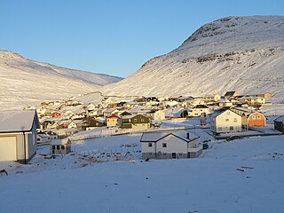
Funningur is a village on the Faroe Islands. It is located on the northwest coast of Eysturoy. It was the only village in the municipality called Funnings kommuna, which on 1 January 2009 became part of Runavíkar kommuna.

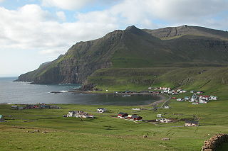
Trongisvágur is a village on the island of Suduroy in the Faroe Islands.

Suðuroy is the southernmost of the Faroe Islands. The island covers 163.7 square kilometres (63.2 sq mi). In 2017 there were 4,607 inhabitants, but there has been a gradual decline in the population numbers ever since the 1950s. In 2005 the population had been 5,036. Suðuroy region comprises this island and Lítla Dímun, the next isle northward in the Faroes, which is uninhabited.

Sørvágsfjørður is a fjord on the west side of the island of Vágoy in the Faroe Islands which is approximately 3.5 km (2.2 mi) long.
Vørðufelli is a mountain overlooking the village Sørvágur on the Faroe Islands. Its height is 284 metres above sea level. It is situated between Húsadalur, Vága, Vatnsdalur, and close to Klovin.

Nónfjall is a 367 metre high mountain on the island Vágar in the Faroe Islands, the mountain is located south of the village of Sørvágur, near Vágar Airport and east of the mountain Høgafjall. The name Nónfjall translates to 'Noon mountain'. However, the Faroese use the word noon differently from the current English usage. In the Faroese language noon refers to 15:00 in the 24-hour clock or 3pm in the 12-hour clock, whereas in the English language noon usually now refers to 12:00 or 12pm.

Tindhólmur is an islet on the southside of Sørvágsfjørður, west of Vágar in the Faroe Islands. It has its name from the five peaks, which are named Ytsti, Arni, Lítli, Breiði, Bogdi. The islet is uninhabited. It has an area of 650,000 square metres (0.25 sq mi) and its highest point is 262 metres (860 ft).

Cape Enniberg is a cliff located on the Island of Viðoy. It is 754 metres (2,474 ft) high, thus one of the highest promontories in the world. Enniberg is the northernmost point of the Faroe Islands.
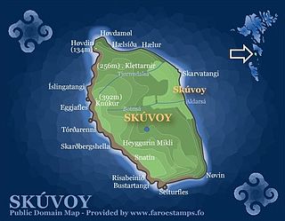
Knútur is marginally the highest point of Skúvoy in the central Faroe Islands. Located on the western side of the island, the hill has a height of 392 or 393 metres. Heyggjurin Mikli towards the south of Skúvoy is marginally lower at 391 metres.

Skælingur is a village on the west of the main Faroese island of Streymoy in the Kvívík Municipality.

Listasavn Føroya is an art museum in Tórshavn, Faroe Islands for mostly permanent exhibits of Faroese arts. Tórshavn is the capital of Faroe Islands.

Conceição das Alagoas is a Brazilian municipality located in the west of the state of Minas Gerais. Its population as of 2007 was estimated to be 20,426 people living in a total area of 1,348 km². The city belongs to the mesoregion of Triângulo Mineiro and Alto Paranaíba and to the micro-region of Uberaba. It became a municipality in 1938.
Gluggarnir is a mountain in the Faroe Islands. At 610 metres, it is the highest mountain on the southernmost island, Suðuroy. The mountain is located between the villages of Fámjin and Trongisvágur.

Kambur is a mountain in Suðuroy, Faroe Islands, located on the northern side of the village Porkeri: Kambur is also visible from Hov.

Eiði Municipality is a municipality of the Faroe Islands. The town of Eiði is the administrative centre. Its area comprises a northwesterly part of the island of Eysturoy. In 2015 it had a population of 687 people. It contains the settlements of Eiði, Ljósá and Svínáir.