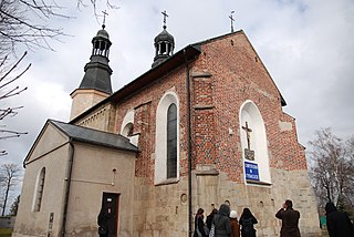
Přestavlky is a small village in the Pardubice Region of the Czech Republic. It has around 190 inhabitants.

Granica is a village in the administrative district of Gmina Strzegom, within Świdnica County, Lower Silesian Voivodeship, in south-western Poland. Prior to 1945 it was in Germany.

Heydarieh mosque of Qazvin is a building in the city of Qazvin in Iran.

Jesienicha is a settlement in the administrative district of Gmina Czarna Białostocka, within Białystok County, Podlaskie Voivodeship, in north-eastern Poland. It lies approximately 8 kilometres (5 mi) north of Czarna Białostocka and 29 km (18 mi) north of the regional capital Białystok.

Grocholice is a village in the administrative district of Gmina Poddębice, within Poddębice County, Łódź Voivodeship, in central Poland. It lies approximately 10 kilometres (6 mi) west of Poddębice and 47 km (29 mi) west of the regional capital Łódź.

Czarny Las is a village in the administrative district of Gmina Żytno, within Radomsko County, Łódź Voivodeship, in central Poland. It lies approximately 8 kilometres (5 mi) east of Żytno, 26 km (16 mi) south-east of Radomsko, and 97 km (60 mi) south of the regional capital Łódź.

Prandocin is a village in the administrative district of Gmina Słomniki, within Kraków County, Lesser Poland Voivodeship, in southern Poland. It lies approximately 2 kilometres (1 mi) north of Słomniki and 26 km (16 mi) north-east of the regional capital Kraków.

Rzemiędzice is a village in the administrative district of Gmina Słaboszów, within Miechów County, Lesser Poland Voivodeship, in southern Poland. It lies approximately 1 kilometre (1 mi) north-west of Słaboszów, 17 km (11 mi) east of Miechów, and 44 km (27 mi) north-east of the regional capital Kraków.

Zarzecze is a village in the administrative district of Gmina Wodzisław, within Jędrzejów County, Świętokrzyskie Voivodeship, in south-central Poland. It lies approximately 6 kilometres (4 mi) east of Wodzisław, 13 km (8 mi) south of Jędrzejów, and 48 km (30 mi) south-west of the regional capital Kielce.

Dąbrówka is a village in the administrative district of Gmina Tarłów, within Opatów County, Świętokrzyskie Voivodeship, in south-central Poland. It lies approximately 8 kilometres (5 mi) south of Tarłów, 24 km (15 mi) north-east of Opatów, and 77 km (48 mi) east of the regional capital Kielce.

Bukowie is a village in the administrative district of Gmina Kunów, within Ostrowiec County, Świętokrzyskie Voivodeship, in south-central Poland. It lies approximately 4 kilometres (2 mi) south of Kunów, 10 km (6 mi) west of Ostrowiec Świętokrzyski, and 46 km (29 mi) east of the regional capital Kielce.
Karolków Rybnowski is a village in the administrative district of Gmina Rybno, within Sochaczew County, Masovian Voivodeship, in east-central Poland.
Bicz-Ostatki is a village in the administrative district of Gmina Stare Miasto, within Konin County, Greater Poland Voivodeship, in west-central Poland.

Lizawy is a village in the administrative district of Gmina Ślesin, within Konin County, Greater Poland Voivodeship, in west-central Poland. It lies approximately 3 kilometres (2 mi) west of Ślesin, 17 km (11 mi) north of Konin, and 92 km (57 mi) east of the regional capital Poznań.

Łukowo is a village in the administrative district of Gmina Czersk, within Chojnice County, Pomeranian Voivodeship, in northern Poland. It lies approximately 5 kilometres (3 mi) south-west of Czersk, 27 km (17 mi) east of Chojnice, and 82 km (51 mi) south-west of the regional capital Gdańsk.

Delowo is a village in the administrative district of Gmina Stężyca, within Kartuzy County, Pomeranian Voivodeship, in northern Poland. It lies approximately 2 kilometres (1 mi) south-west of Stężyca, 24 km (15 mi) south-west of Kartuzy, and 50 km (31 mi) south-west of the regional capital Gdańsk.

Hermanowa Wola is a settlement in the administrative district of Gmina Ryn, within Giżycko County, Warmian-Masurian Voivodeship, in northern Poland. It lies approximately 3 kilometres (2 mi) east of Ryn, 17 km (11 mi) south-west of Giżycko, and 73 km (45 mi) east of the regional capital Olsztyn.
Wólka Pilecka is a village in the administrative district of Gmina Reszel, within Kętrzyn County, Warmian-Masurian Voivodeship, in northern Poland.
Hòa Sơn is a commune (xã) and village in Hiệp Hòa District, Bắc Giang Province, in northeastern Vietnam.

East Haven is an unincorporated community in Wayne Township, Wayne County, in the U.S. state of Indiana.


