Rio Guadalmina | |
River | |
Mouth of the Guadalmina River between Marbella and Estepona | |
Country | Spain |
---|---|
Source | |
- location | Igualeja, Sierra Bermeja , Spain |
Mouth | |
- location | Mediterranean Sea, Málaga , Spain |
- elevation | 0 m (0 ft) |
- coordinates | 36°27′36″N5°0′19″W / 36.46000°N 5.00528°W Coordinates: 36°27′36″N5°0′19″W / 36.46000°N 5.00528°W |
Length | 28 km (17 mi) |
The river Guadalmina (from the Arabic for "Wadi (river) of the port") is a short coastal river of the Mediterranean basin in southern Spain that runs entirely within the Andalusian province of Málaga.
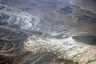
Wadi, alternatively wād, is the Arabic term traditionally referring to a valley. In some instances, it may refer to a dry (ephemeral) riverbed that contains water only when heavy rain occurs.
Andalusia is an autonomous community in southern Spain. It is the most populous, and the second largest autonomous community in the country. The Andalusian autonomous community is officially recognised as a "historical nationality". The territory is divided into eight provinces: Almería, Cádiz, Córdoba, Granada, Huelva, Jaén, Málaga and Seville. Its capital is the city of Seville.
The Province of Málaga is located on the southern mediterranean coast of Spain, in Andalusia. It is bordered by the Mediterranean Sea to the south and by the provinces of Cádiz, Seville, Córdoba, and Granada (clockwise).
Only 28 kilometres (17 mi) in length, the Guadalmina rises in the Sierra Bermeja, in the municipality of Igualeja, but its main course begins below the mountains in the municipality of Benahavís, forming a karst aquifer in an area known as Las Angosturas (the narrows). [1] [2] The river flows into the municipality of Marbella near San Pedro de Alcántara, and serves to delimit its border from that of the municipality of Estepona.
Igualeja is a town and municipality in the province of Málaga, part of the autonomous community of Andalusia in southern Spain. It is situated in the west of province in Valle del Genal. It belongs to the comarca of Serranía de Ronda. The municipality is situated approximately 20 kilometers from Ronda and 142 kilometres from the city of Málaga. It has a population of approximately 1,000 residents.
Benahavís is a Spanish mountain village between Marbella, Estepona, and Ronda, 7 kilometers from the coast.
Karst is a topography formed from the dissolution of soluble rocks such as limestone, dolomite, and gypsum. It is characterized by underground drainage systems with sinkholes and caves. It has also been documented for more weathering-resistant rocks, such as quartzite, given the right conditions. Subterranean drainage may limit surface water, with few to no rivers or lakes. However, in regions where the dissolved bedrock is covered or confined by one or more superimposed non-soluble rock strata, distinctive karst features may occur only at subsurface levels and be totally missing above ground.
The Guadalmina was formerly of defensive strategic importance for the people of Marbella; its waters also served to power watermills for grinding grain into flour. The La Concepción reservoir is the primary water source for this municipality; it is formed by a diversion dam on the Río Verde, where the waters of the rivers Guadalmina, Guadalmansa and Guadaiza join and are captured, [3] then transported to provide the water supply of the Costa del Sol towns of Benalmadena, Fuengirola, Mijas, Benahavís, Marbella, Casares and Manilva.
A watermill or water mill is a mill that uses hydropower. It is a structure that uses a water wheel or water turbine to drive a mechanical process such as milling (grinding), rolling, or hammering. Such processes are needed in the production of many material goods, including flour, lumber, paper, textiles, and many metal products. These watermills may comprise gristmills, sawmills, paper mills, textile mills, hammermills, trip hammering mills, rolling mills, wire drawing mills.
Fuengirola, in ancient times known as Suel and then Suhayl, is a large town and municipality on the Costa del Sol in the province of Málaga in the autonomous community of Andalusia in southern Spain. It is located on the central coast of the province and integrated into the region of the Costa del Sol and the Commonwealth of Municipalities of the Costa del Sol Occidental.
Mijas is a town and municipality in the Province of Málaga, in the autonomous community of Andalusia. Located on the South-Eastern coast of Spain, Mijas belongs to the region of Costa del Sol Occidental. Its centre is a typical Andalusian white-washed village, located on a mountainside about 430 metres or 1,476 feet above sea level, in the heart of the Costa del Sol region.
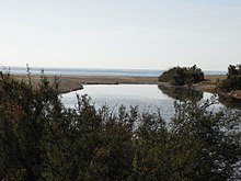
The lower course of the river is heavily urbanized; many homes there have a high risk of inundation. [4] [5]
Near the river's mouth, next to San Pedro de Alcántara, are the important archaeological sites of the early 4th-century Christian church Basílica de Vega del Mar , the 3rd-century vaulted Roman baths of Las Bóvedas (the Domes) and the eponymous watch tower of Torre de Las Bóvedas. [6]
The Basílica de Vega del Mar is a church in Marbella, southern Spain. This is one of the few examples of North African Visigothic churches built in Andalusia during sixth century. It is located near the mouth of the Guadalmina River along an old Roman road which connected Cadiz with Cartagena.
Castilla–La Mancha is an autonomous community of Spain. Comprised by the provinces of Albacete, Ciudad Real, Cuenca, Guadalajara and Toledo, it was created in 1982. It is bordered by Castile and León, Madrid, Aragon, Valencia, Murcia, Andalusia, and Extremadura. It is one of the most sparsely populated of Spain's regions. Albacete is the largest and most populous city. Its capital city is Toledo, and its judicial capital city is Albacete.
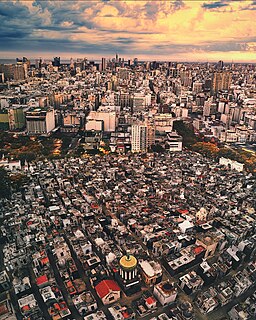
La Recoleta Cemetery is a cemetery located in the Recoleta neighbourhood of Buenos Aires, Argentina. It contains the graves of notable people, including Eva Perón, presidents of Argentina, Nobel Prize winners, the founder of the Argentine Navy, and a granddaughter of Napoleon. In 2011, the BBC hailed it as one of the world's best cemeteries, and in 2013, CNN listed it among the 10 most beautiful cemeteries in the world.
Quiché is a department of Guatemala.
Marbella is a city and municipality in southern Spain, belonging to the province of Málaga in the autonomous community of Andalusia. It is part of the Costa del Sol and is the headquarters of the Association of Municipalities of the region; it is also the head of the judicial district that bears its name.
In Spain traditionally and historically, some autonomous communities are also divided into comarcas.
Fusagasugá or Fusa is a town and municipality in the department of Cundinamarca, in central Colombia. It is located in the warm valley between the rivers Cuja and Panches, a central region of the Andes Mountains in South America. The municipality has an estimated population of 134,523 as of 2015. The urban region has 108,157 inhabitants. The municipality itself covers an area of 206 km2 (80 sq mi).
Hermigua is a town and a municipality in the northeastern part of La Gomera in the province of Santa Cruz de Tenerife of the Canary Islands, Spain. It is located 12 km northwest of the island's capital, San Sebastián de la Gomera. The Garajonay National Park covers the southern part of the municipality.
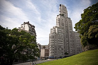
The Kavanagh Building is an Art Deco skyscraper in Buenos Aires, located at 1065 Florida Street in the barrio of Retiro, overlooking Plaza San Martín. It was the highest skyscraper in Latin America.
San Pedro de Alcántara lies on the main Costa del Sol coastal road the N340/A7 as well as the new toll motorway the AP7, 10 km west of Marbella in Andalucia, Southern Spain. It is easily accessed from either Málaga or Cádiz and via the C339 from Sevilla and Ronda. The nearest airports of Málaga and Gibraltar are both within an hour's drive. It is situated in the fertile plain of the same name, Vega de San Pedro Alcántara, a broad stretch of coastal lowland surrounded in a semicircle by rugged hills. On the East the Sierra Blanca of Marbella, dominated by its highest peak Pico del Astonar (1.270 m.) better known locally as "La Concha" because of its resemblance to a fluted sea shell when viewed from the west. To the North, there is the Sierra del Real or El Real del Duque, the Sierra de las Nieves and those of Tolox, on the West of the town the Monte Mayor and, finally, closing the mountain line the Sierra Bermeja.
San Juan Bautista Tuxtepec, or simply referred to as Tuxtepec, is the head of the municipality by the same name and is the second most populous city of the Mexican state of Oaxaca. It is part of the Tuxtepec District of the Papaloapan Region. As of the 2005 census, the city is home to a population of 94,209 and 144,555 in the municipality, though census data are often under reported for various reasons. The municipality resides in the region called La Cuenca, is located 36 feet above sea level, and occupies an area of approximately 580 square miles (1,500 km2). The city itself is surrounded by the Papaloapan River, and lies a few kilometers south of the Cerro de Oro Dam on its tributary the Santo Domingo River. The municipality is bordered by the state of Veracruz in the north, the municipalities of Loma Bonita to the east and San José Chiltepec to the south. It is almost 100 miles (160 km) to the port of Veracruz, 130 miles (210 km) to Oaxaca City, the state capital, and 310 miles (500 km) to Mexico City.
Salinas del Manzano is a city of Spain in the province of Cuenca in the autonomous community of Castile-La Mancha. It has an area of 33.65 km² with population of 105 inhabitants and a population density of 3.21 inhabitants / km².
Las Bóvedas son una estructura en la Ciudad Vieja de Cartagena en Colombia, unida a las paredes. El mar caribe es visible desde la parte superior de la estructura. Fueron construidos como mazmorras. Se ubican entre los fuertes de Santa Clara y Santa Catalina.
The Marbella blast furnaces were the first iron works in Spain.
Janq'u Quta is a lake in Bolivia located in the La Paz Department, Pedro Domingo Murillo Province, El Alto Municipality. It is situated south of the mountain Wayna Potosí and north-east of Milluni Lake at a height of about 4,664 metres (15,302 ft). The little lake north-east of Janq'u Quta is named Pata Quta (Pata Khota).
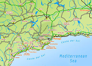
This article shows a list of towns in the Costa del Sol in Andalusia, Spain.
Altos Mirandinos metropolitan area or Los Teques metropolitan area is a metropolitan area in Miranda, Venezuela, that includes 3 municipalities, it's part of the Greater Caracas area. It has a population of 454,929 inhabitants.
Professor Marianne Vere Cardale de Schrimpff is a Colombian anthropologist, archaeologist, academic and writer.
The Piura River is a river in northern Peru. The river flows westward from the Andes to the Pacific Ocean and is susceptible to major flooding. Piura is the largest city along the river's course.
Más apartados se ven los meandros del Guadalmina, con remansos tan profundos como el Charcón, encajados aquéllos en el río hasta perderse en las “Angosturas”, entrecruzándose en la lejanía una serie de crestas y picos...
Los principales aportes de agua en la zona proceden, junto a la lluvia, de la red hidrográfica superficial y de los acuíferos. La red hidrográfica superficial está compuesta por un conjunto de cuencas independientes, que desaguan todas ellas en el Mediterráneo. Esta red presenta cauces de trazado poco sinuoso y dirección meridiana en lo general. Las principales cuencas son las del Guadalmansa (24 km de longitud y 59 km2 de cuenca) Guadalmina (22,4 km y 67,4 km2) y Guadaiza (20 kmy 45,6 Km2). Completan el conjunto un número de cursos más pequeños como Cañas Verdes, Saladillo, Dos Hermanas, Chopo, etc., también de trazado meridiano en lo general.
...en el río Guadalmina se incluyen como alto riesgo las viviendas de la urbanización Guadalmina Alto, las Yucas y Casasola.
Wikimedia Commons has media related to Guadalmina . |