Related Research Articles
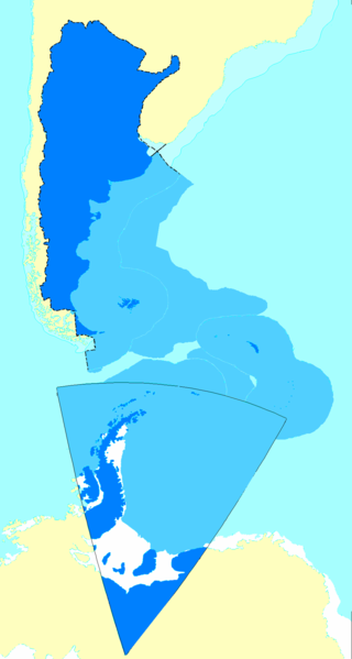
This is a list of the extreme points of The Americas, the points that are farther north, south, east or west than any other location on the continent. The continent's southernmost point is often said to be Cape Horn, which is the southernmost point of the Chilean islands. The Americas cross 134° of longitude east to west and 124° of latitude north to south.
Tawi is a river that flows through the Jammu region in the Indian-administered union territory of Jammu and Kashmir and Pakistan-administered Azad Jammu and Kashmir. The Tawi is a major left bank tributary of the river Chenab.
Pritchard Provincial Park is a provincial park in British Columbia, Canada, located on the north side of the South Thompson River between the communities of Monte Creek (W) and Chase (E). The Park is actually split into two sections. The best access to the actual Park is from the water; as you would need Private Land owners permission to access from the land. The area in between the Park's boundaries is supposedly under the Province of British Columbia's jurisdiction, but is not part of the Provincial Park itself.

The Atuel River is a river located mainly in the south of the Argentine province of Mendoza, with its last part in La Pampa. It is a tributary of the Desaguadero River.

The Diamante River is a river in the Argentine province of Mendoza. It is born from glaciers on the Maipo, a volcano in the Andes range in the Argentine–Chilean border, and flows east until emptying in the Desaguadero River. Its drainage basin covers an area of 2,750 square kilometres (1,060 sq mi) in the central region of Mendoza.

The Melado is a river of Linares province, Maule Region, of Chile. It rises in the "Cordillera de los Andes" with the name of river Guaiquivilo where it is formed by two tributaries, the river Cajón Troncoso, originating near the Argentine border and the river Palaleo, from the outflow of Dial lake, located some 70 km upstream from the joining of the two rivers. The Guaiquivilo flows northwardly along a typical interandean longitudinal valley.

The Aluminé River is a geographical feature of Neuquén Province, Argentina. It flows southward from Lake Aluminé, near the town of Aluminé, for around 170 km (105 mi), past which it becomes a tributary of the Collón Curá River.
The Fénix Grande River is a river of Argentina.
The Pelque River is a river of Argentina.

The Tecka River is a river of Argentina.
The Cupsuptic River is a 23.7-mile-long (38.1 km) river in Maine. It flows from its source near the Canada–United States border to Cupsuptic Lake, the northern arm of Mooselookmeguntic Lake, which drains via other lakes into the Androscoggin River. Although short, the Cupsuptic River includes three of the highest mountains of New England — Kennebago Divide, Snow Mountain, and White Cap Mountain — within its watershed. The name "Cupsuptic" derives from the Abenaki language, meaning "a closed-up stream."
The East Branch Cupsuptic River is a short tributary of the Cupsuptic River in Maine. It flows about 4 miles (6 km) from its source in a cirque between Snow Mountain and Twin Mountains, to its mouth on the Cupsuptic.
The First East Branch Magalloway River is a 7.0-mile-long (11.3 km) river in northwestern Maine. It is a tributary of the Magalloway River, which flows to the Androscoggin River and ultimately to the tidal Kennebec River and the Atlantic Ocean.
The South Branch Moose River is a tributary of the Moose River in Franklin County, Maine. Its source on Caribou Mountain is about 1.5 miles (2 km) from the Canada–United States border, in Skinner. From there, the river winds generally north for 11.0 miles (17.7 km) to its confluence with the main stream of the Moose River in Lowelltown.

The Almonte is a river in Spain. The 97 km (60 mi) long river is a left tributary of the Tajo, the longest river of the Iberian peninsula. It lies in its entirety in the Extremadura region.

Bozhinov Glacier is the 5 km long and 2.5 km wide glacier on Danco Coast in Graham Land on the Antarctic Peninsula situated north of Krebs Glacier and south of Nobile Glacier. Flowing westwards to enter Gerlache Strait at Kapisturia Cove in Charlotte Bay.

Samodiva Glacier is the 3.7 km long and 1.8 km wide glacier in the east part of Chavdar Peninsula in Graham Land on the Antarctic Peninsula. Situated east of Tumba Ice Cap and west of Pirin Glacier. Draining north-northeastwards east of Mount Pénaud to enter Curtiss Bay west of Seaplane Point.
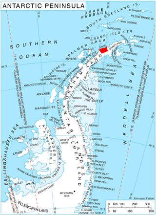
Pirin Glacier is the 5.7 km long and 6 km wide glacier situated next east of Chavdar Peninsula on Davis Coast on the Antarctic Peninsula. Situated west of Wright Ice Piedmont, north of Gregory Glacier and east of Samodiva Glacier. Draining north-northwestwards from Boulton Peak to enter Curtiss Bay east of Seaplane Point.
References
- Rand McNally, The New International Atlas, 1993.
- GEOnet Names Server
45°41′03″S70°19′11″W / 45.6842°S 70.3198°W
| | This article about a place in Chubut Province, Argentina is a stub. You can help Wikipedia by expanding it. |
| | This article related to a river in Argentina is a stub. You can help Wikipedia by expanding it. |