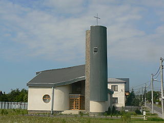
De Waal is a village in the Dutch province of North Holland. It is a part of the municipality of Texel, and lies about 15 km north of Den Helder.

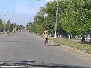
Snihurivka is a city in Mykolaiv Oblast, Ukraine. It is the administrative center of Snihurivka Raion.
Dandupalya is a village in the taluk of Hoskote in Karnataka, India. It lies near the Old Madras Road, National Highway 4, about 5 kilometers from the town of Hoskote and an hour's drive from Bangalore. It has become notorious for the activities of the Dandupalya gang which between about 1996 and 2001 committed murders, rapes, and robberies. The gang numbered about 30 men and women, some of whom lived in Dandupalya. They are thought to have killed more than 80 people. Sixteen death sentences and four sentences of life imprisonment have been given to members of the gang, while others have received shorter prison sentences.

Kusín is a village and municipality in Michalovce District in the Kosice Region of eastern Slovakia.

Kubáňovo is a village and municipality in the Levice District in the Nitra Region of Slovakia.

Dobârceni is a commune in Botoșani County, Romania. It is composed of six villages: Bivolari, Brăteni, Cișmănești, Dobârceni, Livada and Murguța.

Grănicești is a commune located in Suceava County, Romania. It is composed of six villages: Dumbrava, Grănicești, Gura Solcii, Iacobești, Românești and Slobozia Sucevei.

Ususău is a commune in Arad County, Romania, situated in the couloir zone of the Mureş River, in the northern part of the Lipovei Hills. The administrative territory of the commune is 13,543 hectares. It is composed of five villages: Bruznic (Marosborosznok), Dorgoș (Dorgos), Pătârș (Petercse), Ususău and Zăbalț (Szabálcs). Until 2005, the commune was called Dorgoș and that village was the commune centre.

Rynarzewo is a village in the administrative district of Gmina Szubin, within Nakło County, Kuyavian-Pomeranian Voivodeship, in north-central Poland. It lies approximately 8 kilometres (5 mi) north-east of Szubin, 18 km (11 mi) south-east of Nakło nad Notecią, and 14 km (9 mi) south-west of Bydgoszcz.

Mănăștiur is a commune in Timiș County, Romania. It is composed of four villages: Mănăștiur, Pădurani (Maroserdőd), Remetea-Luncă (Hosszúremete) and Topla (Topla).

Wężyczyn is a village in the administrative district of Gmina Latowicz, within Mińsk County, Masovian Voivodeship, in east-central Poland. It lies approximately 5 kilometres (3 mi) north of Latowicz, 22 km (14 mi) south-east of Mińsk Mazowiecki, and 59 km (37 mi) east of Warsaw.

Rozwozin is a village in the administrative district of Gmina Żuromin, within Żuromin County, Masovian Voivodeship, in east-central Poland. It lies approximately 6 kilometres (4 mi) west of Żuromin and 124 km (77 mi) north-west of Warsaw.

Dziembówko is a village in the administrative district of Gmina Kaczory, within Piła County, Greater Poland Voivodeship, in west-central Poland. It lies approximately 6 kilometres (4 mi) south-west of Kaczory, 11 km (7 mi) south-east of Piła, and 75 km (47 mi) north of the regional capital Poznań.

Żelice is a village in the administrative district of Gmina Wągrowiec, within Wągrowiec County, Greater Poland Voivodeship, in west-central Poland. It lies approximately 10 kilometres (6 mi) west of Wągrowiec and 48 km (30 mi) north of the regional capital Poznań.

Chwalim is a village in the administrative district of Gmina Kargowa, within Zielona Góra County, Lubusz Voivodeship, in western Poland. It lies approximately 4 kilometres (2 mi) west of Kargowa and 26 km (16 mi) north-east of Zielona Góra.

Posucice is a village in the administrative district of Gmina Branice, within Głubczyce County, Opole Voivodeship, in south-western Poland, close to the Czech border. It lies approximately 3 kilometres (2 mi) north-east of Branice, 15 km (9 mi) south of Głubczyce, and 68 km (42 mi) south of the regional capital Opole.
Tismice is a village and municipality in Kolín District in the Central Bohemian Region of the Czech Republic.
Petrovice II is a village and municipality in Kutná Hora District in the Central Bohemian Region of the Czech Republic.

Gorobilje is a village in the municipality of Požega, western Serbia. According to the 2002 census, the village has a population of 1506 people.There is a beautiful old, wooden Serbian Orthodox Church of Saint John the Baptist in the village.

Markaz is a village in Heves County in northern Hungary's Mátra mountains about 14 kilometres from Gyöngyös. The primary local industries are viniculture, fishing and tourism. The town has a population of 1,789, and an area of 25.61 sq. kilometers.


