Related Research Articles

The Macquarie River - Wambuul is part of the Macquarie–Barwon catchment within the Murray–Darling basin, is one of the main inland rivers in New South Wales, Australia.

Gwydir River, a major inland perennial river of the Barwon catchment within the Murray–Darling basin, is located in the Northern Tablelands, North West Slopes, and Orana districts of New South Wales, Australia.
Cudgegong River, a perennial stream that is part of the Macquarie catchment within the Murray–Darling basin, is located in the central western and Orana districts of New South Wales, Australia.
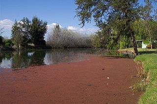
Bogan River, a perennial river that is part of the Macquarie–Barwon catchment within the Murray–Darling basin, is located in the central west and Orana regions of New South Wales, Australia.

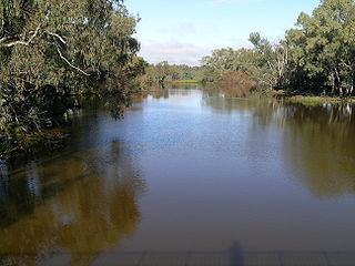
Barwon River, a perennial river that is part of the Murray–Darling basin, is located in the north-west slopes and Orana regions of New South Wales, Australia.

Burrendong Dam is a rock-fill embankment major gated dam with a clay core across the Macquarie River upstream of Wellington in the central west region of New South Wales, Australia. The dam's purpose includes flood mitigation, irrigation, water supply and hydro-electric power generation. The dam impounds Lake Burrendong and is filled by the waters from the Macquarie, and Cudgegong rivers as well as Meroo Creek.
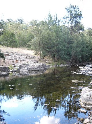
Turon River, a perennial stream that is part of the Macquarie catchment within the Murray–Darling basin, is located in the central western district of New South Wales, Australia. Partly situated in the Turon National Park, the river is host to numerous recreational and tourist activities such as horse riding, gold panning, canoeing, camping, and seasonal fishing.

Spring Creek Dam is a minor embankment dam across the Spring Creek upstream of Orange in the central western region of New South Wales, Australia. The impounded reservoir is called the Spring Creek Reservoir.
The Mangrove Creek, a perennial river that is part of the Hawkesbury-Nepean catchment, is located in the Central Coast region of New South Wales, Australia.

Fish River, a perennial stream that is part of the Macquarie catchment within the Murray–Darling basin, is located in the central western district of New South Wales, Australia. The Fish River is in Wiradjuri country and its indigenous name is Wambuul, which means “winding river”.
Bell River, a watercourse that is part of the Macquarie catchment within the Murray–Darling basin, is located in the central west region of New South Wales, Australia.
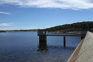
Oberon Dam or Fish River Dam is a major ungated concrete slab and buttress with earth embankment dam comprising a concrete ski jump chute spillway and fuse plug across the Fish River upstream of Oberon in the Central Tablelands region of New South Wales, Australia. The dam's purpose includes flood mitigation, industrial, and water supply. The impounded reservoir is called Lake Oberon.

The Billabong Creek, a partly perennial stream of the Murray River catchment within the Murray-Darling basin, is located in the Riverina region of New South Wales, Australia.
Araluen Creek, a partly perennial stream of the Moruya River catchment, is located in the Southern Tablelands and South Coast regions of New South Wales, Australia.
The Adjungbilly Creek, a mostly–perennial river that is part of the Murrumbidgee catchment within the Murray–Darling basin, is located in the South West Slopes and Riverina regions of New South Wales, Australia.
The Gunningbland Creek, a perennial river of the Lachlan sub–catchment, part of the Murrumbidgee catchment of the Murray-Darling basin, is located in the Central West region of New South Wales, Australia.
The Jerra Jerra Creek, a perennial stream of the Murray River catchment within the Murray-Darling basin, is located in the Riverina region of New South Wales, Australia.

Grahway is a bounded rural locality, and cadastral parish, 100 kilometers south of Nyngan, New South Wales. It is located at 32°12′05″S 146°38′31″E on Gunningbar Creek near the junction with the Bogan River and is in Bogan Shire and Flinders County. The locality is 32 kilometers south of the town of Nymagee, and west of Tottenham, New South Wales.
Walton is a bounded rural locality, and cadastral parish, 100 kilometers south of Nyngan, New South Wales. It is located at 32°10′26″S 146°34′16″E on Gunningbar Creek near the junction with the Bogan River and is in Bogan Shire and Flinders County. The locality is south of the town of Nymagee, and west of Tottenham, New South Wales.
Canonba is a locality in the Orana region of New South Wales, Australia. There was also a village of the same name, which is now a ghost town. It lay on Duck Creek, a tributary of the Bogan River, approximately 30 km north-east of Nyngan. Since 1983, the old village site has been known officially as Old Canonba.
References
- ↑ Macquarie and Cudgegong Regulated Rivers Water Source, at NSW Department of Water and Energy.
- ↑ GUNNINGBAR CREEK WEIR. Sydney Morning HeraldFriday 9 December 1910 page 5.
- ↑ "Map of Bogan River, NSW". Bonzle Digital Maps of Australia. Retrieved 5 May 2010.
- ↑ Gunningbar Creek at search Australia.
- ↑ New South Wales. Parliament. Legislative Council, Votes & Proceedings, Volume 2.
| | This Central West geography article is a stub. You can help Wikipedia by expanding it. |