Related Research Articles
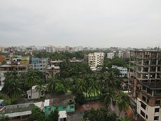
Comilla District, officially known as Cumilla District, is a district located in southeastern Bangladesh. It lies about 100 kilometres south east of Dhaka. Comilla is bordered by Brahmanbaria and Narayanganj districts to the north, Noakhali and Feni districts to the south, Tripura state of India to the east and Munshiganj and Chandpur districts to the west.

Vrindavan, also spelt Vrindaban and Brindaban, is a historical city in the Mathura district of Uttar Pradesh, India. It is located in the Braj Bhoomi region and holds religious importance for Hindus who believe that Krishna, one of the main deities in Hinduism, spent most of his childhood in this city. Vrindavan has about 5,500 temples dedicated to the worship of Krishna and his chief consort Radha.

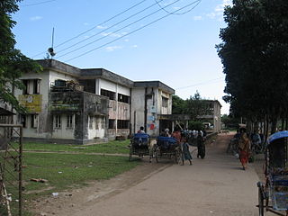
Munshiganj, also historically and colloquially known as Bikrampur, is a district in central Bangladesh. It is a part of the Dhaka Division and borders Dhaka District.

Kachua is an upazila (sub-district) of Chandpur District in Bangladesh, located in the Chittagong Division. It is a part of the Greater Comilla region.

Lohagara is an upazila of Chattogram District in Chattogram Division, Bangladesh. Lohagara is situated between Chattogram and Cox's Bazar. It is one of the largest and most densely populated upazilas of Bangladesh. It has headquarters in Lohagara.

Kapasia is an upazila (sub-district) of Gazipur District in central Bangladesh, part of the Dhaka Division. It is located at 24.1000°N 90.5708°E, and is best known as the home upazila of Tajuddin Ahmad, the first Prime Minister of Bangladesh. The modern-day upazila was a part of the historic Bhawal Estate and falls within its boundary.

Pakundia is an upazila (subdistrict) in Kishoreganj District, Dhaka Division, Bangladesh. Its total land area is 180.52 square kilometres. It has a population of 237,218 residents. It was formed in 1922 as a thana. On 14 September 1983, it was turned into an upazila.

Fulbaria is an upazila of the Mymensingh District in Bangladesh.

Bandar is an upazila (sub-district) of the Narayanganj District in central Bangladesh, part of the Dhaka Division. Bandar is a part of Greater Dhaka; the conurbation surrounding the Bangladeshi capital city of Dhaka.
Belabo is an upazila of the Narsingdi District of Bangladesh, located in the Dhaka Division. Here the 2,500-year-old civilisation of Wari-Bateshwar has been discovered. It is believed that it was a port city with foreign trade with Ancient Rome, Southeast Asia and other regions. It is the oldest city so far discovered after Indus Valley civilisation. Though part of Narsingdi, the Bengali dialect spoken by the people of Belabo is similar to that of Greater Mymensingh.
Bhuyanpur is an upazila of Tangail District in the Division of Dhaka, Bangladesh.

Ghatail is an upazila located in Tangail District, Bangladesh. The upazila is bounded by Gopalpur and Madhupur upazilas on the north, Fulbaria and Bhaluka upazilas on the east, Kalihati and Sakhipur upazilas on the south, Bhuapur and Gopalpur upazilas on the west. Main rivers are Bangshai, Jhinai, Toak.

Kalihati is an upazila of Tangail District, Dhaka Division, Bangladesh.

Madhupur is an upazila of Tangail District in the Division of Dhaka, Bangladesh.

Baraigram is an upazila of Natore District, located in the Rajshahi Division of Bangladesh.

Lalpur is an upazila of Natore District, located the Rajshahi Division of Bangladesh.

Gangachara is the northernmost upazila of Bangladesh's Rangpur District, located in the Rangpur Division.
Mohanganj is an upazila of Netrokona District in the Mymensingh division of Bangladesh. It is one of the 10 upazilas of Netrakona district. Mohanganj is largely known as the capital of Lower Bangladesh as it is the economic heart of Lower Bangladesh generally known as Haor.
Sagardighi is a village in Dhalapara Union under Ghatail Upazila of Tangail District, Bangladesh.

Bibi Chini Mosque is an ancient mosque and archaeological site located in Barguna District of Bangladesh. It is located in the Bibi Chini village under Betagi Upazila. This Mughal architecture style mosque was built by an Islamic preacher named Shah Neyamat Ullah.
References
- ↑ টাঙ্গাইলের 'গুপ্ত বৃন্দাবন' হতে পারে ইকোট্যুরিজম কেন্দ্র. Channel i (in Bengali). Retrieved 17 December 2019.
- ↑ গুপ্তবৃন্দাবন (তমাল বৃক্ষ). Dhalapara Union (in Bengali). Archived from the original on 17 December 2019. Retrieved 17 December 2019.
24°28′57″N90°14′16″E / 24.48250°N 90.23778°E
| | This Dhaka Division location article is a stub. You can help Wikipedia by expanding it. |