
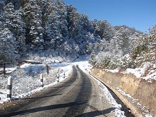
Bhojpur is one of two urban municipalities in Bhojpur District of Province No. 1 of Nepal. It was established on 18 May 2014 merging the existing Bhaisipankha, Bokhim, Bhojpur, Taksar Village Development Committees It is the district headquarters of Bhojpur District, a hilly/mountainous district in Province No. 1. At the time of the 2011 Nepal census it had a population of 27204 with an area of 159.51 square kilometres (61.59 sq mi).

Bhojpur District is one of 14 districts of Province No. 1 of eastern Nepal. The district's area is 1,507 km² with a population of 182,459 (2011). The administrative center is Bhojpur. It is surrounded by Dhankuta and Sankhuwasabha in the east, Khotang in the west, again Sankhuwasabha in north-east and Solukhumbu in the north-west and Udayapur in the South.

Khotang District is one of 14 districts of Province No. 1 of eastern Nepal. The district, with Diktel as its district headquarters, covers an area of 1,591 km2 (614 sq mi) and has a population (2011) of 206,312. The district has been bordered by Bhojpur District in the east, Udayapur district in the south, Okhaldhunga district in the west and Solukhumbu district in the North.

Sankhuwasabha District is one of 14 districts of Province No. 1 of eastern Nepal. The district's area is 3,480 km² with a population of 159,203 in 2001 and 158,742 in 2011. The administrative center is Khandbari.
Solukhumbu District (Nepali: सोलुखुम्बु जिल्लाlisten , Sherpa: ཤར་ཁུམ་བུ་རྫོང་ཁ།, Wylie: shar khum bu dzong kha) is one of 14 districts of Province No. 1 of eastern Nepal. As the name suggests, it consists of the subregions Solu and Khumbu.

Kanda, Bajura is a village in Bajura District in the Seti Zone of north-western Nepal. At the time of the 1991 Nepal census it had a population of 2,741 and had 484 houses in the village.
Chhinamukh is a village development committee in Bhojpur District in the Kosi Zone of eastern Nepal. At the time of the 1991 Nepal census it had a population of 3375 persons living in 639 individual households.
Dhodalekhani is a village development committee in Bhojpur District in the Kosi Zone of eastern Nepal. At the time of the 1991 Nepal census it had a population of 2412 persons living in 455 individual households.
Jarayotar is a Village Development Committee in Bhojpur District in the Kosi Zone of eastern Nepal. At the time of the 2011 Nepal census it had a population of 4031 persons residing in 721 individual households. According to ancestors, this place had a large forest with many animals among which antelope were abundant and the land was dug by them to form a plain land. So, the name of the village was kept Jarayotar.
Khairang is a Village Development Committee in Bhojpur District in the Kosi Zone of eastern Nepal. At the time of the 1991 Nepal census it had a population of 3050 persons residing in 533 individual households.
Kudak Kaule is a village development committee in Bhojpur District in the Kosi Zone of eastern Nepal. At the time of the 1991 Nepal census it had a population of 2734 persons living in 507 individual households.
Patle Pani is a village development committee in Bhojpur District in the Kosi Zone of eastern Nepal. At the time of the 1991 Nepal census it had a population of 3787 persons living in 743 individual households.
Sano Dumba is a village development committee in Bhojpur District in the Kosi Zone of eastern Nepal. At the time of the 1991 Nepal census it had a population of 2761 persons living in 501 individual households.
Syamsila is a village development committee in Bhojpur District in the Kosi Zone of eastern Nepal. At the time of the 1991 Nepal census it had a population of 2767 persons living in 517 individual households.
Taksar is a Market in Bhojpur Municipality in Bhojpur District in the Kosi Zone of eastern Nepal. At the time of the 1991 Nepal census it had a population of 4524 persons residing in 829 individual households.
Thulo Dumba is a village development committee in Bhojpur District in the Kosi Zone of eastern Nepal. At the time of the 1991 Nepal census it had a population of 2604 persons living in 537 individual households.
Tiwari Bhanjyang is a village development committee in Bhojpur District in the Kosi Zone of eastern Nepal. At the time of the 1991 Nepal census it had a population of 3004 persons living in 534 individual households. The mayor of this VDC is Manit Nidhi Tiwari.
Tunggochha is a village development committee in Bhojpur District in the Kosi Zone of eastern Nepal. At the time of the 1991 Nepal census it had a population of 2446 persons living in 421 individual households.
Bhorle is a Village Development Committee in Rasuwa District in the Bagmati Zone of northern Nepal. At the time of the 1991 Nepal census it had a population of 4884 people residing in 903 individual households.
Siddheshwari is a village development committee in Sindhuli District in the Janakpur Zone of south-eastern Nepal. At the time of the 1991 Nepal census it had a population of 16,759 people living in 3080 individual households.

