Related Research Articles

The River Towy is one of the longest rivers flowing entirely within Wales. Its total length is 120 km (75 mi). It is noted for its sea trout and salmon fishing.

The River Teifi in Wales forms the boundary for most of its length between the counties of Ceredigion and Carmarthenshire, and for the final 3 miles (4.8 km) of its total length of 76 miles (122 km), the boundary between Ceredigion and Pembrokeshire. Its estuary is northwest of Cardigan, known in Welsh as Aberteifi, meaning 'mouth of the Teifi'. Teifi has formerly been anglicised as "Tivy".
ˈ The Afon Ogwen is a river in north-west Wales draining from some of the greatest peaks in Snowdonia before discharging to the sea on the eastern side of Bangor, Gwynedd.

The River Llynfi, is one of three main tributaries of the River Ogmore.

The River Garw runs for about 12 miles from its source in the hills north of Blaengarw to the confluence with the River Ogmore and the River Llynfi at Aberkenfig. It is one of three main tributaries of the River Ogmore which runs through the town of Bridgend. It is in Wales, United Kingdom.

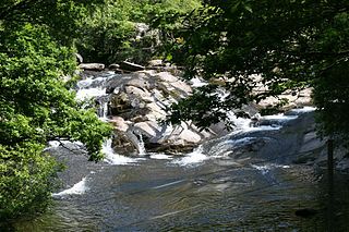
The River Cynon in South Wales is a main tributary of the Taff. Its source is the rising of Llygad Cynon at 219 m (719 ft) above sea level at Penderyn, Rhondda Cynon Taf and flows roughly southeast, into the Taff at Abercynon in the same district. The water emerging at Llygad Cynon has been traced back to the sink of the Nant Cadlan at Ogof Fawr.
The A481 is a road in Powys, Wales, which connects with the A483 road, not far from the A470 road at Llanelwedd, Builth Wells and leads to the A44 road near Llanfihangel Nant Melan. It is the main road leading to the A44 which connects Builth to Leominster and Hereford across the border with England.
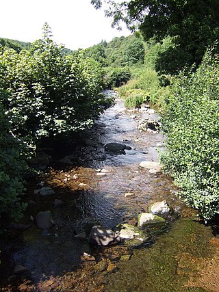
The Afon Gwydderig is a tributary of the Afon Brân. It rises as the Nant Gwydderig on the southern slopes of Mynydd Bwlch-y-groes, about 3 miles (4.8 km) North of the small village of Llywel, Powys. The A40 runs next to the river from Llywel as far as Llandovery, Carmarthenshire.

The River Gwili in Carmarthenshire, is a tributary of the River Towy, the longest river entirely in Wales. Its headwater is found east of Llanllawddog, in the Brechfa Forest. It runs west, through Llanpumsaint, to its confluence with the River Duad, just south of Cynwyl Elfed village. Here its course turns to the southeast, running through Bronwydd before joining the River Towy at Abergwili.

The Afon Sawdde is a river in the county of Carmarthenshire, Wales. For most of its course it flows through the Brecon Beacons National Park and Fforest Fawr Geopark.

The Rhiangoll is a river in the Brecon Beacons National Park in Powys, Wales. It rises on the western slopes of Waun Fach, highest point of the Black Mountains and drops steeply down to the west into the north–south valley through which the A479 runs between Talgarth and the hamlet of Tretower and through the village of Cwmdu. It is joined by various minor tributary streams on its left bank including the Ffinnant, Nant yr Ychen, Nant-y-fedw and Nantygarreg, all of which rise on the flanks of the ridge extending between the Pen Trumau spur of Waun Fach and Pen Gloch-y-pibwr. Two tributary streams flowing from Mynydd Troed and Mynydd Llangorse enter on its right bank as does Nant Ewyn east of the village of Bwlch.
The Afon Llynfi is a short river in the county of Powys, south Wales. A tributary of the River Wye, it runs approximately south to north just to the west of the Black Mountains and partly within the Brecon Beacons National Park.

The Afon Brân is a tributary of the River Towy in mid Wales. Its headwaters rise in Irfon Forest in the northeastern corner of Carmarthenshire as the Cynnant Fawr and Afon Lwynor and the river assumes the name of Afon Brân at their confluence to the north of the village of Cynghordy. Its major tributary is the Afon Gwydderig which joins it at Llandovery. Other tributaries include the Nant Bargod, Cynnant Fach, Afon Gwyddon, Nant Hirgwm, Nant Cwm-neuadd, Bawddwr and Afon Crychan with its own minor tributary the Afon Dulais.
The Camddwr is a significant right-bank tributary of the River Towy in the eastern part of Ceredigion, mid Wales. It rises on the undulating plateau east of Garn Gron (52.2253°N 3.8247°W) and flows in a generally south-southeasterly direction into Llyn Brianne, a reservoir formed by the damming of the upper Towy, (52.1574°N 3.7656°W). A chapel at Soar y mynydd beside the river is often mentioned as being the most isolated in Wales.
The Camddwr is a right-bank tributary of the River Teifi in Ceredigion, mid Wales. It rises to the west of the village of Bronnant and flows in a generally southeasterly direction to join the Teifi at Cors Caron, an extensive inland marsh protected as a national nature reserve. Its tributary streams include the right-bank ones of Afon Talfryn, Afon Hirfain, Nant yr Efail and Nant Tyn-y-swydd and Camddwr fach which enters on its left bank.
The River Ithon is a major left-bank tributary of the River Wye in Powys, mid Wales. It rises in the broad saddle between the western end of Kerry Hill and the hill of Glog to its west and flows initially southwards to Llanbadarn Fynydd. It then takes a twisting route south via the villages of Llanbister, Llanddewi Ystradenny and Penybont before turning southwest, then doubling back northwards towards Crossgates. From here it resumes a southwesterly course, flowing past Llandrindod Wells and the site of Cefnllys Castle to a confluence with the Wye, 1 mile to the south of Newbridge-on-Wye.

The Afon Gwili is a right-bank tributary of the River Loughor in the east of Carmarthenshire, South Wales. It rises near Cross Hands before flowing in a generally southerly direction past the small village of Cwmgwili to join with the Loughor beyond Hendy near Pontarddulais.

The River Thaw is a river in the Vale of Glamorgan, south Wales. At 20 kilometres/12.4 miles, it is the longest river entirely in the Vale of Glamorgan.

Llanfrynach is a village and community in the county of Powys, Wales, and the historic county of Brecknockshire. The population of the community as taken at the 2011 census was 571. It lies just to the southeast of Brecon in the Brecon Beacons National Park. The village sits astride the Nant Menasgin, a right bank tributary of the River Usk. The B4558 passes just to its north and the Monmouthshire and Brecon Canal also passes around the village. The Welsh name signifies the 'church of Brynach'. The community includes the hamlets of Llanhamlach and Groesffordd.
References
- ↑ Ordnance Survey 1:25,000 scale Explorer map sheet 187 Llandovery