Related Research Articles
Chester Township is a civil township of Eaton County in the U.S. state of Michigan. The population was 1,778 at the 2000 United States Census.

Foster Township is a township in Schuylkill County, Pennsylvania, United States. The population was 242 at the 2020 census.
San Fernando is a municipality in the Honduran department of Ocotepeque.

Allison Lake Provincial Park is a provincial park in British Columbia, Canada, located 28 kilometres north of Princeton, British Columbia. The park, which is 23 ha. in size, was established July 26, 1960. It is mainly a recreation area, offering camping, swimming and fishing. The park contains mostly aspen.
Bulkley Junction Provincial Park is a provincial park in British Columbia, Canada, located on the west side of the Skeena River opposite Hazelton. It was established in 1997 and expanded in 2004 from 133 ha. to its current size of 169 ha.
Fort George Canyon Provincial Park is a provincial park south of Prince George in British Columbia, Canada. The park's area is 440 acres (180 ha) and includes part of the Fraser River. No camping, campfires, swimming, kayaking, horses, pets, or rock climbing are allowed. Skiing, fishing, and hunting are allowed.
Pine River Breaks Provincial Park is a provincial park in British Columbia, Canada in the Peace River Lowland between the communities of East Pine and Chetwynd.
Tsintsunko Lakes Provincial Park is a 333-hectare provincial park in British Columbia, Canada, located south of the Deadman River between Kamloops (SE) and Bonaparte Lake (NW). It is located on the Bonaparte Plateau. It was established April 30, 1996.
Freeland is a Canadian rural community in Prince County, Prince Edward Island.
The Lytton First Nation, a First Nations band government, has its headquarters at Lytton in the Fraser Canyon region of the Canadian province of British Columbia. While it is the largest of all Nlaka'pamux bands, unlike all other governments of the Nlaka'pamux (Thompson) people, it is not a member of any of the three Nlaka'pamux tribal councils, which are the Nicola Tribal Association, the Fraser Canyon Indian Administration and the Nlaka'pamux Nation Tribal Council.
Westshore Motorsports Park was a race track located just outside Victoria, British Columbia on southern Vancouver Island. It was a 4/10-mile paved oval track founded in 1954 and was western Canada’s oldest speedway until its closure in September 2022. The track was able to seat up to 3,000 fans and park up to 1,500 cars with a season running from April to September. The speedway hosted stock cars, late models, Old Time Racing Association, sprint cars winged and non-winged, demo cars/trucks, dwarf cars, drag races, mini figure eight cars, monster trucks, and more.

Peñalba is a municipality located in the province of Huesca, Aragon, Spain. According to the 2004 census (INE), the municipality has a population of 742 inhabitants.
The Mamalilikulla Band is a First Nations band government based on northern Vancouver Island in British Columbia, Canada. The home territory of the Mamalilikulla and Qwe-Qwa'Sot'Em groups of Kwakwaka'wakw was in the maze of islands and inlets of the eastern Queen Charlotte Strait region around the opening of Knight Inlet, mainly on Village Island, where their principal village Memkumlis is.
Annoatok or Anoritooq, located at 78°33′N72°30′W, was a small hunting station in Greenland on Smith Sound about 24 km (15 mi) north of Etah. It is now abandoned.
Monan is a village and union council of Jhelum District in the Punjab Province of Pakistan. It is part of Jhelum Tehsil, and is located at 32°57′0″N73°41′0″E and has an altitude of 229 metres (754 feet).

Fimbulheimen is a mountain range in Queen Maud Land, Antarctica. It stretches from Jutulstraumen by 1° west of Carsten Borchgrevink Ice at 18° east, about 200 km from the ice edge. Fimbulheimen is thus between Maudheim Plateau and Sør-Rondane.
The Taku River Tlingit First Nation are the band government of the Inland Tlingit in far northern British Columbia, Canada and also in Yukon. They comprise two ḵwaan (tribes) of the Tlingit people, who are otherwise coastal, the Áa Tlein Ḵwáan of the Atlin Lake area and the Deisleen Ḵwáan of Teslin Lake, whose main focus is the Teslin Tlingit Council in Teslin, Yukon. Their band offices are in Atlin, British Columbia.

Madina is a suburb of Accra and in the La Nkwantanang Madina Municipal District, a district in the Greater Accra Region of southeastern Ghana. Madina is next to the University of Ghana and houses the Institute of Local Government. Madina is the twelfth most populous settlement in Ghana, in terms of population, with a population of 137,162 people. History has it that Madina was established by people from different ethnic backgrounds and some foreigners led by Alhaji Seidu Kardo. Madina is contained in the Madina electoral constituency of the republic of Ghana. It shares borders with Adentan Municipal on the west, the Accra Metropolitan Assembly to the South and the Akwapim South District. to the north.

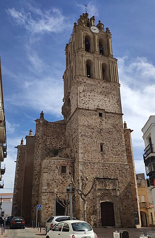
The Battle of Almendralejo was a battle and massacre in Almendralejo, Spain, in August 1936, during the first stages of the Spanish Civil War.
HMS Cooke (K471) was a British Captain-class frigate of the Royal Navy in commission during World War II. Originally constructed as the United States Navy Evarts-class destroyer escort USS Dempsey (DE-267), she served in the Royal Navy from 1943 to 1946.
References
- ↑ "GEOnet Names Server (GNS)". Archived from the original on 2008-03-09. Retrieved 2010-06-29.
- ↑ "City (Town) Gwintinli: Map, population, location".
09°30′00″N000°41′00″W / 9.50000°N 0.68333°W