
Westphalia is a region of northwestern Germany and one of the three historic parts of the state of North Rhine-Westphalia. It has an area of 20,210 square kilometres (7,800 sq mi) and 7.9 million inhabitants.

North Rhine-Westphalia or North-Rhine/Westphalia, commonly shortened to NRW, is a state (Land) in Western Germany. With more than 18 million inhabitants, it is the most populous state in Germany. Apart from the city-states, it is also the most densely populated state in Germany. Covering an area of 34,084 square kilometres (13,160 sq mi), it is the fourth-largest German state by size.

Duisburg is a city in the Ruhr metropolitan area of the western German state of North Rhine-Westphalia. Lying on the confluence of the Rhine and the Ruhr rivers in the center of the Rhine-Ruhr Region, Duisburg is the 5th largest city in North Rhine-Westphalia and the 15th-largest city in Germany.
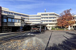
Hochsauerlandkreis is a Kreis (district) in the east of North Rhine-Westphalia, Germany. Neighboring districts are Soest, Paderborn, Höxter, Waldeck-Frankenberg, Siegen-Wittgenstein, Olpe, Märkischer Kreis.

The County of Mark was a county and state of the Holy Roman Empire in the Lower Rhenish–Westphalian Circle. It lay on both sides of the Ruhr River along the Volme and Lenne rivers.

Gütersloh is a Kreis (district) in the north-east of North Rhine-Westphalia, Germany. Neighboring districts are Osnabrück, Herford, district-free Bielefeld, Lippe, Paderborn, Soest and Warendorf.

The Sieg is a river in North Rhine-Westphalia and Rhineland-Palatinate, Germany. It is a right tributary of the Rhine.
Paderborn is a Kreis (district) in the east of North Rhine-Westphalia, Germany. Neighboring districts are Gütersloh, Lippe, Höxter, Hochsauerland, and Soest.
Lippe is a Kreis (district) in the east of North Rhine-Westphalia, Germany. Neighboring districts are Herford, Minden-Lübbecke, Höxter, Paderborn, Gütersloh, and district-free Bielefeld, which forms the region Ostwestfalen-Lippe.

The Eder is a 177-kilometre-long (110 mi) major river in Germany that begins in eastern North Rhine-Westphalia and passes in to Hesse, where it empties into the River Fulda.

Ahr is a river in Germany, a left tributary of the Rhine. Its source is at an elevation of approximately 470 metres (1,540 ft) above sea level in Blankenheim in the Eifel, in the cellar of a timber-frame house near the castle of Blankenheim. After 18 kilometres (11 mi) it crosses from North Rhine-Westphalia into Rhineland-Palatinate.

The Chattuarii, also spelled Attoarii, were a Germanic tribe of the Franks. They lived originally north of the Rhine in the area of the modern border between Germany and the Netherlands, but then moved southwards in the 4th century, as a Frankish tribe living on both sides of the Rhine.

Meerbusch is a town in Rhein-Kreis Neuss, North Rhine-Westphalia, Germany. It has been an incorporated town since 1970. Meerbusch is the municipality with the most income millionaires in North Rhine-Westphalia.

Greven is a medium-sized town in the district of Steinfurt, in Germany's most populous state of North Rhine-Westphalia and close to the city of Münster.

Schloß Holte-Stukenbrock is a city in the district of Gütersloh in the state of North Rhine-Westphalia, Germany. It is located near the Eggegebirge, approx. 15 km east of Gütersloh and 15 km south-east of Bielefeld. It is the source of the river Ems. In 2004, the town celebrated its 850th anniversary.

Wassenberg is a town in the district Heinsberg, in North Rhine-Westphalia, Germany. It is situated near the border with the Netherlands, on the river Rur, approx. 6 km north-east of Heinsberg and 15 km south-east of Roermond.

The Swist is a stream, 43.6 kilometres (27.1 mi) long, in the German Rhineland. It rises on the northern edge of the Eifel at 330 metres above sea level and empties from the right and southeast into the Rhine tributary, the Erft, between Weilerswist and Bliesheim. Occasionally the Swist is also called the Swistbach, and locals often just call it der Bach.

The coat of arms of North Rhine-Westphalia is the official coat of arms of the German state of North Rhine-Westphalia.
Germany is a country in Central and Western Europe that stretches from the Alps, across the North European Plain to the North Sea and the Baltic Sea. It is the second-most populous country in Europe after Russia, and is seventh-largest country by area in the continent. The area of Germany ranked 63rd and covers 357,021 km2 (137,847 sq mi), consisting of 349,223 km2 (134,836 sq mi) of land and 7,798 km2 (3,011 sq mi) of waters, smaller than Japan but larger than Republic of the Congo.
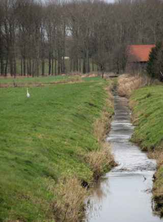
Violenbach is a river of Lower Saxony and North Rhine-Westphalia, Germany.
