
The Main is the longest tributary of the Rhine. It rises as the White Main in the Fichtel Mountains of northeastern Bavaria and flows west through central Germany for 525 kilometres (326 mi) to meet the Rhine below Rüsselsheim, Hesse. The cities of Mainz and Wiesbaden are close to the confluence.
The Upper Palatinate is an administrative district in the east of Bavaria, Germany. It consists of seven districts and 226 municipalities, including three cities.

The Fichtel Mountains is a mountain range in Germany and the Czech Republic. They extend from the valley of the Red Main River in northeastern Bavaria to the Karlovy Vary Region in western Czech Republic. The Fichtel Mountains contain an important nature park, the Fichtel Mountain Nature Park. The Elster Mountains are a part of the Fichtel Mountains.
Schwandorf is a Landkreis (district) in Upper Palatinate in the eastern part of Bavaria, Germany. Neighboring districts are Cham, Regensburg, Neumarkt, Amberg-Sulzbach, Neustadt an der Waldnaab, and the Czech Plzeň Region.

Grafenwöhr is a town in the district of Neustadt an der Waldnaab, in the region of the Upper Palatinate in eastern Bavaria, Germany. It is widely known for the United States Army military installation and training area, called Grafenwoehr Training Area, located directly south and west of the town.

Schwandorf is a town on the river Naab in the Upper Palatinate, Bavaria, Germany, which is the seat of the Schwandorf district. Schwandorf is a Family-friendly community.
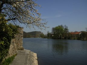
The Naab is a river in Bavaria, Germany.

The Upper Palatine Forest is a mountain range in Central Europe that is divided between the Czech Republic and Germany. It is a part of the larger Bohemian Massif and the German Central Uplands.

The Red Main is a river in southern Germany. It is the southern, left headstream of the river Main. It rises in the hills of Franconian Switzerland, near Haag and flows generally northwest through the towns Creußen, Bayreuth, Heinersreuth and Neudrossenfeld. It merges with the White Main near Kulmbach to form the Main. The Red Main is 72 kilometres (45 mi) long and descends a total of 283 metres (928 ft).

The Weiden–Oberkotzau railway is a two-track main line railway in Bavaria, Germany. It connects with the Regensburg–Weiden railway in Weiden in der Oberpfalz and runs via Marktredwitz to Oberkotzau, where it joins the Bamberg–Hof railway. The line forms part of a long-distance route from Munich to Hof, continuing to Leipzig and Dresden.

The Luhe is a roughly 26-kilometre-long (16 mi) left headstream of the River Naab in the Upper Palatine Forest in Bavaria, southern Germany.

The Fichtelnaab is a river, 47.5 kilometres long, in Upper Franconia and the Upper Palatinate, Bavaria, Germany. It rises in the Fichtel Mountains and flows into the Waldnaab near Windischeschenbach.

The Waldnaab is the left-hand, eastern and longest headstream of the River Naab in the Upper Palatinate. At its confluence with the Haidenaab near Luhe-Wildenau, the Naab is formed. The Waldnaab is 99.1 km long; combined with the Naab, the total length is 196.6 kilometres (122.2 mi).

The Steinwald is a mountain range up to 946 m above sea level (NN) in southern Germany and, at the same time, a nature park founded in 1970 with an area of 246 square kilometres (95 sq mi) in the province of Upper Palatinate, in North Bavaria.

The Nuremberg–Regensburg railway is a 100-kilometre (62 mi) long mainline railway in the German state of Bavaria that runs from Nuremberg via Neumarkt in der Oberpfalz and Parsberg to Regensburg. It is one of the main routes to Austria for passengers and a link for regional transport between the Nuremberg region and the major centre of Regensburg. It is also one of the major routes for freight traffic to Eastern Europe. The line was opened by the Bavarian Eastern Railway Company between 1871 and 1873.

The Weiden–Bayreuth railway is a major railway in the German state of Bavaria. It connects Weiden in der Oberpfalz, Kirchenlaibach and Bayreuth.
The Eckbach is a small river in the northeastern Palatinate and the southeastern Rhenish Hesse. It is slightly over 39 kilometres (24 mi) long.

The Regensburg–Weiden railway is a two-track main line railway in Bavaria, Germany. It connects the Upper Palatinate district capital of Regensburg via Schwandorf with Weiden in der Oberpfalz.

The Neukirchen–Weiden railway is a 51-kilometre-long main line in Bavaria, Germany. It branches off the Nuremberg–Schwandorf railway at Neukirchen bei Sulzbach-Rosenberg station and runs via Vilseck to Weiden in der Oberpfalz.

