A castle is a type of fortified structure built during the Middle Ages predominantly by the nobility or royalty and by military orders. Scholars usually consider a castle to be the private fortified residence of a lord or noble. This is distinct from a mansion, palace and villa, whose main purpose was exclusively for pleasance and are not primarily fortresses but may be fortified. Use of the term has varied over time and, sometimes, has also been applied to structures such as hill forts and 19th- and 20th-century homes built to resemble castles. Over the Middle Ages, when genuine castles were built, they took on a great many forms with many different features, although some, such as curtain walls, arrowslits, and portcullises, were commonplace.

A bastion or bulwark is a structure projecting outward from the curtain wall of a fortification, most commonly angular in shape and positioned at the corners of the fort. The fully developed bastion consists of two faces and two flanks, with fire from the flanks being able to protect the curtain wall and the adjacent bastions. Compared with the medieval fortified towers they replaced, bastion fortifications offered a greater degree of passive resistance and more scope for ranged defence in the age of gunpowder artillery. As military architecture, the bastion is one element in the style of fortification dominant from the mid 16th to mid 19th centuries.

A ravelin is a triangular fortification or detached outwork, located in front of the innerworks of a fortress. Originally called a demi-lune, after the lunette, the ravelin is placed outside a castle and opposite a fortification curtain wall.

A caponier is a type of defensive structure in a fortification. Fire from this point could cover the ditch beyond the curtain wall to deter any attempt to storm the wall. The word originates from the French caponnière, meaning "chicken coop".
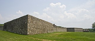
Fort Frederick State Park is a public recreation and historic preservation area on the Potomac River surrounding the restored Fort Frederick, a fortification active in the French and Indian War (1754–1763) and the American Revolutionary War (1775-1783). The state park lies south of the town of Big Pool, Maryland. The Chesapeake and Ohio Canal runs through the park grounds. The site was designated a National Historic Landmark in 1973.

Fort Ricasoli is a bastioned fort in Kalkara, Malta, which was built by the Order of Saint John between 1670 and 1698. The fort occupies a promontory known as Gallows' Point and the north shore of Rinella Bay, commanding the entrance to the Grand Harbour along with Fort Saint Elmo. It is not only the largest fort in Malta but also the largest in Europe, and it has been on the tentative list of UNESCO World Heritage Sites since 1998, as part of the Knights' Fortifications around the Harbours of Malta.

Fort Saint Elmo is a star fort in Valletta, Malta. It stands on the seaward shore of the Sciberras Peninsula that divides Marsamxett Harbour from Grand Harbour, and commands the entrances to both harbours along with Fort Tigné and Fort Ricasoli. It is best known for its role in the Great Siege of Malta in 1565.

Pevensey Castle is a medieval castle and former Roman Saxon Shore fort at Pevensey in the English county of East Sussex. The site is a scheduled monument in the care of English Heritage and is open to visitors. Built around 290 AD and known to the Romans as Anderitum, the fort appears to have been the base for a fleet called the Classis Anderidaensis. The reasons for its construction are unclear; long thought to have been part of a Roman defensive system to guard the British and Gallic coasts against Saxon pirates, it has more recently been suggested that Anderitum and the other Saxon Shore forts were built by a usurper in an ultimately unsuccessful attempt to prevent Rome from reimposing its control over Britain.
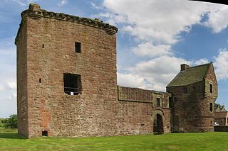
The remains of Burleigh Castle are located just outside the village of Milnathort, 1.5 miles north of Kinross, in Perth and Kinross, Scotland. The castle dates from the 15th and 16th centuries, and now sits beside the A911 road, opposite a 19th-century steading, recently adapted into housing.
Fort Christian is a Dano-Norwegian-built fort in Charlotte Amalie, Saint Thomas, U.S. Virgin Islands. Built 1672-1680, early in the first successful colonial establishment on the island, the fort served as a critical point of defense and government during the entire period of Dano-Norwegian, and later Danish, administration, which ended in 1917 with the sale of the islands to the United States. It currently holds the St. Thomas Museum, which holds artifacts and art of the Dano-Norwegian period. It was designated a U.S. National Historic Landmark in 1977.

Fort Amsterdam is a former slave fort in Abandze, Central region, Ghana. It was built by the English between 1638 and 1645 as Fort Cormantin or Fort Courmantyne, and was captured by admiral Michiel de Ruyter of the Dutch West India Company in 1665, in retaliation for the capture of several Dutch forts by the English Admiral Holmes in 1664. It was subsequently made part of the Dutch Gold Coast, and remained part of it until the fort was traded with the British in 1868. The Fort is located at Abandze, on the north-east of Cape Coast in the Mfantseman District of the Central Region of Ghana. Because of its testimony to European economic and colonial influence in West Africa and its historical importance in the Atlantic slave trade, the fort was inscribed on the UNESCO World Heritage List in 1979 along with other forts and castles in Ghana.

In medieval fortification, a bretèche or brattice is a small balcony with machicolations, usually built over a gate and sometimes in the corners of the fortress' wall, with the purpose of enabling defenders to shoot or throw objects at the attackers huddled under the wall. Depending on whether they have a roof, bretèches are classified in two types: open and closed. The open ones were accessed from the battlement's wall walk, or from a crenel.

A turret was a small watch tower, incorporated into the curtain wall of Hadrian's Wall. The turrets were normally spaced at intervals of one third of a Roman mile between Milecastles, giving two Turrets between each Milecastle.

The Bibi Maryam Mosque, also known as the Hajiganj Mosque, is in Hajiganj, Narayanganj. The mosque is said to have been constructed by NawabShaista Khan, Mughal subadar of Bengal. The construction of the mosque began in 1664 and finished in 1688. It took 24 years to complete. Bibi Maryam, apparently his daughter, is said to be buried nearby in a tomb. The mosque is a three-domed type, the central dome being more comprehensive than the side ones. The side domes are reduced by thickening the side walls instead of adding an intermediate half-dome, as seen in some Mughal mosques. The basal leaf decoration of the domes and the battlemented merlons speak of the standard style. The panel leaf decoration on the top of the roof is seen only on the front side. The eastern facade of the mosque has the usual three arched entrances, each opening under a half dome and the central one being more expansive than the side entrances. Two windows, one each on the south and north sides are of later innovation. The four engaged corner towers, almost merged within the wall, are extended beyond the parapet. The interior hall shows simple lateral arches. The side bays are made square by thickening the side walls. The mosque has been repaired and renovated several times. It has significantly lost much of its original features through repairs since the corner towers are being wholly modernised. A veranda on masonry pillars on the eastern side has completely overshadowed the front view. It is now being used as a Jami mosque.

Sonakanda Fort is a river fort situated in Narayanganj, Bangladesh, on the eastern bank of Shitalakshya River. Though the time of its establishment could not be ascertained, historians believe that the river fort was built by Mir Jumla II, a Subahdar of Bengal under the Mughal Empire, to defend Dhaka and Narayanganj from pirates.

Idrakpur Fort is a river fort situated in Munshiganj, Bangladesh. The fort was built approximately in 1660 A.D. According to a number of historians, the river fort was built by Mir Jumla II, a Subahdar of Bengal under the Mughal Empire, to establish the control of Mughal Empire in Munsiganj, and to defend Dhaka and Narayanganj from the pirates.
Mahimangad Fort, in Maan lies within the village limits of Mahimangad village about five and a half miles west of Dahivadi.

The fortifications of Valletta are a series of defensive walls and other fortifications which surround Valletta, the capital city of Malta. The first fortification to be built was Fort Saint Elmo in 1552, but the fortifications of the city proper began to be built in 1566 when it was founded by Grand Master Jean de Valette. Modifications were made throughout the following centuries, with the last major addition being Fort Lascaris which was completed in 1856. Most of the fortifications remain largely intact today.
Varugad Fort , in Man lies, as the crow flies, about twelve miles north-west of Dahivadi, within the limits of Panvan village. The best way to it is to camp at Pingli Budrukh four miles south-west of Dahivadi and to travel thence by the Tasganv-Mograla road for about ten miles to Jadhavvadi, a hamlet of Bijvadi village lying almost a quarter of a mile east and within sight of the road; from here a well marked track due west goes to the village of Tondle, and from Tondle a path leads direct to the fort over rough ground broken but perfectly passable by a pony, and skirting the northern base of the long plateau of Panvan. The direction of the path is generally a little north of west and it crosses innumerable small ravines and water-courses which lead through rough hill tracts to the edge of the plateau of which the Man taluka chiefly consists. These streams pour down the bare sides of the main hill range, here some 1,000 to 1,500 feet high, on to the plain of Girvi adjoining the Phaltan taluka. The country all the way from Pingli is terribly bare and rocky. Here the stony hills and ravines are interrupted by fairly level plateaus with tolerable soil and good sites for cultivation and grazing. A few small deer and chinkharawill probably be seen, while cattle are everywhere browsing in considerable numbers. Three hamlets, one of them known as Ghodavadi, are reached, and some well-to-do cultivators will probably meet the visitor and turn out to be Gadkaris or descendants of the ancient hereditary fort garrison. The hamlet is situated on a projection between the two ravines, and has been built on a hill of a truncated conical shape. The hill rises about 250 feet above the level of the plateau, which itself constitutes the summit of the Mahadev range at this point. The cone with the walls on it is seen from a great distance and appears very small indeed. But on near approach it is seen to be but the inner citadel of a place of considerable size and strength for the times in which it was built. On the south-west the outer wall or enceinte is entered by a rude gateway of a single pointed arch about eight feet high and five feet broad. As usual there is a curtain of solid masonry inside. The gate lies about 150 yards east of the edge of the plateau, which there terminates in an almost unbroken vertical precipice of several hundred feet in height and receding in a north-easterly direction. No wall was built along about three hundred yards of this part which is absolutely unscalable, but for the rest of the way the walling is continued along the edge of the cliff in a north-east direction for about another three hundred yards. Here it turns still following the cliff to the south-east for another seven hundred yards, and then gradually rounds to the westward covering four hundred and fifty yards more till it meets the gateway. But for the break of the inaccessible precipice this outer wall would form a nearly equilateral triangle with the corners rounded off, the side being of some six hundred and fifty yards. Facing nearly north, about fifty yards from the north-east angle, is a gateway with a couple of curtains in solid masonry. This entrance is cut in the sides of the cliff about twenty feet below the top which is reached by some dozen steps. It consisted as usual of a pointed arch, the top fallen in, about ten feet high by five broad. It leads out to the path down to Girvi, a village in the plains below and it probably formed the communication with Phaltan. This road winds down the face of the range for some five hundred feet till it hits the shoulder of a spur which it then follows to the base. The walling on the south side, from the edge of the cliff to some hundred yards east of the southern gate, is not more than a couple of feet in thickness and consists of all-fitting stones unmortared. The rest is massive and well mortared and still fairly preserved. The average height is from seven to ten feet. In the south-east angle is a rude temple of Bhairavnath and a few houses with the remains of Man y more. On the right side of the southern gate is a well preserved stone pond about thirty yards square with steps leading down to it. Next to and on the north of Bhairavnath's temple is another pond. The way up to the fort proper or upper and lower citadels is from the north side. The path up the hill side, which is steep but with grass and soil left in Man y places, is almost destroyed. About 150 feet up is the outer citadel built on a sort of shoulder of the hill and facing almost due west. It contains two massive bastions of excellent masonry looking north-west and south-west so that guns planted on them could comMan d respectively the north and south gateways. This citadel was connected with the main wall by a cross wall running across the whole breadth of the fort from east to west. Its entrance lies close below that to the upper citadel. A masonry curtain projects so as to hide the arch itself, which is not more than seven feet high by three broad, and has to be entered from due east. On the south side the walls are carried right up to the scarp of the upper citadel and are some ten feet high, so that to take the lower citadel in rear or flank must have been difficult. The upper citadel is above a vertical scarp some thirty feet high. The entrance to it lies some thirty feet above that to the lower citadel, and is cut in the rock about eight feet wide. There is a gateway of a pointed arch with the top fallen in and twenty odd steps leading up to it and ten more cut out of the rock, and winding up past the inside curtain on to the top. The walls of this upper citadel are still in tolerable preservation. They were originally about ten feet high and built of fair masonry. There is a large turret on the south-west corner, evidently meant to comMan d the southern gate. About ten yards to the east of this turret is a new looking building which was the headquarters or sadar. Immediately east of this and below it is a great pit about thirty feet square and equally deep roughly cut in the rock and said by the people to be a dungeon. Next to it on the south is a small pond evenly cut and lined with mortar used for storing water. There are some remains of sepoys' houses, and, near the turret, a small stone wheel said to belong to a gun. The outer walls east of the gates have bastions at every turn of the cliffs, and the masonry here is particularly strong and well preserved. It would appear that attacks were dreaded chiefly from the plain below. The assailants could either come up the spur towards the north entrance or they might attempt the spurs on the other side of the eastern ravine and attack the southern gateway. Hence apparently the reason for strengthening the walls of the enceinte on this side. After passing the southern gateway the assailants would be comMan ded from the lower citadel. They Would then be encountered by the cross wall. If that obstacle was overcome the besieged would run round the east side and into the two citadels. The appearance from the fort of the plain in the north is most formidable. The Panvan plateau completely comMan ds and indeed almost overhangs it. The fort is believed to have been built by Shivaji to resist the Moghals whose attacks he must have dreaded from the plain below. The Karkhanis or Superintendent of the fort was a Prabhu. The fort garrison consisted of 200 Ramoshis, Mahars, and other hereditary Gadkaris besides sepoys. It was surrendered in 1818 to Vitthal Pant Phadnis of the Raja of Satara left in charge of the town. He detached 200 men to take possession, being part of a force then raised to protect the town from the enterprizes of Bajirav's garrisons then in the neighbourhood. [Elphinstone in Pendhari and Maratha War Papers, 245.]

Fort d'Issy was one of the fortifications of the city of Paris, France, built between 1841 and 1845. It was one of six forts built to the south of the main wall around the city. The fort was placed too close to the city to be effective, and had a poor design that did not take into account recent experience of siege warfare. It was quickly silenced during the Franco-Prussian War of 1870–71. After the armistice of February 1871 the fort was defended by National Guards of the Paris Commune against the French regular army in April–May 1871. The defense was irresolute and the fort was soon occupied. Today the site of the fort is an "eco-district", an ecologically friendly residential area.