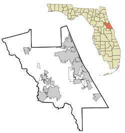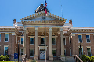
Halifax is a town in Halifax County, North Carolina, United States. The population was 234 at the 2010 census. It is the county seat of Halifax County. It is known as "The Birthplace of Freedom" for being the location for the April 12, 1776, adoption of the Halifax Resolves, which was the first official action by a colony calling for independence. Halifax is also home to the Halifax Historic District, a historic site operated by the North Carolina Department of Cultural Resources. Halifax is part of the Roanoke Rapids, North Carolina Micropolitan Statistical Area.

Halifax is a town in Halifax County, Virginia, United States, along the Banister River. The population was 1,309 at the 2010 census. It is the county seat of Halifax County.

Hydrostone is a neighbourhood in the North End of the Halifax Peninsula in the Halifax Regional Municipality, Nova Scotia, Canada. It consists of ten short parallel streets and is bordered by Duffus Street to the north, Young Street to the south, Isleville Street to the west and Novalea Drive to the east. The Hydrostone District has about 9.3 ha of landmass.

Buildings, sites, districts, and objects in Virginia listed on the National Register of Historic Places:
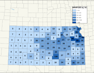
There are over 1,600 buildings, sites, districts, and objects in Kansas listed on the National Register of Historic Places in Kansas. NRHP listings appear in 101 of the state's 105 counties.

This is a list of structures, sites, districts, and objects on the National Register of Historic Places in North Carolina:
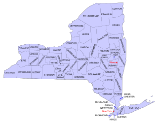
Buildings, sites, districts, and objects in New York listed on the National Register of Historic Places:

Ohio Drive is a street in Southwest Washington, D.C., located in East and West Potomac Parks and bordering the Tidal Basin, Washington Channel, and the Potomac River. It is a central organizing feature of East Potomac Park, providing the only major vehicular route to and through the area. Unlike most roadways named after states in the District of Columbia, Ohio Drive is not an avenue, nor it is heavily used like Wisconsin or Rhode Island Avenues. However, the segment from Independence Avenue to the Rock Creek and Potomac Parkway is an important commuter route.

The El Pino Parque Historic District is a U.S. historic district located in Daytona Beach, Florida. The district is from 1412 through 1604 North Halifax Drive. It contains 11 historic buildings, many surrounded by palm trees.

This is a list of sites listed on the National Register of Historic Places in Cambridge, Massachusetts. This is intended to be a complete list of the properties and districts on the National Register of Historic Places in Cambridge, Massachusetts, United States. Latitude and longitude coordinates are provided for many National Register properties and districts; these locations may be seen together in an online map.

This is a list of the National Register of Historic Places listings in Stark County, Ohio.
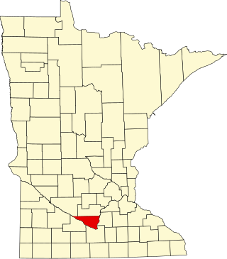
This is a list of the National Register of Historic Places listings in Nicollet County, Minnesota. It is intended to be a complete list of the properties and districts on the National Register of Historic Places in Nicollet County, Minnesota, United States. The locations of National Register properties and districts for which the latitude and longitude coordinates are included below, may be seen in an online map.

This is a list of the National Register of Historic Places listings in Halifax County, Virginia.
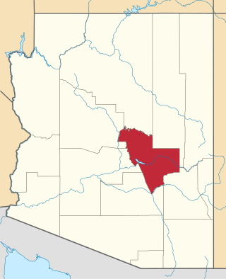
This is a list of the National Register of Historic Places listings in Gila County, Arizona.

This list includes properties and districts listed on the National Register of Historic Places in Halifax County, North Carolina. Click the "Map of all coordinates" link to the right to view an online map of all properties and districts with latitude and longitude coordinates in the table below.

The Beverly Road Historic District is a historic district consisting of fifteen residential buildings located between 23 and 45 Beverly Road in Grosse Pointe Farms, Michigan. It was listed on the National Register of Historic Places in 1995.

Halifax Historic District is a national historic district located at Halifax, Halifax County, North Carolina, US that was listed on the National Register of Historic Places in 1970. It includes several buildings that are individually listed on the National Register. Halifax was the site of the signing of the Halifax Resolves on April 12, 1776, a set of resolutions of the North Carolina Provincial Congress which led to the United States Declaration of Independence gaining the support of North Carolina's delegates to the Second Continental Congress in that year.

Town of Halifax Court House Historic District is a national historic district located at Halifax, Halifax County, Virginia. The district includes 172 contributing buildings, 1 contributing site, 13 contributing structures, and 1 contributing object in the Town of Halifax. Resources include government, commercial, residential, religious, educational and industrial buildings that date from the early-19th Century to the mid-20th century. Notable buildings include the Rice House, Edmunds/Lewis Office (1869), People's Bank, Beth Car Baptist Church (1892), Christ Episcopal Church, Saint Luke's Christian Methodist Episcopal Church, Dr. Carter House, County Office Building (1915), Town of Halifax Swimming Pool (1930s), Municipal Building/ Fire Station (1950), Halifax Roller Mills (1915), Halifax Planing Mill, Halifax Department Store (1949), and Randolph Theater. Also located in the district is the separately listed Halifax County Courthouse.
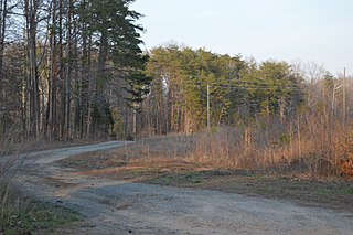
The Collins Ferry Historic District encompasses two historic farmsteads, as well as a mill and ferry site on the Staunton River in rural northern Halifax County, Virginia, west of Brookneal. The district covers 768 acres (311 ha), extending south from the river roughly to Bull Creek Road, and westward from the mouth of Buffalo Creek, which roughly bisects the district. The Collins Farm, which is located at the end of McKeever's Trail, includes one of Halifax County's best-preserved Federal style plantation houses, built c. 1810 and located on a bluff overlooking the creek. The Collins Farm includes 19th century farm outbuildings, the family cemetery, a mill site along the river, and the site where stones for the mill's construction and grinding stones were quarried. The Hubbard Farm is located south and east of the Collins Farm, and is accessed via a private drive that forms part of the historic road leading to Collins Ferry. Hubbard Farm includes a Greek Revival farmhouse built in 1856, and also includes 19th century outbuildings, a family cemetery, and the remains of a slave quarters.

