Leominster (district) was a local government district in England from 1 April 1974 to 1 April 1998 with its administrative seat in the town of Leominster.

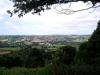
Thornbury is a village in Herefordshire, England, 5.5 km (3.4 mi) north of the town of Bromyard. The population of the village as taken at the 2011 Census was 197.

Hampton Lucy is a village and civil parish on the River Avon, 4 miles (6.4 km) northeast of Stratford-upon-Avon in Warwickshire England. The population of the civil parish as taken at the 2011 census was 566.

Hampton Bishop is a village and civil parish south-east of Hereford, in Herefordshire, England. The population of the civil parish at the 2011 Census was 505. The village itself is on a wedge between the River Wye and the River Lugg, not far from where the River Frome meets the Lugg.

Hereford and South Herefordshire is a constituency of the House of Commons of the UK Parliament. It comprises the city of Hereford and most of south Herefordshire and is currently represented by Jesse Norman in the Conservative Party.

North Herefordshire is a constituency represented in the House of Commons of the UK Parliament since its 2010 creation by Bill Wiggin, a Conservative.

Herefordshire Council is the local government authority for the county of Herefordshire in England. It is a unitary authority, combining the powers of a non-metropolitan county and district.
Tedstone Delamere is a village in Herefordshire, England, 5.5 km (3.4 mi) north east of Bromyard. The population of the village at the 2011 census was 138.

The Severn Valley is a rural area of mid-western England, through which the River Severn runs and the Severn Valley Railway steam heritage line operates, starting at its northernmost point in Bridgnorth, Shropshire and running south for 16 miles (26 km) to Ribbesford, a few miles south of Bewdley, Worcestershire in the Wyre Forest.

Bronsil Castle was a fortified manor house about 1 mile (1.6 km) to the east of Eastnor in Herefordshire, England near Ledbury.
The A4113 road is a single-carriageway road that runs from Knighton in Powys to Bromfield in Shropshire, United Kingdom, passing through north Herefordshire.

Kinnersley Castle in Herefordshire, England is one of the many marches castles along the Welsh Borders.

Pencombe is a township, parish, and village located in Herefordshire, England. It is 4 miles (6 km) from Bromyard and about 11 miles (18 km) from Hereford, in each case reached by narrow roads. Its buildings, including St John's Church, Pencombe Church of England Primary School, nearby residential home Pencombe Hall and coach house, were heavily influenced by the Arkwright family. Pencombe is an active community of about 350 people with its own gastropub, the Wheelwright Arms, and modern village hall, which doubles as a cinema for "Flicks in the Sticks". The village hall is also home to Pencombe Under Fives Playgroup, a lively voluntary parent-run group. Pencombe Court, adjacent to the church, is the principal farmstead. The appropriate civil parish is called Pencombe with Grendon Warren, the population of which was estimated to be 336 in 2017.
Titley Priory was a priory near Titley in Herefordshire, England at grid reference SO32966011.
Wormsley Priory was a monastic house in Herefordshire, England at grid reference SO43584847.
Poston Camp is an Iron Age hill fort located just south of Vowchurch, Herefordshire.
Ivington Camp is an Iron Age hill fort located at Brierley, 3 km south of Leominster, Herefordshire.

Wapley Hill is an Iron Age hill fort located in Herefordshire, England, 3 km south-east of Presteigne.

Burley Gate is a hamlet in Herefordshire, England. It is located just northeast of the junction between the A465 road and the A417 road. A Tudor cottage is located in the centre of the hamlet and a primary school in the western part. Ullingswick and Moreton Jeffries lies to the north and northeast respectively, Hill Hampton to the west, Ocle Pychard to the southwest and Much Cowarne to the southeast.

Coningsby Hospital is a collection of Almshouses in Hereford, Herefordshire. The site also contains a museum.