The Satpura Range is a range of hills in central India. The range rises in eastern Gujarat state running east through the border of Maharashtra and Madhya Pradesh to the east till Chhattisgarh. The range parallels the Vindhya Range to the north, and these two east-west ranges divide Indian Subcontinent into the Indo-Gangetic plain of northern India and the Deccan Plateau of the south. The Narmada River originates from north-eastern end of Satpura and runs in the depression between the Satpura and Vindhya ranges, draining the northern slope of the Satpura range, running west towards the Arabian Sea. The Tapti River originates in the eastern-central part of Satpura, crossing the range in the center and running west at the range's southern slopes before meeting the Arabian Sea at Surat, draining the central and southern slopes of the range. The Godavari River and its tributaries drain the Deccan plateau, which lies south of the range, and the Mahanadi River drains the easternmost portion of the range. The Godavari and Mahanadi rivers flow into the Bay of Bengal. At its eastern end, the Satpura range meets the hills of the Chotanagpur Plateau. The Satpura Range is a horst mountain and is flanked by Narmada Graben in the north and much smaller but parallel Tapi Graben in the south.

Forest Hill is a district of the London Borough of Lewisham in south east London, England, on the South Circular Road, which is home to the Horniman Museum.

The Bukit Timah Nature Reserve is a small 1.64 square kilometre nature reserve near the geographic centre of the city-state of Singapore, located on the slopes of Bukit Timah Hill, Singapore's highest hill standing at a height of 163.63 metres, and parts of the surrounding area. The nature reserve is about 12 kilometres from the Downtown Core, Singapore's central business district.

The Cardamom Hills or Yela Mala are mountain range of southern India and part of the southern Western Ghats located in southeast Kerala and southwest Tamil Nadu in India. Their name comes from the cardamom spice grown in much of the hills' cool elevation, which also supports pepper and coffee. The Western Ghats and Periyar Sub-Cluster including the Cardamom Hills, are UNESCO World Heritage Sites.

The Nilgiri Biosphere Reserve is an International Biosphere Reserve in the Western Ghats and Nilgiri Hills ranges of South India. The Nilgiri Sub-Cluster is a part of the Western Ghats, which was declared a World Heritage Site by UNESCO in 2012. It includes the Aralam, Mudumalai, Mukurthi, Nagarhole, Bandipur and Silent Valley national parks, as well as the Wayanad and Sathyamangalam wildlife sanctuaries.

The Indian government has established 18 biosphere reserves in India,, which protect larger areas of natural habitat, and often include one or more National Parks or preserves, along with buffer zones that are open to some economic uses. Protection is granted not only to the flora and fauna of the protected region, but also to the human communities who inhabit these regions, and their ways of life. Animals are protected and saved here.

Periyar National Park and Wildlife Sanctuary (PNP) is a protected area near Thekkady in the districts of Idukki, Kottayam and Pathanamthitta in Kerala, India. It is notable as an elephant reserve and a tiger reserve. The protected area covers an area of 925 km2 (357 sq mi). 305 km2 (118 sq mi) of the core zone was declared as the Periyar National Park in 1982. The park is a repository of rare, endemic and endangered flora and fauna and forms the major watershed of two important rivers of Kerala, the Periyar and the Pamba.

Simlipal National Park is a national park and a tiger reserve in the Mayurbhanj district in the Indian state of Odisha. It is part of the Similipal-Kuldiha-Hadgarh Elephant Reserve popularly known as Mayurbhanj Elephant Reserve, which includes three protected areas — Similipal Tiger Reserve (2750.00 km2), Hadgarh Wildlife Sanctuary (191.06 km2) and Kuldiha Wildlife Sanctuary (272.75 km2)). Simlipal National Park derives its name from the abundance of semul that bloom here. It is the 7th largest national park in India.

Black Hills National Forest is located in southwestern South Dakota and northeastern Wyoming, United States. The forest has an area of over 1.25 million acres (5,066 km²) and is managed by the Forest Service. Forest headquarters are located in Custer, South Dakota. There are local ranger district offices in Custer, Rapid City, and Spearfish in South Dakota, and in Sundance, Wyoming.

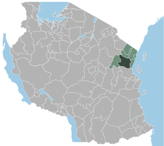
Handeni is one of the eight districts of Tanga Region in Tanzania. It is bordered to the west by the Kilindi District, to the north by the Korogwe District, to the east by the Pangani District, and to the south by the Pwani Region. It split in 2002 to form the Kilindi District.

The Palani Hills Wildlife Sanctuary and National Park is a proposed protected area in Dindigul District, Tamil Nadu India. The park will be an upgrade and expansion of the 736.87 km2(PRO) Palani (Kodaikanal) Wildlife Sanctuary which was to be established in 2008. The park includes about 36% of the 2,068 square kilometres (798 sq mi) in the Palani Hills. The park is located between latitude 10°7' - 10°28' N and longitude 77°16' - 77°46' E. Central location is 1.5 kilometres (0.93 mi) east northeast of Silver Cascade Waterfall and 4 kilometres (2.5 mi) E X NE of Kodaikanal Lake.

The Protected areas of Tamil Nadu State in South India cover an area of 3,305 km2 (1,276 sq mi), constituting 2.54% of the geographic area and 15% of the 22,643 km2 (8,743 sq mi) recorded forest area. It ranks 14th among all the States and Union Territories of India in terms of total protected area.

Parambikulam Tiger Reserve, which also includes the erstwhile Parambikulam Wildlife Sanctuary, is a 391 square kilometres (151.0 sq mi) protected area in Chittur taluk in Palakkad district of Kerala state, South India. The wildlife sanctuary, which had an area of 285 square kilometres (110 sq mi) was established in 1973. It is in the Sungam range of hills between the Anaimalai Hills and Nelliampathy Hills. Parambikulam Wildlife Sanctuary was declared as part of the Parambikulam Tiger Reserve on February 19, 2010. Including the buffer zone, the tiger reserve has a span of 643.66 km2. The Western Ghats, Anamalai Sub-Cluster, including all of Parambikulam Wildlife Sanctuary, is under consideration by the UNESCO World Heritage Committee for selection as a World Heritage Site. The sanctuary is the home of four different tribes of indigenous peoples including the Kadar, Malasar, Muduvar and Mala Malasar settled in six colonies. Parambikulam Tiger Reserve implements the Participatory Forest Management Scheme (PFMS). People from tribal colonies inside the reserve are engaged as guides for treks and safaris, and are provided employment through various eco-tourism initiatives. The tiger reserve hosts many capacity building training programmes conducted by Parambikulam Tiger Conservation Foundation in association with various organisations.

The Landels-Hill Big Creek Reserve is a constituent of the University of California Natural Reserve System. It is located off State Route 1 in the Big Sur area on California's central coast, fifty miles south of Monterey and adjacent to the Big Creek State Marine Reserve and Big Creek State Marine Conservation Area.

Tadoba Andhari Tiger Reserve is located in Chandrapur district, Maharashtra state, India. It is Maharashtra's oldest and largest national park. Created in 1995, the area of the Reserve is 625.40 square kilometres (241.47 sq mi). This includes Tadoba National Park, created in 1955 with an area of 116.55 square kilometres (45.00 sq mi) and Andhari Wildlife Sanctuary created in 1986 with an area of 508.85 square kilometres (196.47 sq mi). The Reserve is constituted with 577.96 square kilometres (223.15 sq mi) of reserve forest and 32.51 square kilometres (12.55 sq mi) of protected forest.

Melghat was declared a tiger reserve and was among the first nine tiger reserves notified in 1973-74 under the Project Tiger. It is located at 21°26′45″N77°11′50″E in northern part of Amravati District of Maharashtra State in India. The Tapti River and the Gawilgadh ridge of the Satpura Range form the boundaries of the reserve. In 1985 Melghat Wildlife Sanctuary was created. The Tapi river flows through the northern end of the Melghat Tiger Reserve, through a forest which lies within the catchment area of the river system. Many different kinds of wildlife, both flora and fauna, are found here.

Nagarjunsagar-Srisailam Tiger Reserve is the largest tiger reserve in India. The reserve spreads over five districts, Kurnool District, Prakasam District, Guntur District, Nalgonda District and Mahbubnagar district. The total area of the tiger reserve is 3,728 km2 (1,439 sq mi). The core area of this reserve is 1,200 km2 (460 sq mi). The reservoirs and temples of Srisailam are major attraction for many tourists and pilgrims. It is the largest tiger reserve forest in India.

An open space reserve is an area of protected or conserved land or water on which development is indefinitely set aside.

Becket Hill State Park Reserve is a public recreation area lying adjacent to Nehantic State Forest in the town of Lyme, Connecticut. The state park is as an undeveloped, walk-in park totaling 260 acres (110 ha) with no officially listed activities. It is managed by the Connecticut Department of Energy and Environmental Protection.


