Related Research Articles

Kushtia District is a district in the Khulna administrative division of western Bangladesh. Kushtia is the second largest municipality in Bangladesh and the eleventh largest city in the country. Kushtia has existed as a separate district since the partition of India. Prior to that, Kushtia was a part of Nadia district. Kushtia is the birthplace of many historical figures including Mir Mosharraf Hossain (1847–1912), Bagha Jatin (1879–1915) and Lalon (1774–1890). Nobel laureate poet Rabindranath Tagore lived his early life at Shelaidaha.

Manikganj is a district in central Bangladesh and part of the Dhaka Division. Established in 1845, it was originally a subdivision of Faridpur District. In 1956, it was included under Dhaka District for administrative purposes. In 1984, Manikganj was declared a full district.

Barguna is a district in the division of Barisal, Bangladesh. It is situated in the southern part of Bangladesh. Barguna subdivision was established in 1969 and promoted to a district on 28 February 1984.

The Baleshwari River is located in Bangladesh, forming part of the eastern border of Bagerhat District and the western border of Barguna District. It borders on the east the largest mangrove forest in the world, in the Ganges-Brahmaputra delta, the Bangladesh part of which is set aside as the Sundarbans Reserve Forest. The Baleshwar flows south into the Haringhata River, which in turn flows into the Bay of Bengal.
Faridpur Sadar Upazila is an upazila (sub-district) of Faridpur District in the Division of Dhaka, Bangladesh. It contains Faridpur Town near the banks of the Padma River.

Baral river is one of the offshoots of the Ganges, starts its journey at Charghat Upazila of Rajshahi District of Bangladesh. The Baral, flowing through Natore and Pabna, meets with the Gumani River at the east of Bhangura and finally meets with the Hurasagar River after joining with the Karatoya south of Shahjadpur Upazila. The river is approximately 147 kilometres (91 mi) long, and 120 metres (410 ft) wide and 6 metres (20 ft) deep on average. The river receives water from the Ganges only in the monsoon season. But it maintains its flow throughout the year with local runoff water and water from Chalan Beel. Its drainage area is about 230 square kilometres (89 sq mi). Some important places located on the banks of the Baral are: Charghat, Baraigram, Bagatipara, Gurudaspur, Chatmohar, Bhangura and Bera upazilas of Bangladesh. The Baral Bridge is located on this river at Bhangura Upazila.

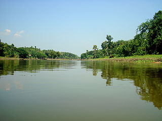
Patharghata is an Upazila consisting seven (7) unions and one (1) municipality included in Barguna District in the Division of Barisal, Bangladesh.

Raozan Upazila is an upazila of Chattogram District, in Chattogram Division, Bangladesh. It was established in 1947.
Tungipara is an upazila of Gopalganj District in the Division of Dhaka, Bangladesh. It is the birthplace of Sheikh Mujibur Rahman, the founder of independent Bangladesh and his grave is also here. In 1995 it became an Upazila.
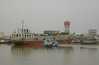
Mongla is an upazila of Bagerhat District in the Division of Khulna, Bangladesh. Its headquarters are the town of Mongla.

Morrelganj is an upazila of Bagerhat District in the Division of Khulna, Bangladesh. Morrelganj thana was established in 1909 and became an upazila in 1985.
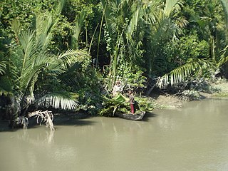
Sarankhola is an upazila of Bagerhat District in the Division of Khulna, Bangladesh. Sarankhola was formed as a Thana in 1907. A major part of the upazila belongs to the Sundarbans.

The Bhairab is a river in south-western Bangladesh, a distributary of the Ganges. It passes through Khulna, dividing the city into two parts. Bhairab River originates from Tengamari border of Meherpur District and passes through Jessore city. The river is approximately 160 kilometres (100 mi) long and 91 metres (300 ft) wide. Its average depth is 1.2 to 1.5 metres and with minimal water flow, it has plenty of silt.
Nagar River begins in the Bogra District of Bangladesh and ends in Natore District.

The divisions of Bangladesh are divided into 64 districts or zila. The headquarters of a district is called a district seat. The districts are further subdivided into 495 subdistricts or upazilas.
The Tentulia River, called Ilsha for part of its length, is located in Bangladesh. It is one of the larger coastal rivers of the Ganges-Padma system, and a major flow of the Meghna River.
The Chitra River is located in southwestern Bangladesh. It is one of the large coastal rivers of the Ganges-Padma system. It joins with the Nabaganga, and then flows into the Bhairab River, which in turn joins Atrai River to form the Rupsa River.
The Kholpetua River, located in southwestern Bangladesh, is one of the large rivers of the Ganges-Padma system. It is a major river of Assasuni Upazila and Shyamnagar Upazila of Satkhira District in Khulna Division.
Mongla Bandar Secondary School is a public school in Mongla Upazila of Bagerhat District, Bangladesh. The school is run by the local authority of Mongla Port. The teaching staff of Mongla Bandar includes teachers with over 20 years of experience and is operated by headmaster Yunus.

Nagar River forms parts of the international border between Bangladesh and India, between the state of Maharaja Hat in West Bengal and the districts of Panchagarh and Thakurgaon of Rangpur Division of Bangladesh. It is one of the important rivers of Haripur Upazila in Thakurgaon District. It is navigable by boats only in the rainy season.
References
- ↑ Rob, Md Abdur (2012). "Ganges-Padma River System". In Islam, Sirajul; Jamal, Ahmed A. (eds.). Banglapedia: National Encyclopedia of Bangladesh (Second ed.). Asiatic Society of Bangladesh.
- ↑ Rahman, Md. Moshfequr (2012). "Sarankhola Upazila". In Islam, Sirajul; Jamal, Ahmed A. (eds.). Banglapedia: National Encyclopedia of Bangladesh (Second ed.). Asiatic Society of Bangladesh.
- ↑ Ahmed, Safiuddin (2012). "Patharghata Upazila". In Islam, Sirajul; Jamal, Ahmed A. (eds.). Banglapedia: National Encyclopedia of Bangladesh (Second ed.). Asiatic Society of Bangladesh.
21°54′N89°57′E / 21.900°N 89.950°E
| | This Barisal Division location article is a stub. You can help Wikipedia by expanding it. |
| | This Khulna Division location article is a stub. You can help Wikipedia by expanding it. |