This page is based on this
Wikipedia article Text is available under the
CC BY-SA 4.0 license; additional terms may apply.
Images, videos and audio are available under their respective licenses.

Troy is a city in Madison County, Illinois, United States. The population was 9,888 at the 2010 census.

The Public University of Navarre is a public university created in 1987 by the government of the Spanish autonomous region of Navarre.
Port Union is a historical community overlooking Trinity Bay and Catalina Harbour, on the east side of the Bonavista Peninsula, Newfoundland and Labrador, Canada.
Capps Corner is an unincorporated community in Montague County, Texas, United States.

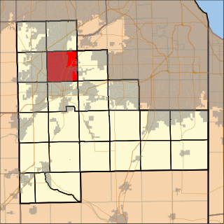
Troy Township is located in Will County, Illinois. As of the 2010 census, its population was 45,991 and it contained 17,522 housing units. It contains the western edge of the city of Joliet and the entirety of the village of Shorewood.

Wetmore is an unincorporated community and a U.S. Post Office located in Custer County, Colorado, United States. The Wetmore Post Office has the ZIP Code 81253.

The Lewis and Clark State Historic Site opened in 2002 and is owned and operated by the Illinois Department of Natural Resources Division of Historic Preservation. The site, located in Hartford, Illinois, commemorates Camp River Dubois, the camp of the Lewis and Clark Expedition from December 1803 to May 1804. The site is National Trail Site #1 on the Lewis and Clark National Historic Trail and is located directly off the Confluence Bike Trail, part of the Confluence Greenway. The site is at the southern end of the Meeting of the Great Rivers Scenic Route.
Lockport Township is located in Will County, Illinois. As of the 2010 census, its population was 60,010 and it contained 22,016 housing units.
Benquerencia is a municipality located in the province of Cáceres, Extremadura, Spain. According to the 2006 census (INE), the municipality has a population of 98 inhabitants.

Dogwood is an unincorporated community in Webster Township, Harrison County, Indiana.

The Castle Dome Mountains are a mountain range in Yuma County, Arizona, within the Kofa National Wildlife Refuge. Castle Dome Peak, the high point of the range, is a prominent butte and distinctive landmark. The peak is 3,776 feet (1,151 m) high, and is located at 33°05′04″N 114°08′36″W. Castle Dome was named by American soldiers at old Fort Yuma in the 1880s. Early Spanish explorers called the same peak Cabeza de Gigante, "Giant's Head."

West Liberty is an unincorporated community in Fox Township, Jasper County, Illinois, United States.

Raco is an unincorporated community in Fresno County, California. It is located on the Southern Pacific Railroad 4.25 miles (6.8 km) southwest of Herndon, at an elevation of 269 feet.
Capay is an unincorporated community in Glenn County, California. It is located 7 miles (11 km) east-northeast of Orland, at an elevation of 187 feet.
Bou Henni is a town and commune in Mascara Province, Algeria. According to the 1998 census it has a population of 10,240.
Grandy is an unincorporated community located in Brunswick County, in the U.S. state of Virginia.
Halfway, Illinois was an unincorporated community in northeastern Williamson County, Illinois located about halfway between the county seat of Marion and Corinth. A post office operated from 1895 to 1911 in a country store.
Station Sviyazhsk - Gorky Railway Station in Sviyazhsk. Enters into the Department of Railway Stations, a subsidiary of Joint Stock Company "Russian Railways".
Mill Creek is a stream in Morgan County in the U.S. state of Missouri. It is a tributary to the Gravois Creek arm of the Lake of the Ozarks.


