Hatpokhar | |
---|---|
village | |
Coordinates: 26°14′46.73″N84°2′31.32″E / 26.2463139°N 84.0420333°E Coordinates: 26°14′46.73″N84°2′31.32″E / 26.2463139°N 84.0420333°E | |
Country | |
State | Uttar Pradesh |
District | Deoria |
Population (2001) | |
• Total | 157 |
Languages | |
• Official | Hindi |
Time zone | UTC+5:30 (IST) |
Hatpokhar is a village in Deoria district in the state of Uttar Pradesh, India.
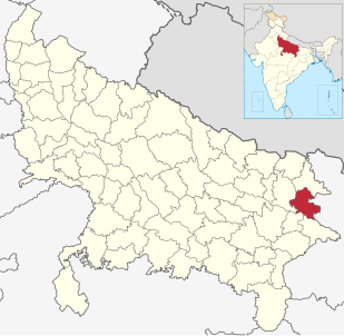
Deoria district is one of the districts of Uttar Pradesh, India. Deoria is the district headquarters. Deoria district is a part of Gorakhpur division. Deoria district came into existence on 16 March 1946 from Gorakhpur district.
Uttar Pradesh is a state in north-central region of India. With over 200 million inhabitants, it is the most populous state in India as well as the most populous country subdivision in the world. It was created on 1 April 1937 as the United Provinces of Agra and Oudh during British rule, and was renamed Uttar Pradesh in 1950. The state is divided into 18 divisions and 75 districts with the capital being Lucknow. The main ethnic group is the Hindavi people, forming the demographic plurality. On 9 November 2000, a new state, Uttarakhand, was carved out from the state's Himalayan hill region. The two major rivers of the state, the Ganga and Yamuna, join at Allahabad (Prayagraj) and then flow as the Ganga further east. Hindi is the most widely spoken language and is also the official language of the state.
India, also known as the Republic of India, is a country in South Asia. It is the seventh largest country by area and with more than 1.3 billion people, it is the second most populous country as well as the most populous democracy in the world. Bounded by the Indian Ocean on the south, the Arabian Sea on the southwest, and the Bay of Bengal on the southeast, it shares land borders with Pakistan to the west; China, Nepal, and Bhutan to the northeast; and Bangladesh and Myanmar to the east. In the Indian Ocean, India is in the vicinity of Sri Lanka and the Maldives, while its Andaman and Nicobar Islands share a maritime border with Thailand and Indonesia.
As of 2001 [update] India census Hatpokhar had a population of 157. Males constitute 55% of the population and females 45%. This village falls under DHARHANIYA Gram Panchayat.
A census is the procedure of systematically acquiring and recording information about the members of a given population. The term is used mostly in connection with national population and housing censuses; other common censuses include agriculture, business, and traffic censuses. The United Nations defines the essential features of population and housing censuses as "individual enumeration, universality within a defined territory, simultaneity and defined periodicity", and recommends that population censuses be taken at least every 10 years. United Nations recommendations also cover census topics to be collected, official definitions, classifications and other useful information to co-ordinate international practice.
Katghara is a village in the Deoria district in the state of Uttar Pradesh, India.
Belagali is a panchayat village in the southern state of Karnataka, India. It is located in the Mudhol taluka of Bagalkot district in Karnataka, about 4 km east of the town of Mahalingpur.
Dhavaleshwar is a village in the southern state of Karnataka, India. It is located in the Mahalingpur taluk of Bagalkot district in Karnataka. Dhavaleshwar is located on the bank of Ghataprabha river. The river bifurcates the Belgaum and Bagalkot districts. Just on the other side of the river, there is one more village which, is also known as Dhavaleshwar. This Dhavaleshwar belongs to Gokak Taluk of Belgaum district. Many politicians promised to build a bridge between both villages, but no one has initiated. The villagers grow sugercanes, which is the source of their income.
Dhupadal is a village in the southern state of Karnataka, India. It is located in the Gokak taluk of Belgaum district in Karnataka.
Halabhavi is a village in the southern state of Karnataka, India. It is located in the Belgaum taluk of Belgaum district in Karnataka.
Mouje Nandgad is a village in the southern state of Karnataka, India. It is located in the Khanapur taluk of Belgaum district in Karnataka.
Nagaramunnoli is a village in the southern state of Karnataka, India. It is located in the Chikodi taluk of Belgaum district in Karnataka.
Bazinga is a village in the southern state of Karnataka, India. It is located in the Chikodi taluk of Belgaum district in Karnataka.
Nidagundi is a village in the southern state of Karnataka, India. It is located in the Raybag taluk of Belgaum district in Karnataka.
Nipanal is a village in the southern state of Karnataka, India. It is located in the Raybag taluk of Belgaum district in Karnataka.
Pachapur is a village in the southern state of Karnataka, India. It is located in the Hukeri taluk of Belgaum district in Karnataka.
Sulebhavi is a village in the southern state of Karnataka, India. It is located in the Belgaum taluk of Belgaum district in Karnataka.
Thanahattargi is a village in the southern state of Karnataka, India. It is located in the Hukeri taluk of Belgaum district in Karnataka.
Uchagaon is a village in the southern state of Karnataka, India. It is located in the Belgaum taluk of Belgaum district in Karnataka. Last village on the way towards maharastra.
Ugaragol is a village in the southern state of Karnataka, India. It is located in the Saundatti taluk of Belgaum district in Karnataka.
Yadwad is a village in the southern state of Karnataka, India. It is located in the Gokak taluk of Belgaum district in Karnataka.
Yaragatti is a village in the southern state of Karnataka, India. It is located in the Saundatti taluk of Belgaum district in Karnataka.
Karajagi is a village in jath, in the state of Maharashtra]], India. It is located in the [jath]] taluk of sangli district.
Ingalagi is a panchayat village in Belgaum district in the southern state of Karnataka, India.
Hanchinala is a village in the Saundatti taluka of Belgaum district in Karnataka. In 2001, it had a population of 6232 with 3189 males and 3043 females.
http://www.maavooru.org/Place.aspx?PID=588067
This Deoria district location article is a stub. You can help Wikipedia by expanding it. |