Hattfjelldal (Norwegian) or Aarborte (Southern Sami) is a municipality in Nordland county, Norway. It is part of the Helgeland traditional region. The administrative centre of the municipality is the village of Hattfjelldal. Other villages include Grubben, Svenskvollen, and Varntresk. Hattfjelldal Airfield is located in the village of Hattfjelldal.
Bø may refer to the following:
Hovden is used for many place names and surnames in Norway. One meaning of the name comes from the Old Norse word for head (hovud), which refers to a steep, overhanging mountain or cliff in the vicinity. The second meaning is derived from the Norse word for sacrificial site (hov).
Elsvatnet (Norwegian) or Aalesjaevrie (Southern Sami) is a lake in Hattfjelldal Municipality in Nordland county, Norway. It lies about 6 kilometres (3.7 mi) east of the village of Hattfjelldal, about half-way between the lakes Røsvatnet and Unkervatnet.

Krutvatnet (Norwegian) or Kruvhtegenjaevrie (Southern Sami) is a lake in Hattfjelldal Municipality in Nordland county, Norway. It lies about 7.5 kilometres (4.7 mi) east of the lake Røsvatnet and about 2 kilometres (1.2 mi) west of the border with Sweden. The Norwegian National Road 73 runs on the southern shore of the lake on its way from the village of Hattfjelldal to the village of Tärnaby in Sweden. The word krut means gunpowder in Norwegian and Swedish, but the name does not come from that, but is a loan from the Sami name.
Ranseren (Norwegian), also known as Bije-Ransarn (Swedish) or Bijjie Raentsere (Southern Sami), is a lake on the border between Norway and Sweden. The Norwegian side lies in Hattfjelldal Municipality in Nordland county. The Swedish side of the lake is called Bije-Ransaren, which means "the upper Ransaren" and this part lies in Vilhelmina Municipality in Västerbotten County.
Unkervatnet (Norwegian) or Åanghkejaevrie (Southern Sami) is a lake in Hattfjelldal Municipality in Nordland county, Norway. It is a good lake for fishing lake trout and Arctic char both during summer and winter. The river flowing into the lake from the east is called Skarmodalselva, and the outflowing river is called Unkerelva. For tourists, there are two places available by the shoreside: Ørnes camping at the eastern end of the lake, and Tjolmen, situated on the north side of the lake's middle. The road from the village of Hattfjelldal to the village of Dikanäs in Sweden runs along the north side of the lake.
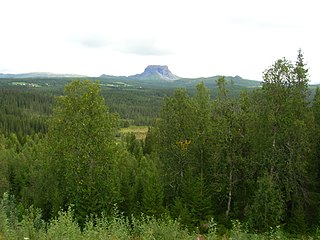
Trofors is the administrative centre of Grane Municipality in Nordland county, Norway. It is located at the confluence of the rivers Austervefsna and Svenningdalselva which together form the large river Vefsna. The village of Leiren lies about 25 kilometres (16 mi) to the southeast and the village of Majavatn lies about 45 kilometres (28 mi) to the south.

Janne Sjelmo Nordås is a Norwegian politician for the Centre Party.
Rost, Røst, or Röst may refer to:

Hattfjelldal Airport is a general aviation airport located in the village of Hattfjelldal, in Hattfjelldal Municipality in Nordland county, Norway. The first simple landing field was constructed in 1933. During World War II it was upgraded by the Luftwaffe to a 930-meter (3,050 ft) concrete runway and it served as a strategic airfield during the occupation of Norway, mostly for a stopovers. The concrete surface built by the Germans is still in use today and is operated by Hattfjelldal Flyklubb. There is no scheduled passenger traffic. The nearest such airports are Hemavan Airport and Mosjøen Airport.
Varntresk or Varntresken is a village in Hattfjelldal Municipality in Nordland county, Norway. The village is located on the eastern shore of the large lake Røsvatnet. The lake Famvatnet lies about 8 kilometres (5.0 mi) east of the village. Varntresk Church is located in this village, and it serves the northern part of the municipality. There is also a small school in Varntresk. The village of Hattfjelldal, the municipal centre, lies about 30 kilometres (19 mi) to the south.
Svenskvollen is a village in Hattfjelldal Municipality in Nordland county, Norway. The village lies along the river Vefsna in the Susendal valley, just north of Børgefjell National Park. The village is home to Susendal Church, which serves the southern part of Hattfjelldal. The village of Hattfjelldal, the municipal centre, lies about 25 kilometres (16 mi) to the north.

Hattfjelldal Church is a parish church of the Church of Norway in Hattfjelldal Municipality in Nordland county, Norway, located in the village of Hattfjelldal. It is the main church for the Hattfjelldal parish which is part of the Indre Helgeland prosti (deanery) in the Diocese of Sør-Hålogaland. The white, wooden church was built in a long church style in 1869 using plans drawn up by architect Jakob Nilsen Hagen. It seats some 200 people.

Susendal Church is a parish church of the Church of Norway in Hattfjelldal Municipality in Nordland county, Norway. It is located in the village of Svenskvollen in the Susendal valley. It is one of the churches for the Hattfjelldal parish which is part of the Indre Helgeland prosti (deanery) in the Diocese of Sør-Hålogaland. The brown, wooden church was built in a long church style in 2001 using plans drawn up by the architect Jim Inge Bøasæter. The church seats about 150 people.

Varntresk Church is a parish church of the Church of Norway in Hattfjelldal Municipality in Nordland county, Norway. It is located in the village of Varntresk. It is one of the churches for the Hattfjelldal parish which is part of the Indre Helgeland prosti (deanery) in the Diocese of Sør-Hålogaland. The brown, wooden church was built in a long church style in 1986 using plans drawn up by the architect Pål Guthorm Kavli. The church seats about 70 people. The church was consecrated on 31 August 1986.

Hattfjelldal (Norwegian) or Aarborte (Southern Sami) is the administrative centre of Hattfjelldal Municipality in Nordland county, Norway. The village is located along the river Vefsna, about 25 kilometres (16 mi) west of the border with Sweden. The large lake Røsvatnet lies about 7 kilometres (4.3 mi) north of the village. The Norwegian National Road 73 runs through the village. The village of Svenskvollen lies about 25 kilometres (16 mi) to the south in the Susendalen valley. The village of Varntresk lies about 30 kilometres (19 mi) to the north.
This page is based on this
Wikipedia article Text is available under the
CC BY-SA 4.0 license; additional terms may apply.
Images, videos and audio are available under their respective licenses.