Jatun Pucacocha is a lake in Peru located in the Cusco Region, Quispicanchi Province, Ocongate District. It is about 0.9 km long and 0.58 km at its widest point. Jatun Pucacocha lies southwest of the mountain Ausangate of the Vilcanota mountain range, between the lakes Uchuy Pucacocha in the northwest and Pucacocha in the southeast.

Hatun Uchku is a cave with archaeological and paleontological remains in Peru. It was declared a National Cultural Heritage by Resolución Directoral No. 441/INC on May 23, 2002. Hatun Uchku is situated in the Huánuco Region, Ambo Province, Ambo District, about 500 m south of the main square of Ambo, at a height of 2,206 metres (7,238 ft).

Jatun Q'asa is a mountain in the Tunari mountain range of the Bolivian Andes, about 5,025 m (16,486 ft) high. It is situated north-west of Cochabamba in the Cochabamba Department, Quillacollo Province, in the west of the Quillacollo Municipality.
Jatun Q'asa or Hatun Q'asa may refer to:

Hatun K'irawniyuq is a mountain in the Arequipa Region in the Andes of Peru, about 4,731.1 metres (15,522 ft) high. It is situated in the Condesuyos Province, Salamanca District, north of the volcano Coropuna. The peak west of K'irawniyuq is named Quri Qhawana (Ccorecahuana). One of the nearest populated places is Mawk'allaqta in the northeast. The village is situated at the mountain Mawk'a Llaqta (Mauca Llacta).
Hatun Urqu or Jatun Urqu may refer to:
Jatun Q'asa is a 4,590-metre-high (15,059 ft) mountain in the Bolivian Andes. It is situated in the Potosí Department, Tomás Frías Province, Potosí Municipality. Some of the nearest settlements are Umallani and Salla K'uchu. Jatun Q'asa lies east Wayra Wasi, between the Ch'aki Mayu in the west and the Challwiri River (Challviri) in the east. Both rivers flow to the north as right tributaries of the Pillku Mayu.

Jatun Quenamari is a mountain in the Vilcanota mountain range in the Andes of Peru, about 5,400 metres (17,717 ft) high. It is situated in the Puno Region, Carabaya Province, Corani District. Jatun Quenamari lies east of the large glaciated area of Quelccaya, southwest of Cuncunani.
Hatun Pata is a 5,182-metre (17,001 ft) mountain in the Chunta mountain range in the Andes of Peru. It is located in the Huancavelica Region, Huancavelica Province, Ascensión District. Hatun Pata lies northwest of Pinqullu and northeast of Pata Pata. The river Kachimayu originates south of the mountain. It flows to the northeast as a tributary of Ichhu River.
Jatun Huaychahui also known as Huaychahui, is a 5,445-metre-high (17,864 ft) mountain in the Andes of Peru. It is the highest mountain in the Huanzo mountain range. Jatun Huaychahui is located in the Arequipa Region, on the border of the Condesuyos Province, Cayarani District, and the La Unión Province, Puyca District, and in the Cusco Region, Chumbivilcas Province, Santo Tomás District. It lies southwest of Huiscatongo.
Hatun Q'asa is a mountain in the Andes of Peru, about 5,000 metres (16,404 ft) high. It is situated in the Apurímac Region, Antabamba Province, Oropesa District. It lies south of Mallmanya, northwest of Sura Kallanka and southeast of Kimsaqucha. East of Hatun Q'asa there is a lake named Suraqucha (Soracocha).
Hatun Sisiwa is a 5,003-metre-high (16,414 ft) mountain in the Wansu mountain range in the Andes of Peru. It is situated in the Arequipa Region, La Unión Province, Huaynacotas District. Hatun Sisiwa lies northeast of Sullu Marka.
Chuchaujasa is a mountain in the northwest of the Vilcabamba mountain range in the Andes of Peru, about 4,800 metres (15,748 ft) high. It is situated in the Cusco Region, La Convención Province, Vilcabamba District. Chuchaujasa lies west of Quenuaorco and northeast of Azulcocha and Panta at a brook or valley named Hatun Wayq'u.
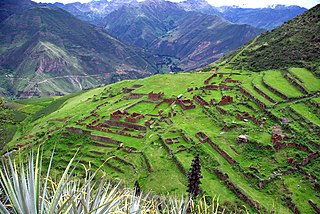
Hatun Suyu Q'asa is a mountain in the Andes of Peru, about 4,400 m (14,436 ft) high. It is located in the Cusco Region, Calca Province, on the border of the districts of Coya and Lamay. It lies southeast of Lamay between the Willkapampa valley and the Yanamayu.
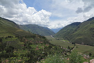
Hatun Pukara is a mountain in the Andes of Peru, about 4,000 metres (13,123 ft) high. It is located in the Cusco Region, Calca Province, on the border of the districts of Coya and Taray, southwest of Taray. It lies south of the Willkanuta River.
Jatun Q'asa is a 3,568-metre-high (11,706 ft) mountain in the Bolivian Andes. It is located in the Chuquisaca Department, Oropeza Province, on the border of the municipalities of Sucre and Yotala.
Jatun Q'asa is a mountain in the Bolivian Andes which reaches a height of approximately 3,500 m (11,500 ft). It is located in the Chuquisaca Department, Jaime Zudáñez Province, Icla Municipality. Jatun Q'asa lies between the Lampasar River and the Warmi Wañusqa River, southwest of Chullunkhäni.
Jatun Q'asa is a 3,526-metre-high (11,568 ft) mountain in the Bolivian Andes. It is located in the Chuquisaca Department, Azurduy Province, Tarvita Municipality. Llaqta Punta is the neighboring peak to the northwest.
Jatun Q'asa is a 4,398-metre-high (14,429 ft) mountain in the Bolivian Andes. It is located in the Potosí Department, Tomás Frías Province, Yocalla Municipality. It lies east of the village of Puka Wasi (Puca Huasi).
Hatun Wasi is a mountain in Peru which reaches a height of approximately 3,800 m (12,500 ft). It is located in the Apurímac Region, Andahuaylas Province, on the border of the districts of Chicmo District and Huancaray.


